Lancashire has little treasures of its own.
Thinking away from the Yorkshire Dales and the Lake District, we decided instead to explore more quiet parts that the Lancashire countryside has to offer. Situated on the north-western edge of the Forest of Bowland, within the Lune Valley—and not too far from Lancaster—one can find the Crook o’ Lune area.
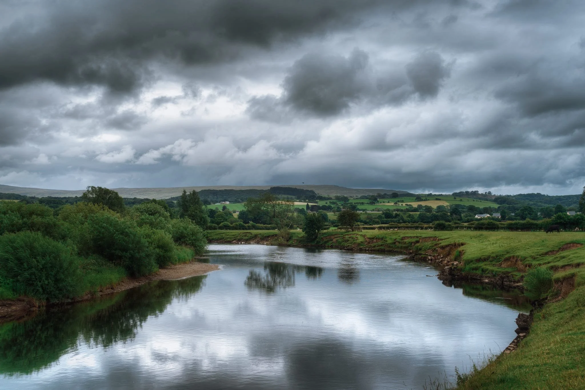
The Crook o’ Lune is named so literally. As the River Lune winds southwest from Kirkby Lonsdale down a wide and flat valley, the Lune valley, it makes a couple of sheer winding bends as it navigates around small hills flanking the valley. The sharpest bend is the Crook. From the hill above the crook one can enjoy expansive views east all the way up the valley, and even make out the unmistakeable shape of Ingleborough in the Yorkshire Dales. This view was made famous by J. M. W. Turner’s Crook of Lune, looking towards Hornby Castle, painted c. 1818.
We enjoyed a solid 6.4 km circular route from Bull Beck Picnic Site, taking in all the sites and sounds on an otherwise overcast day. Dramatic clouds followed us throughout the route, and I’m sure I could get even better photos with more complementary light.
All photos taken on my Sony α7ii using my Sony 24-240mm F3.5-6.3 OSS zoom lens. RAWs converted in Lightroom, edited in Photomatix, and finalised in Photoshop.
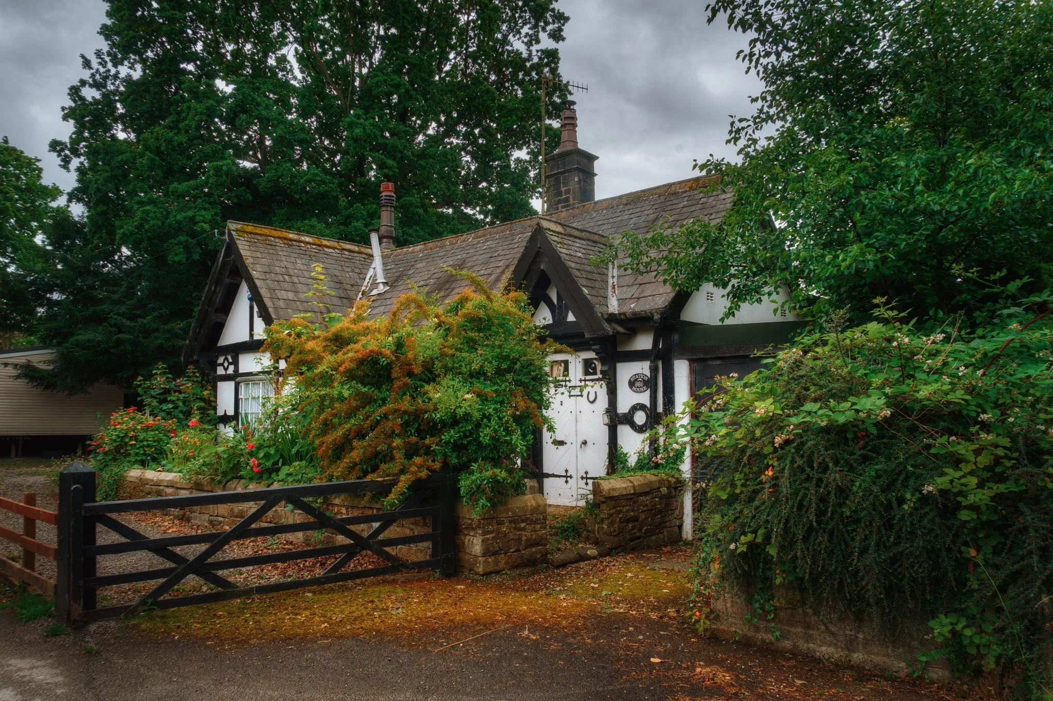
This is the old Station House that was once part of Caton railway station. The station was opened in 1849, and closed in 1961, with the last passengers on the line being served until 1966. This station house survived and is now a private residence. The railway line passing by here has been dismantled and converted into a footpath and cycleway, which we took to make our way towards the Crook o’ Lune.
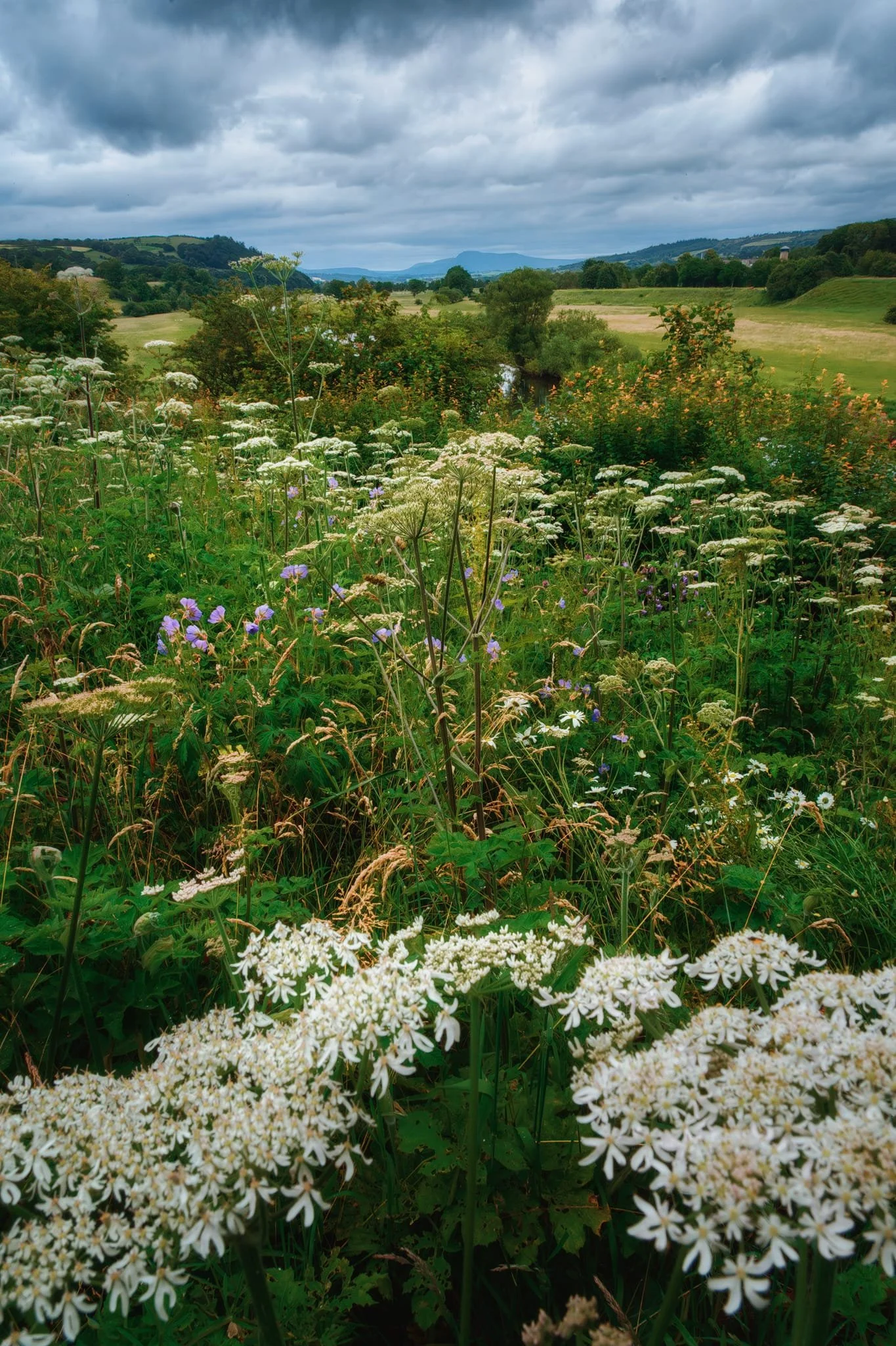
Passing over the eastern viaduct, we made a small detour to the Crook ‘o Lune picnic site. It’s from here that one can enjoy variations of Turner’s view that he famously painted. An explosion of summer flowers served as my foreground interest for this composition.
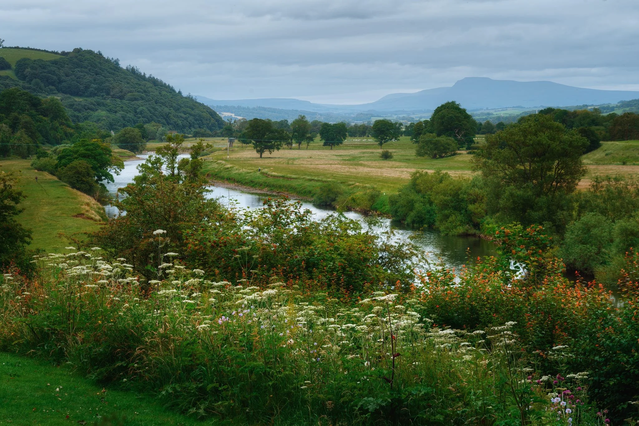
The famous view of the Crook o’ Lune, ringed by wildflowers with the shadow of Ingleborough looming in the distance. The steep hill to the left, View Field, is what contributes to the sudden change in direction of the Lune.
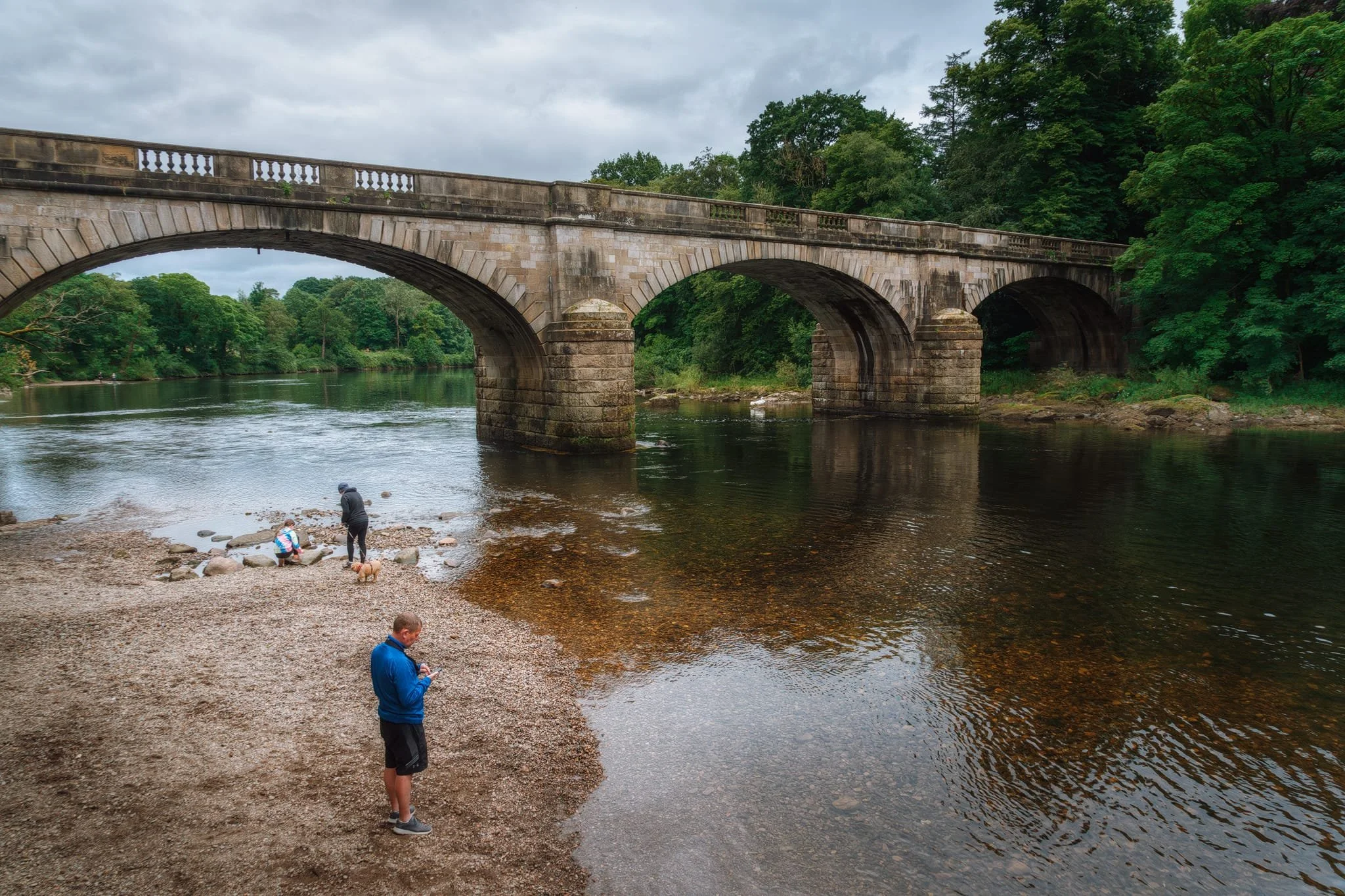
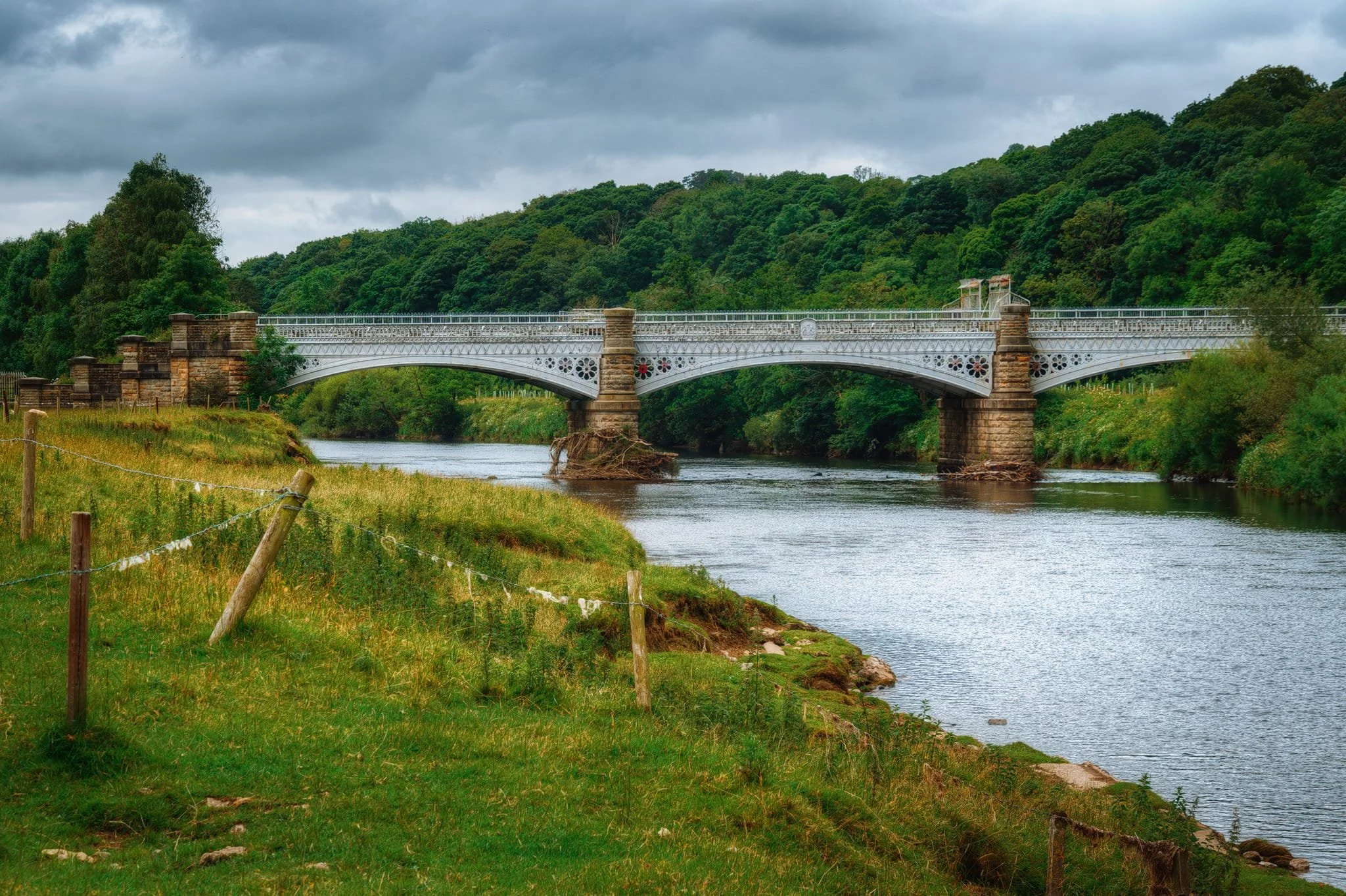
Retracing our steps, we crossed back over the old railway viaduct to locate the footpath alongside the river. At the river shore, families and dogs played around in the water with the Caton Lune Bridge standing above. This is a Grade II listed road bridge. The original bridge at this spot was built privately in 1806. It was a stone structure with three arches, nicknamed “Penny Bridge” because of its toll. By 1880, this original bridge had suffered structural damage. As a result, the current Caton Lune Bridge was built in 1883. Like its predecessor, the new bridge features three arches, but it’s made of sandstone ashlar.
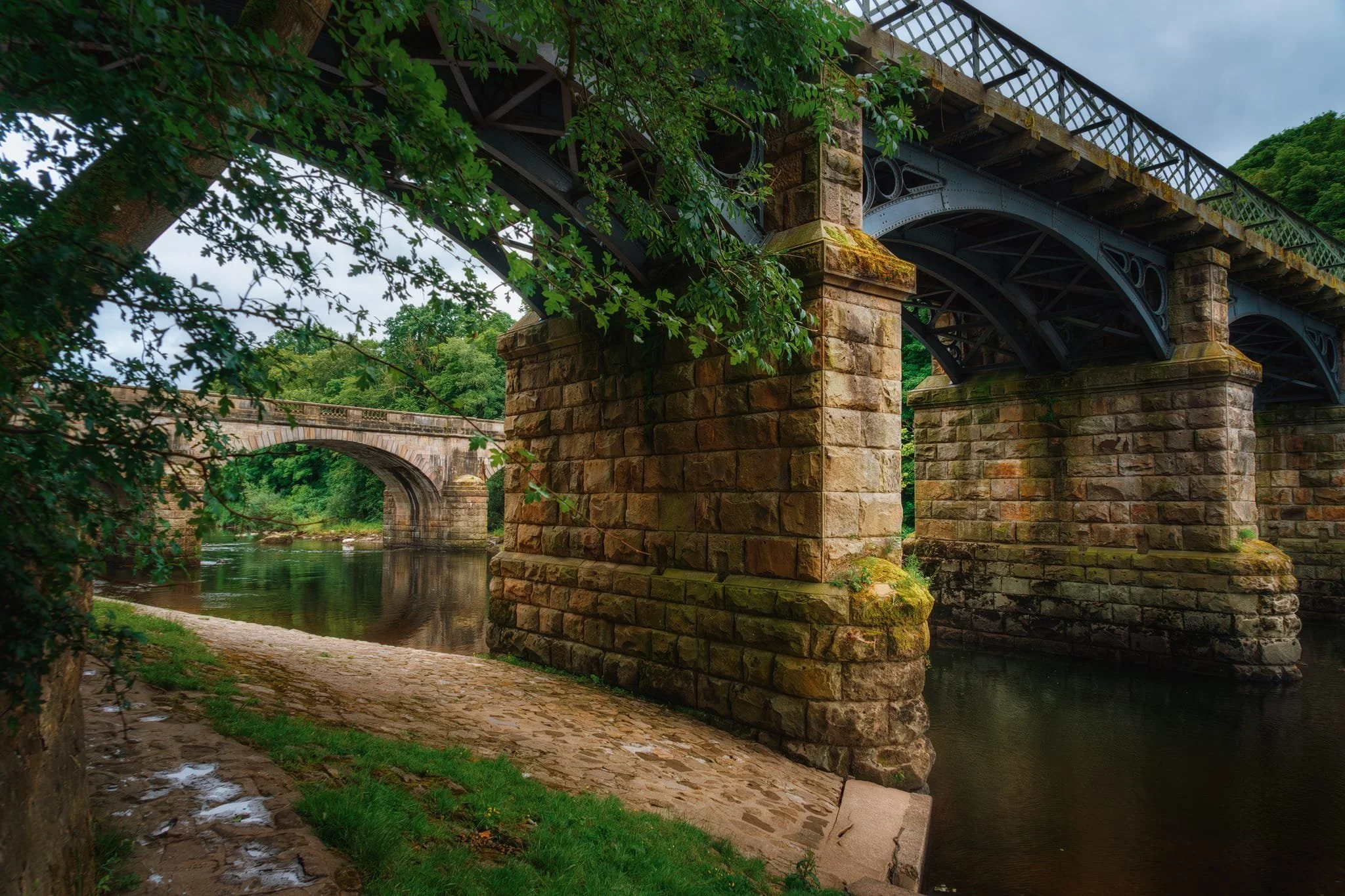
At my lens’ widest point of 24mm, I was able to capture both the Eastern Viaduct and the Caton Lune Bridge. The East Viaduct has five spans and was built in 1849 to carry the “Little” North Western Railway over the river. Like I mentioned earlier, the railway line was fully closed by 1967 and has since been converted into a footpath and cycleway. It underwent major repair and refurbishment in 2013.
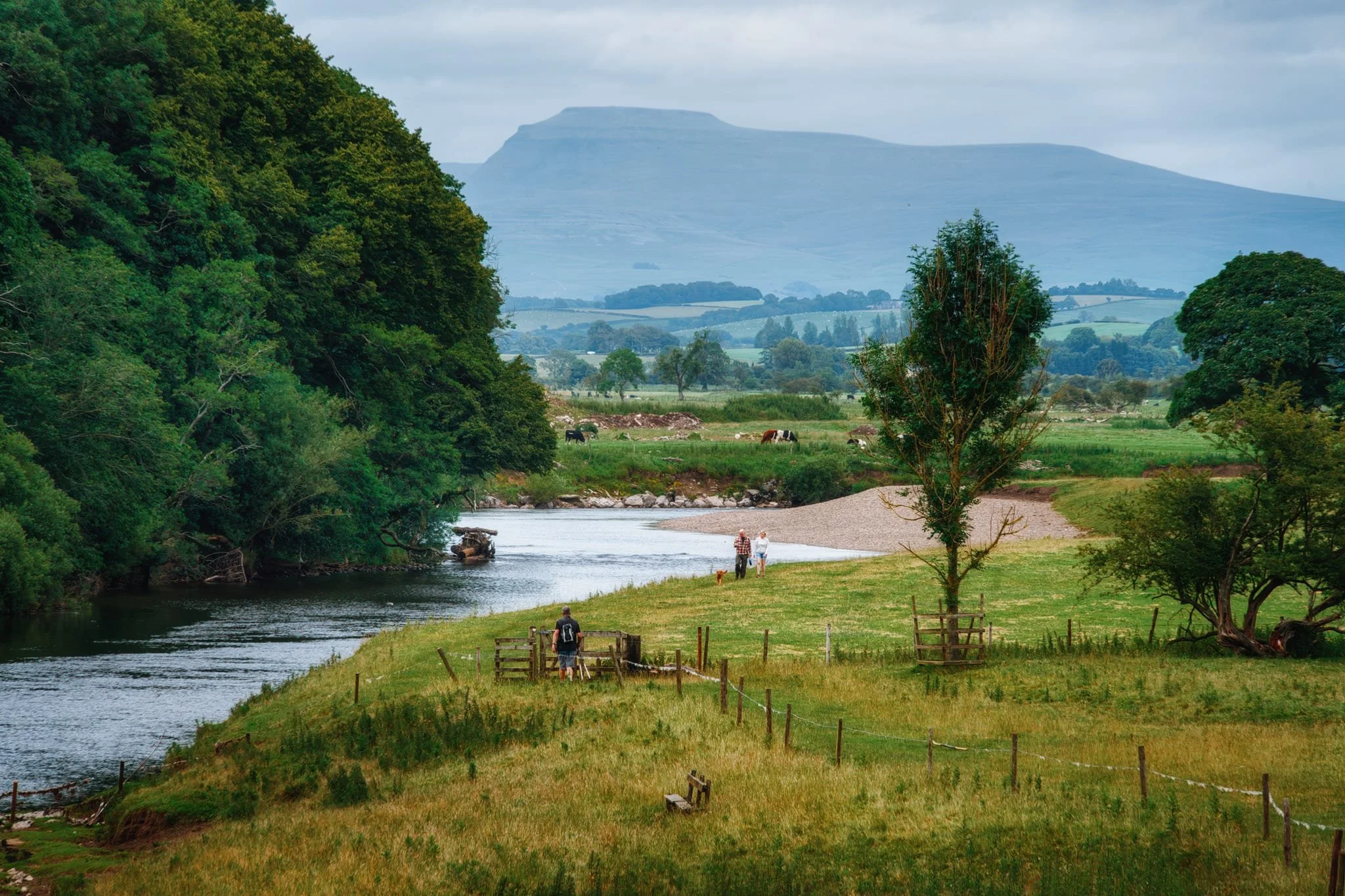
Now on the riverside footpath, a view zoomed in from atop the waterworks bridge—which carries the Thirlmere Aqueduct—shows the distinctive profile of Ingleborough in the Yorkshire Dales.
Looking back at the Waterworks Bridge, originally built in 1906 to carry the Thirlmere Aqueduct over the Lune. The Thirlmere Aqueduct conveys water from Thirlmere, in the Lake District, all the way down to Manchester. At the left of the bridge you can see a series of pillars. There are various stone blocks dotted about those pillars which have inscribed on them flood markings of various historical flood levels. There was also one for Storm Desmond, which occurred in December 2015, that I have intimate experience of. See the image below, my attempt of a reconstruction of where the flood level came up to as indicated by the stone.
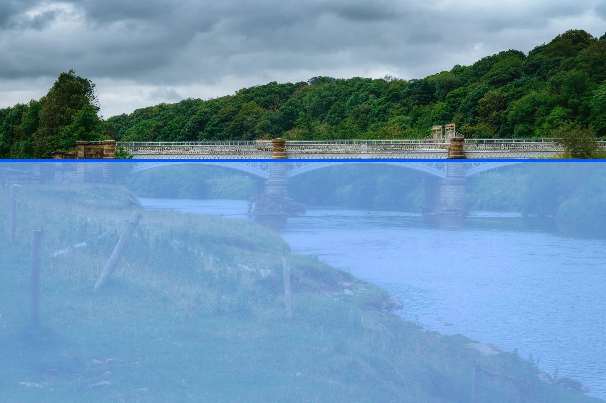
In other words, Storm Desmond turned the entire Lune Valley into a lake.
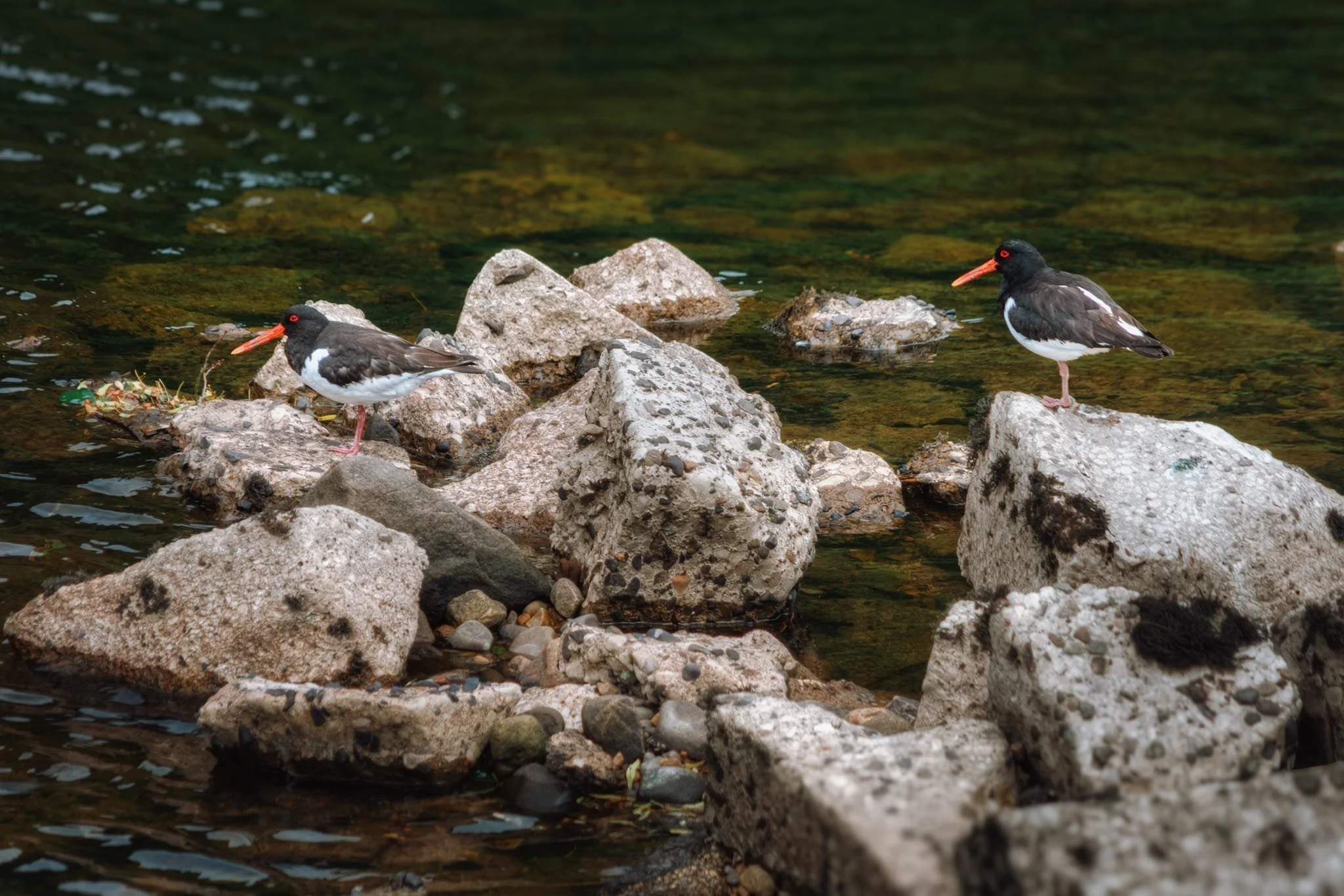
Closer to the Lune’s shore we could make out the characteristic peep! sounds of Oystercatchers, Haematopus ostralegus . I quietly crept towards the water and zoomed in to my lens’ full 240mm reach to snap these two Oystercatchers.
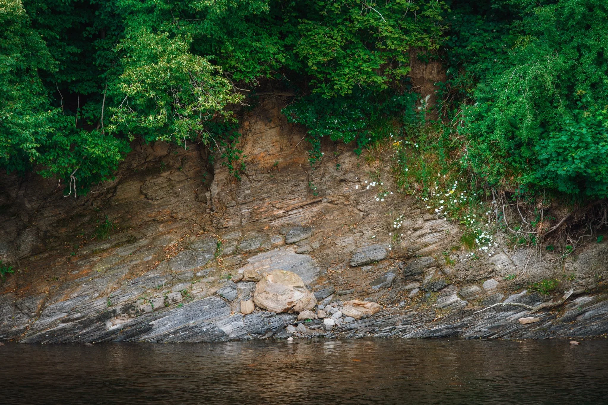
Over the course of eons, the Lune has scoured away the foot of View Field hill, revealing millions of years of historical geology.
On the return leg back to Bull Beck picnic site, dramatic and foreboding clouds build up over the Bowland fells. A bend in the river, complete with glassy reflections, made me stop and attempt a composition.