A lot on offer in such a small space.
For a full nature-based day we started out at the Carding Mill Valley, probably the most well-known part of the Shropshire Hills. It is from here that you can choose any one of a myriad of hiking trails and see the sights.
For us we wanted to check out the reservoir then heading up the ravine containing the Lightspout waterfall. From there we mapped a route onto the top of the Long Mynd, then followed the Bur Way road all the way back down to our car.
All in all, a solid 10km round trip.
Light and weather conditions could definitely have been nicer, but once we were up in the heights of the Long Mynd, the passing squalls created incredible light shows across Church Stretton towards the hills of Caer Caradoc and The Lawley.
All photos taken on my Google Pixel 9 Pro XL. RAWs developed in Capture One, merged together in Photomatix, then edited and finalised in Canva’s new Affinity Studio.
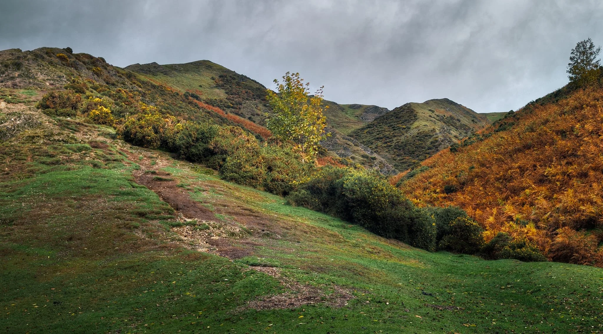
Heading towards the reservoir, this tapestry of colours down Bodbury Hill’s flank caught my attention and I lined up a simple 2-shot panorama.
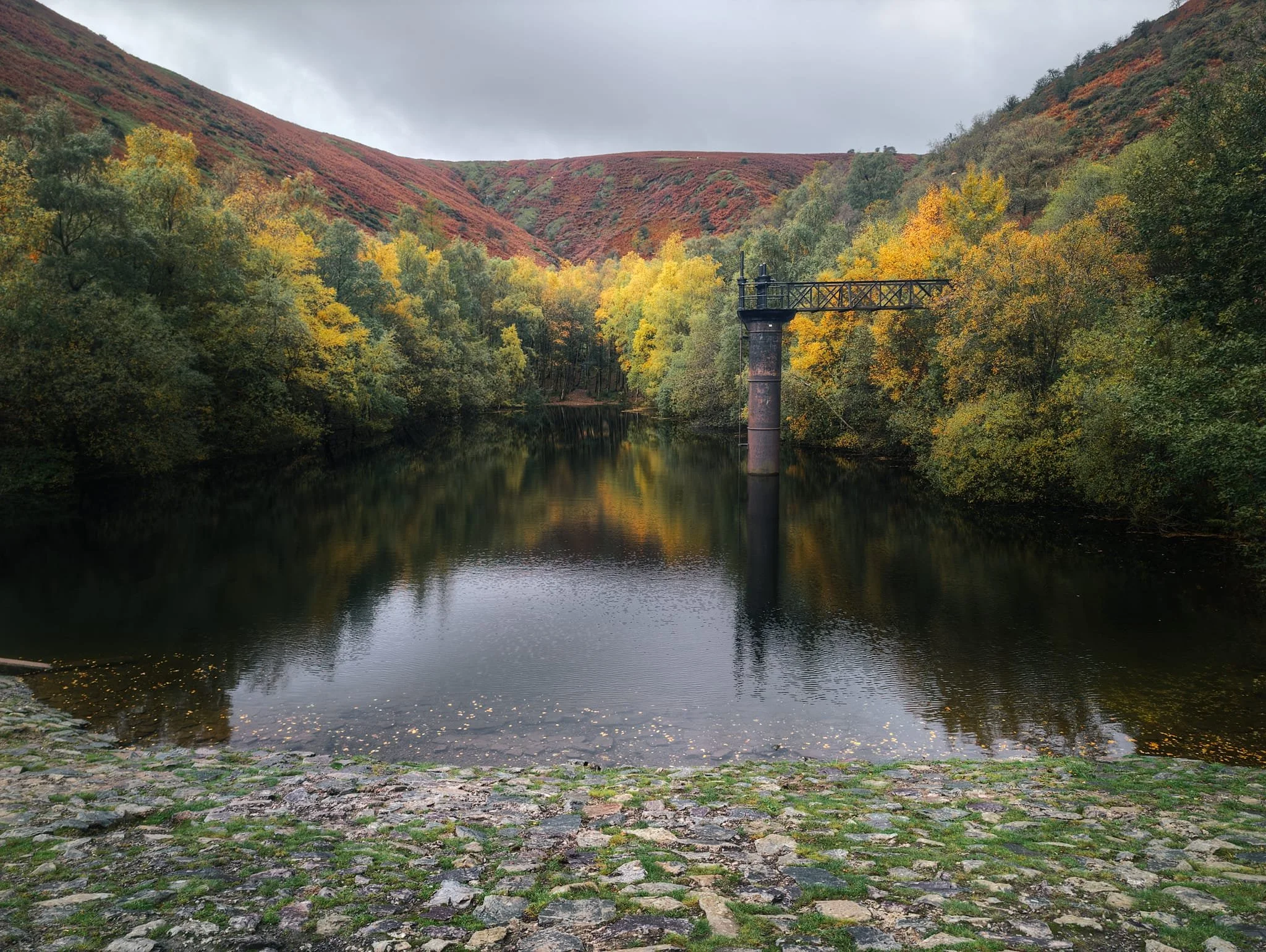
What remains of the reservoir. It was built in 1902 to support nearby Church Stretton’s burgeoning status as a fashionable spa town. No longer in use as a reservoir, it’s popular with outdoor swimmers.
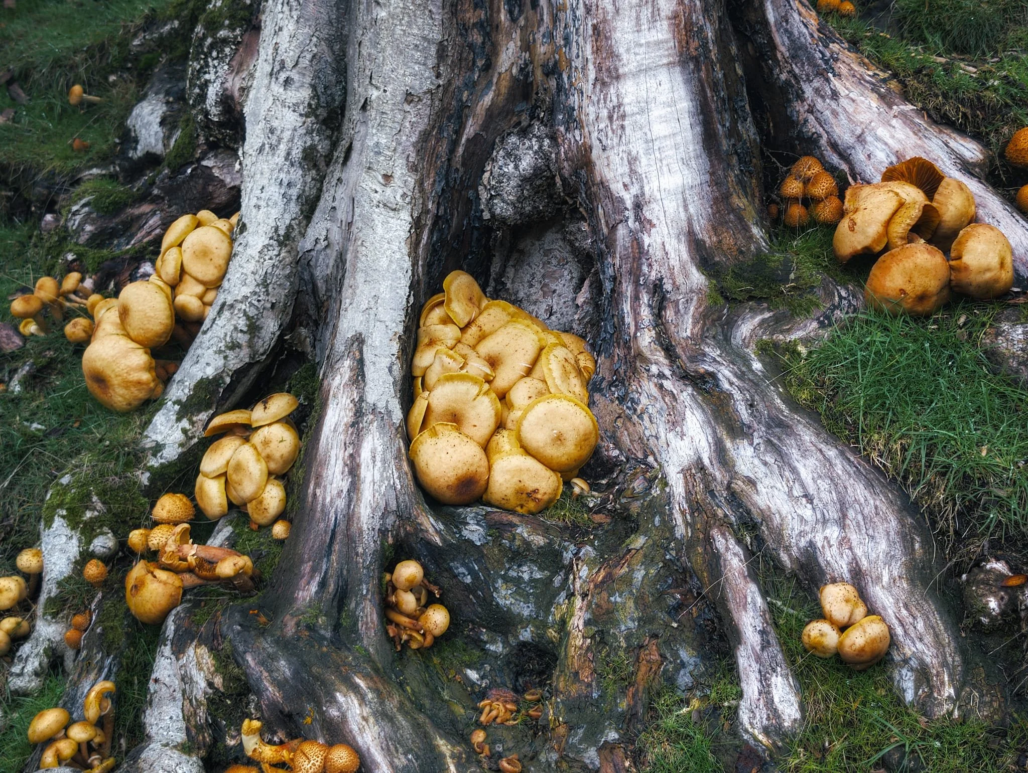
Up the flank of Cow Ridge, above the reservoir, Lisabet and I found a couple of dead trees with these mushrooms growing everywhere . Wanna guess what the are?
Back into the main valley heading north, I looked back to find a burst of light scanning across the flank of Bodbury Hill.
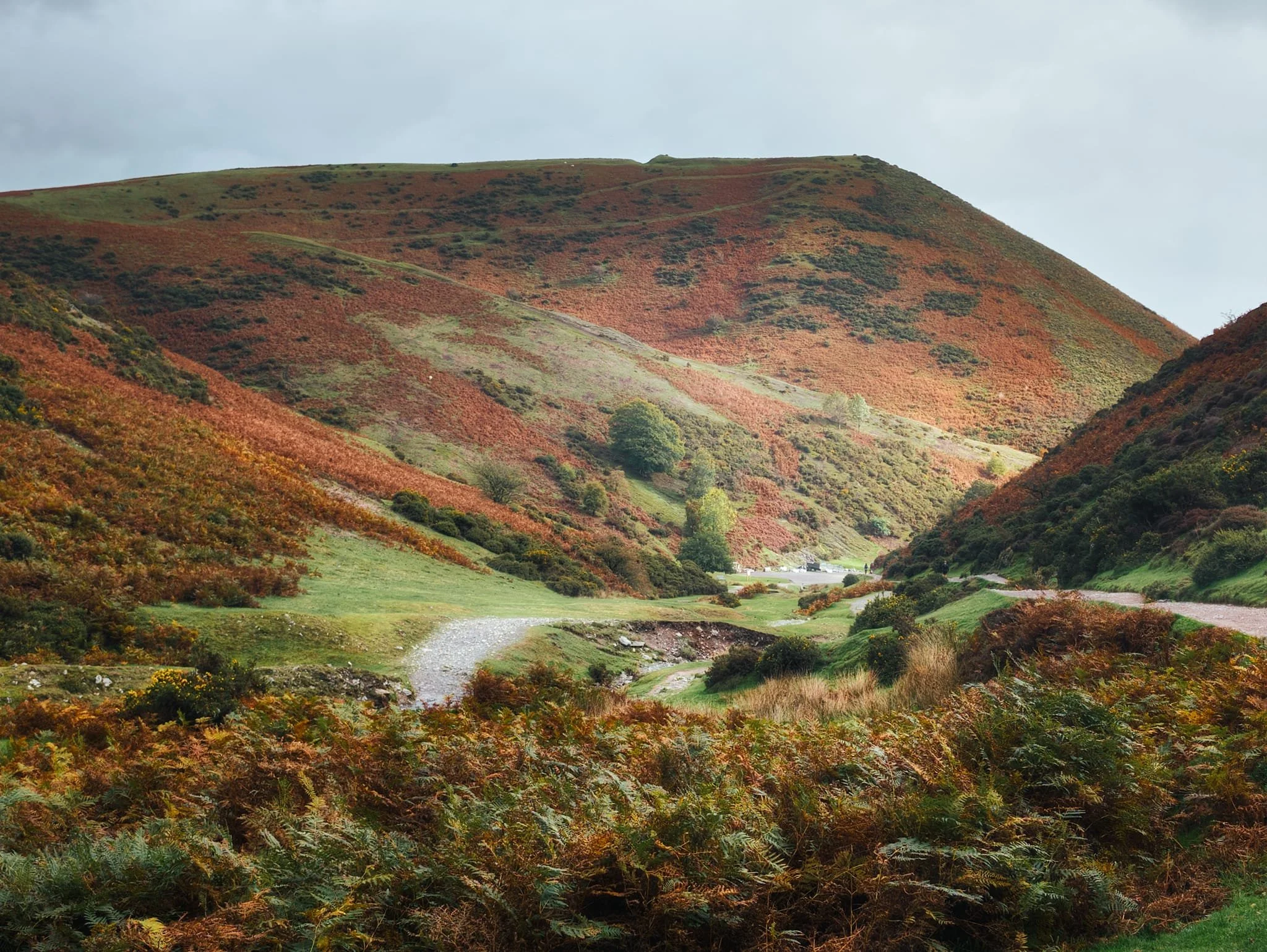
Higher we go as near the junction west towards Lightspout waterfall. Beautiful autumnal colours everywhere, including some stubborn gorse.
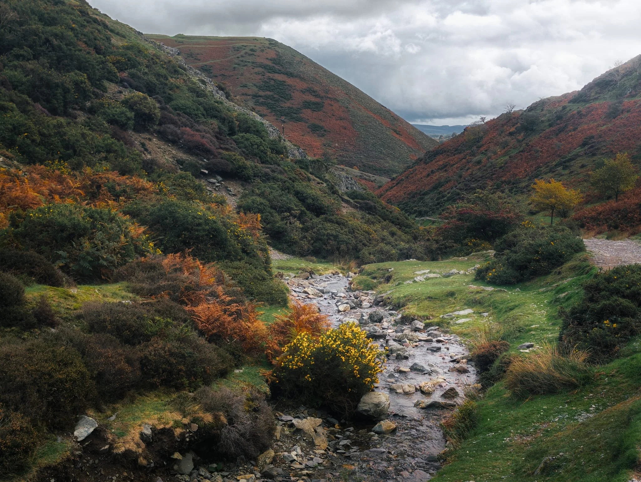
The going up Light Spout Hollow is short yet steep, with a couple of “bad steps” you need to navigate. However, the views back down are terrific. Here, looking back down the ravine sees Haddon Hill bathed in autumnal light.
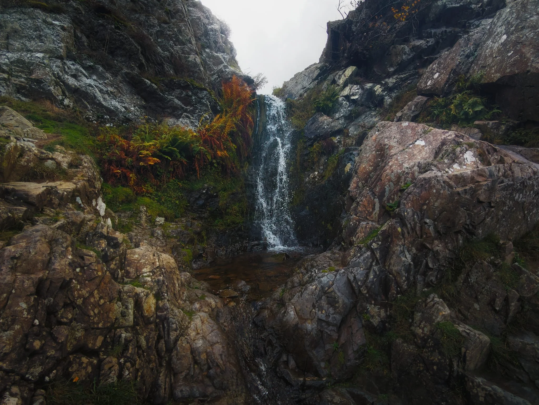
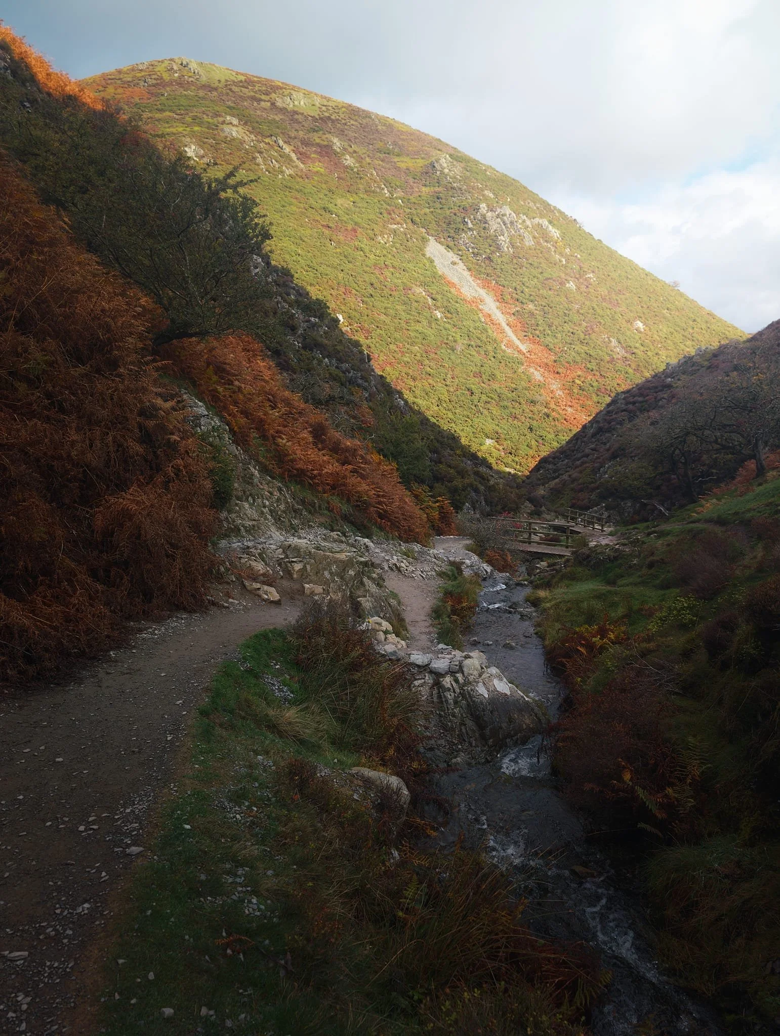
Finally we made it to Lightspout Waterfall, with not a lot of water in it. We forded across the beck a few times in order to get as close as possible to the falls.
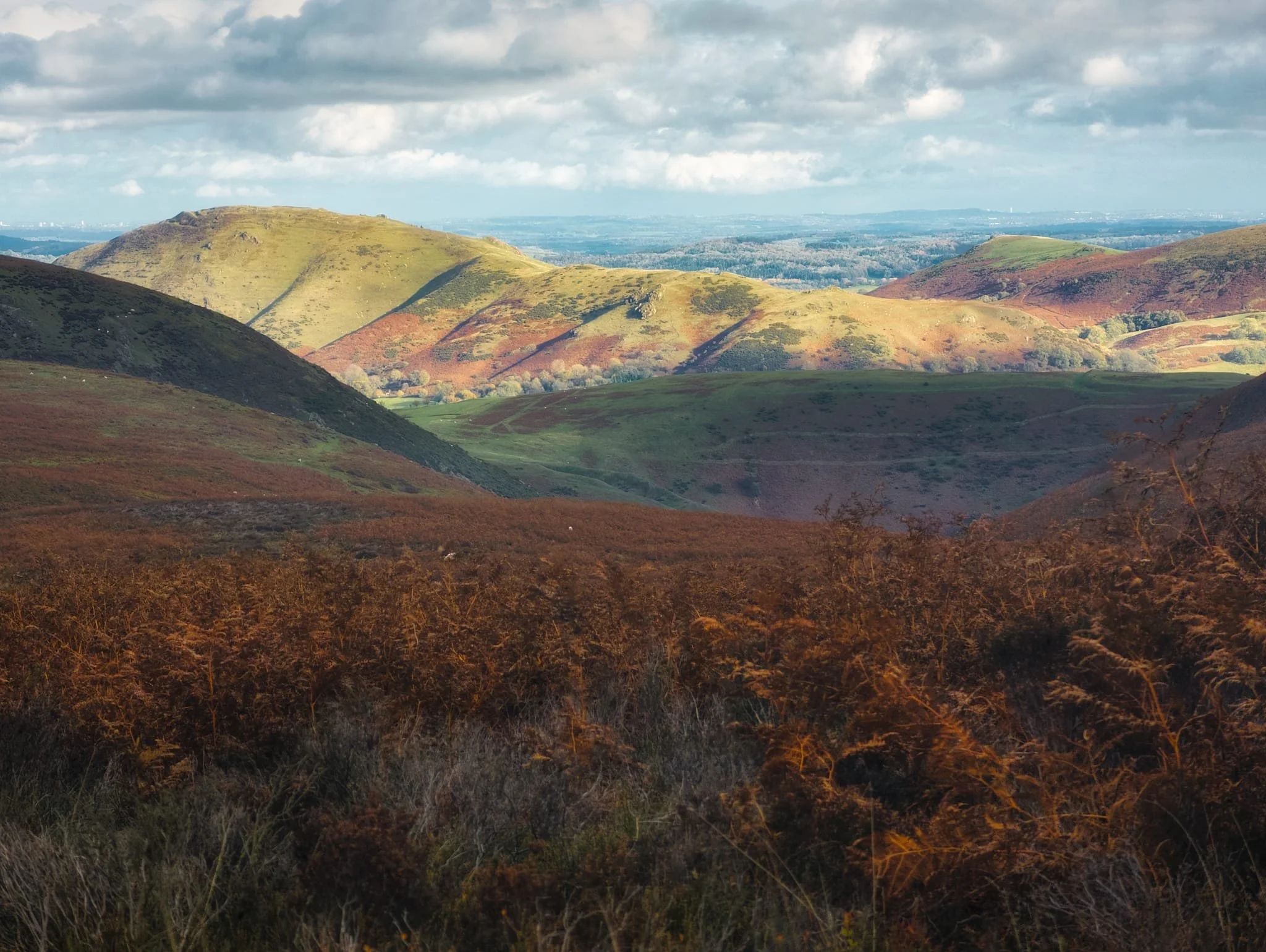
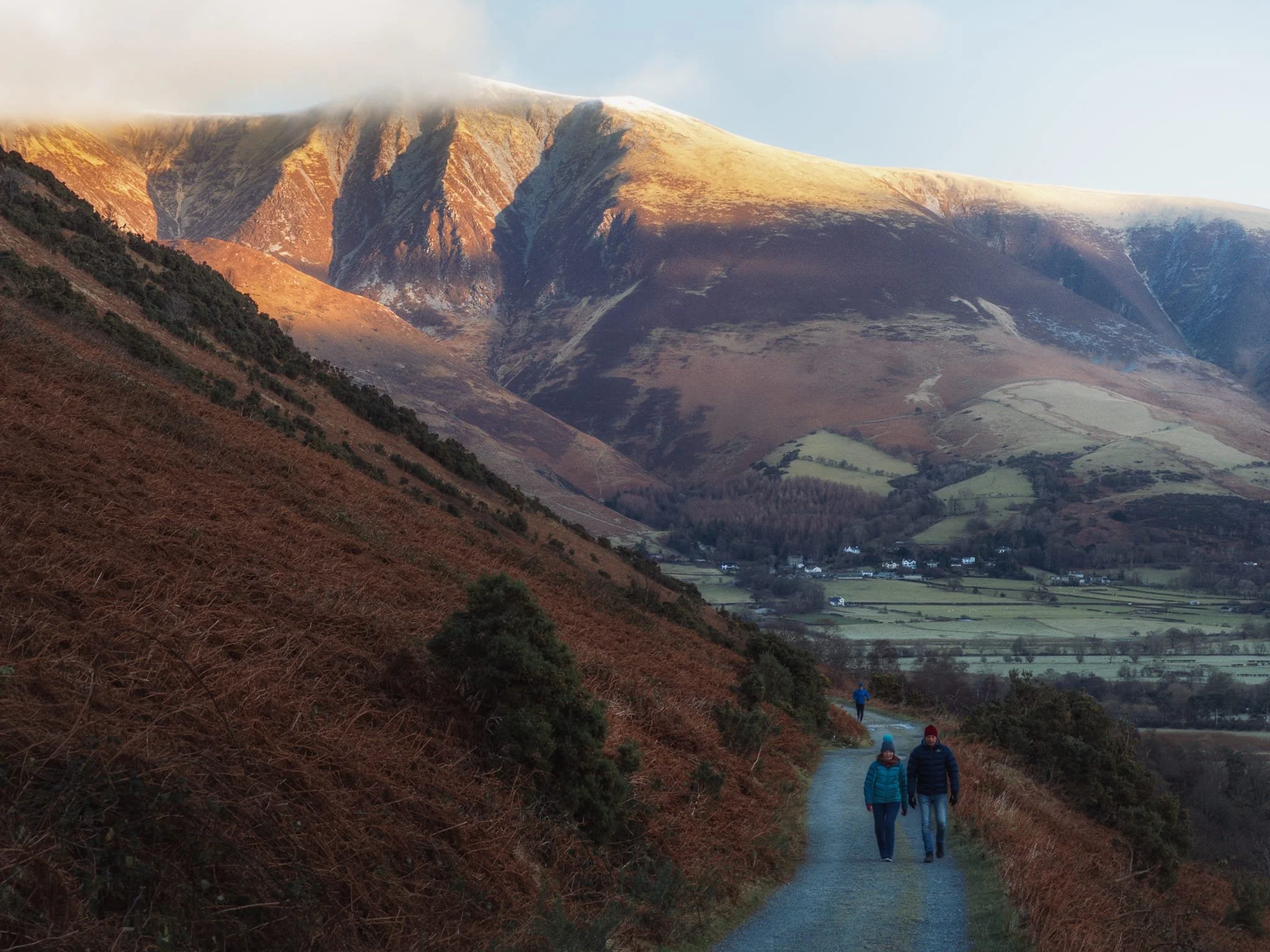
Rather than navigating the ravine back down, we instead continued onwards onto the broad plateau of the Long Mynd. Here, the views really open up. The Long Mynd just means “long mountain”, probably of Brittonic origin, as this broad upland plateau is 7 miles long. Whilst a dark cloud started to pass over us, the light beamed across the valley and illuminated the shape of Caer Caradoc (459 m/1,506 ft).
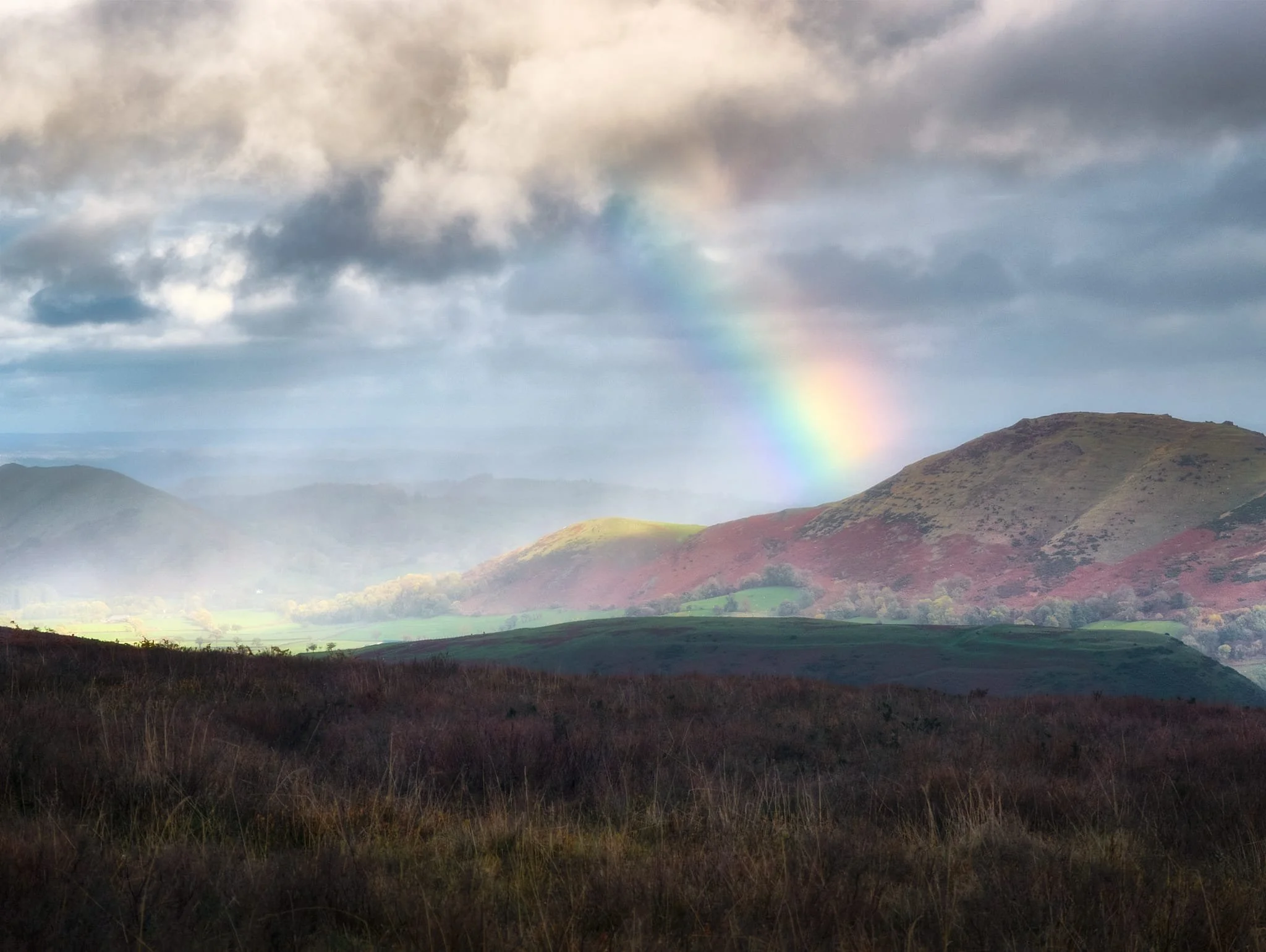
Soon afterwards we “enjoyed” a series of squalls drenching us. However, that did mean we got this superb light show of a rainbow hitting Caer Caradoc and a focused spotlight illuminating the northern Stretton Gap.
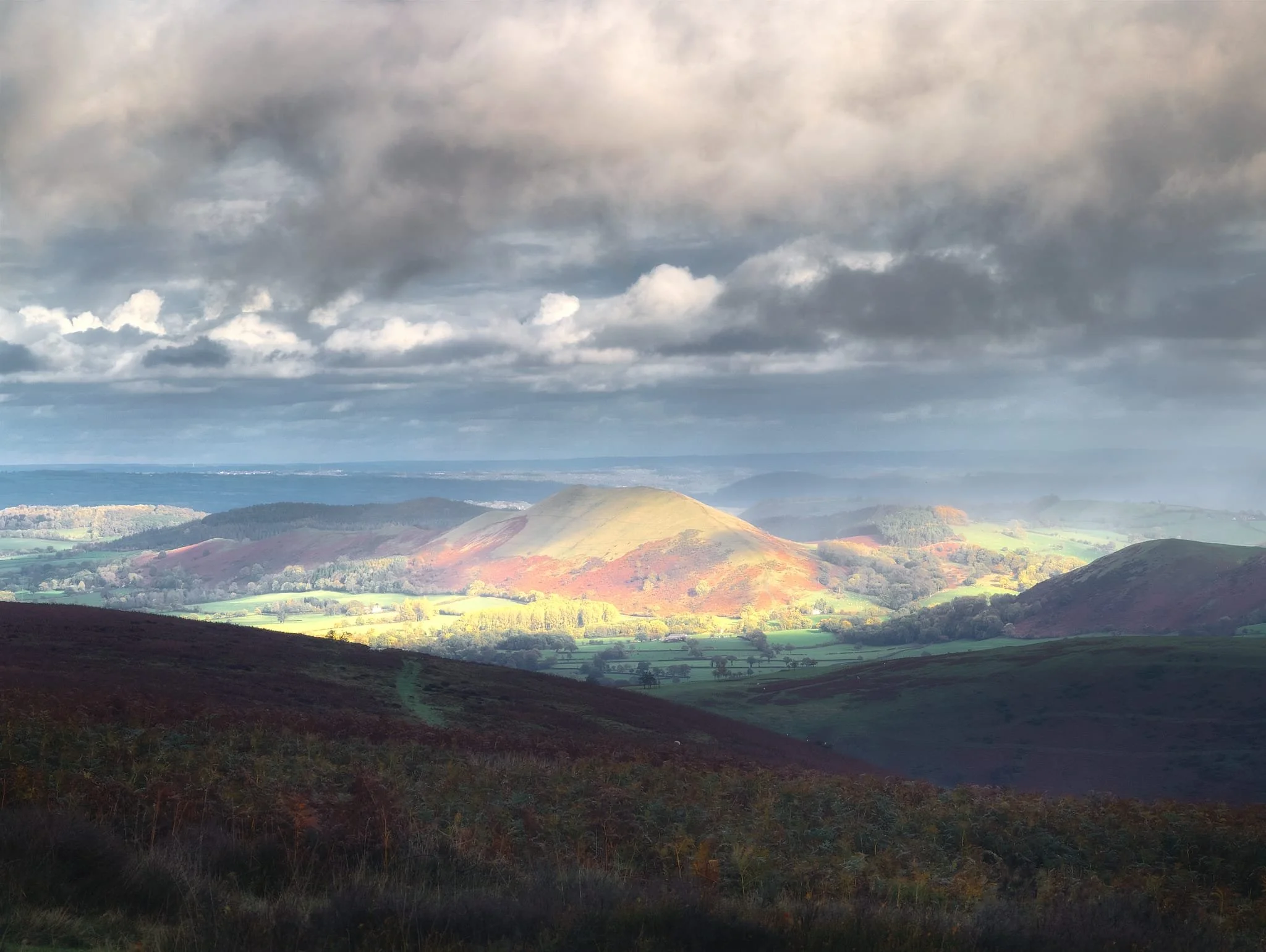
The rain continued to fall and so the light moved on, this time picking out The Lawley as dark clouds raced overhead.
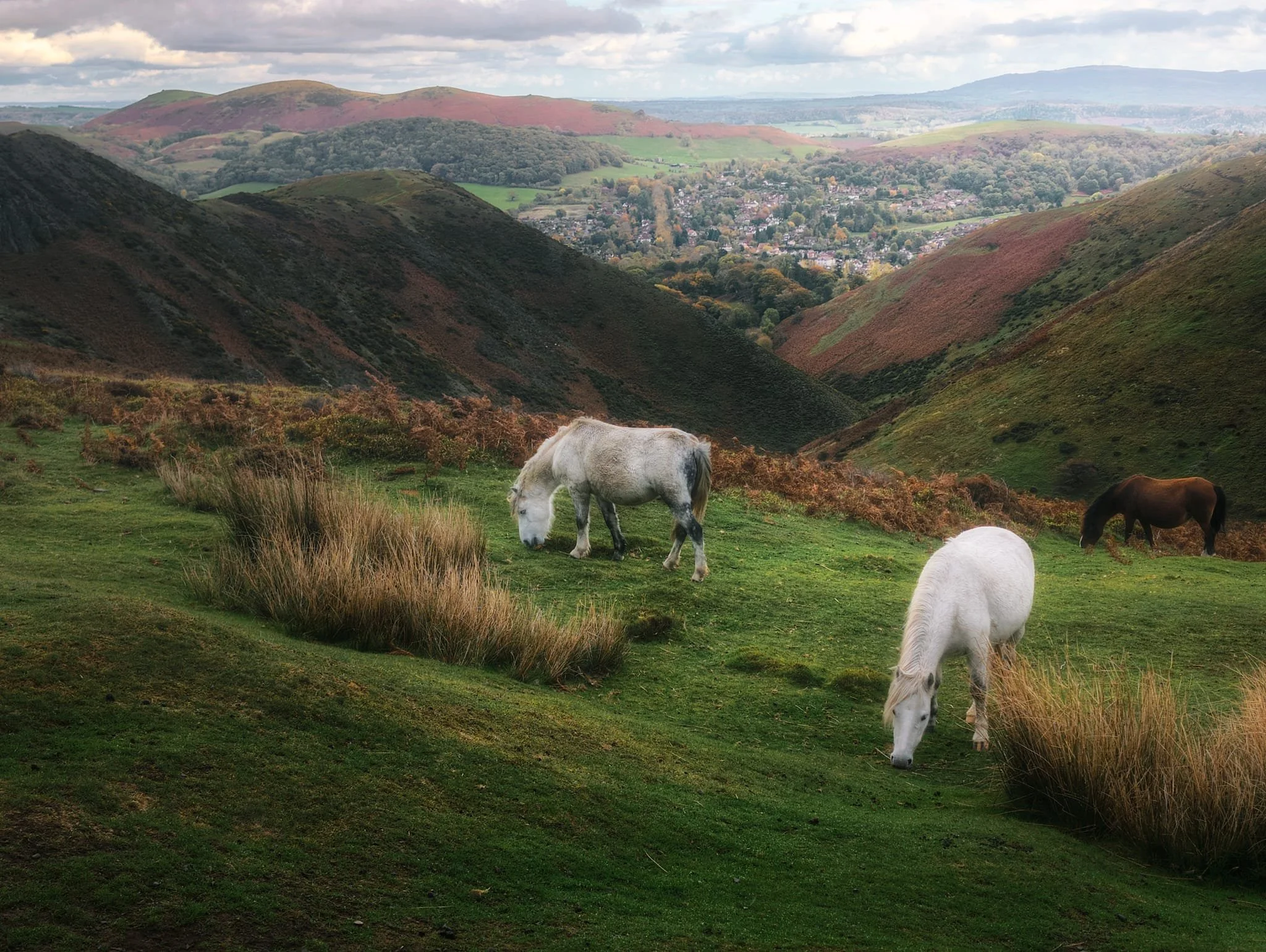
Eventually the rain eased off and we treated to this view of some wild horses grazing above Townbrook Valley, with Church Stretton in the distance and Hope Bowdler Hill off to the left.