This might be a bit of a mish-mash of a post, so bear with me.
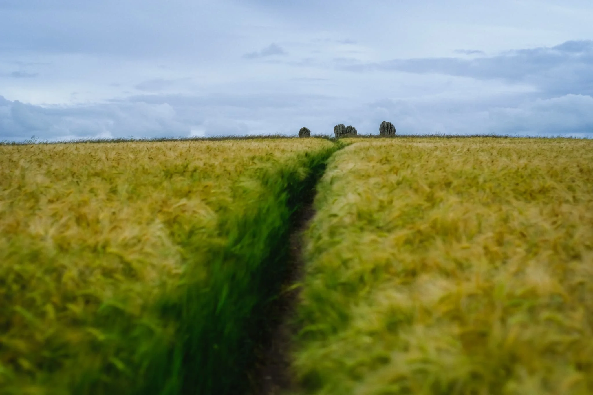
One morning, whilst perusing our favourite weather apps and services, we could see that we needed to stay away from the coast if we wanted to avoid the rain and thunder. Being more in-land would be a better deal. So we began looking at our “wishlist” of Northumberland in-land locations and realised that quite a few of them were fair clustered together.
Despite being in peak summer, it wasn’t all glorious sunshine during our week in Northumberland.
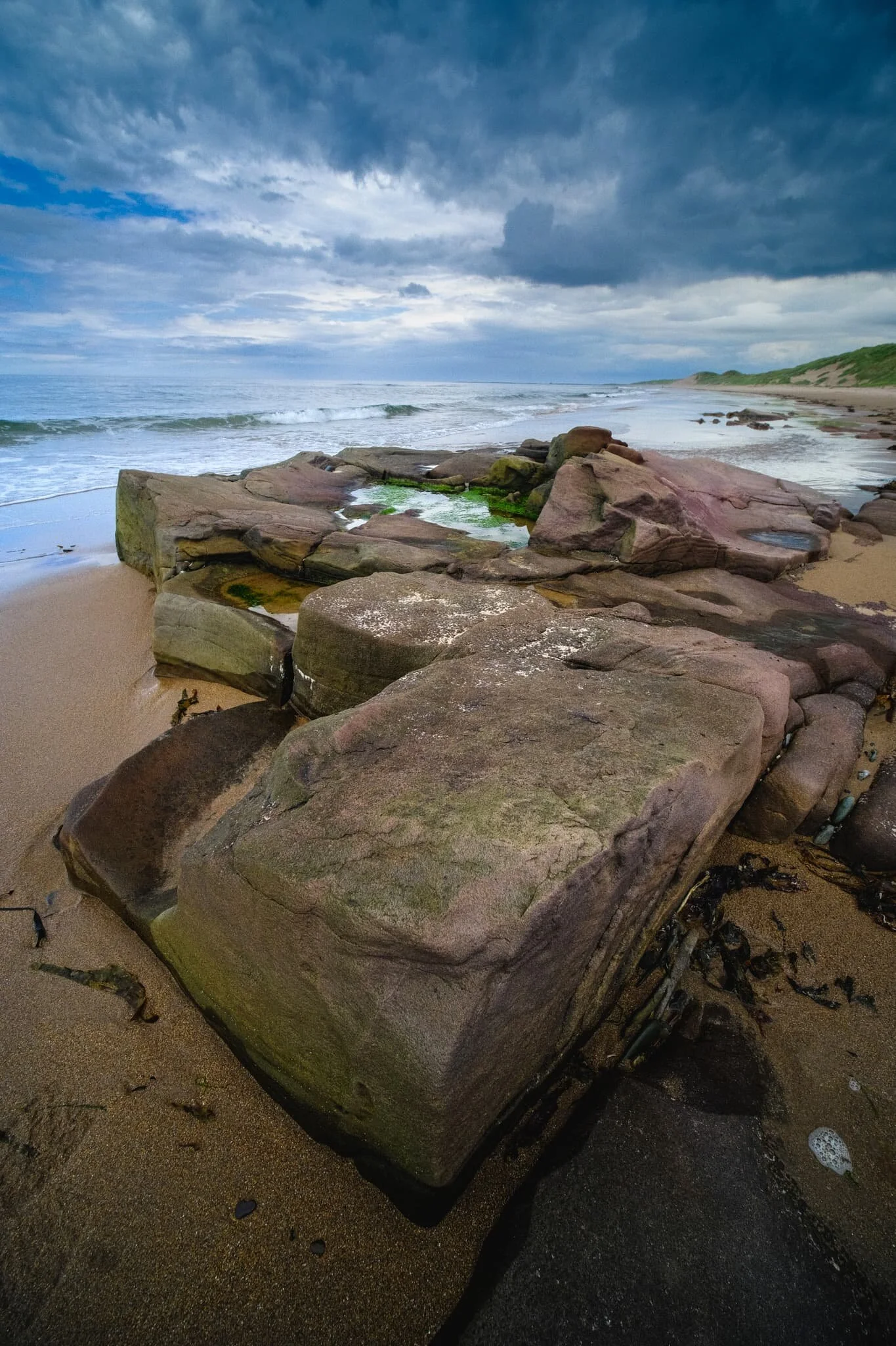
On this particular day I poured over the various weather apps and services I check to ascertain temperatures, chances of rain, atmospheric conditions and more. From what I could see, if we stayed near the coast of Northumberland around Bamburgh we could probably avoid a lot of storms that were moving southwards.
I’m back from a week away! How’s everyone been?
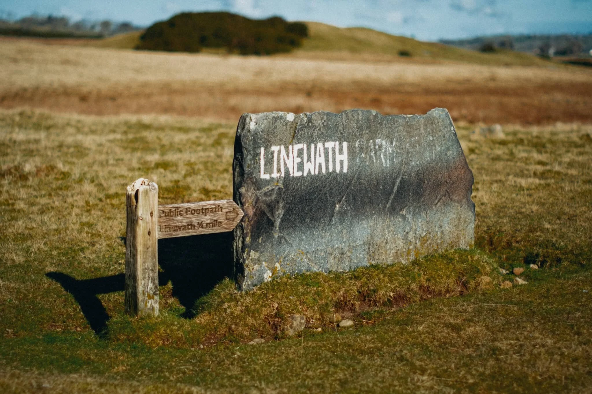
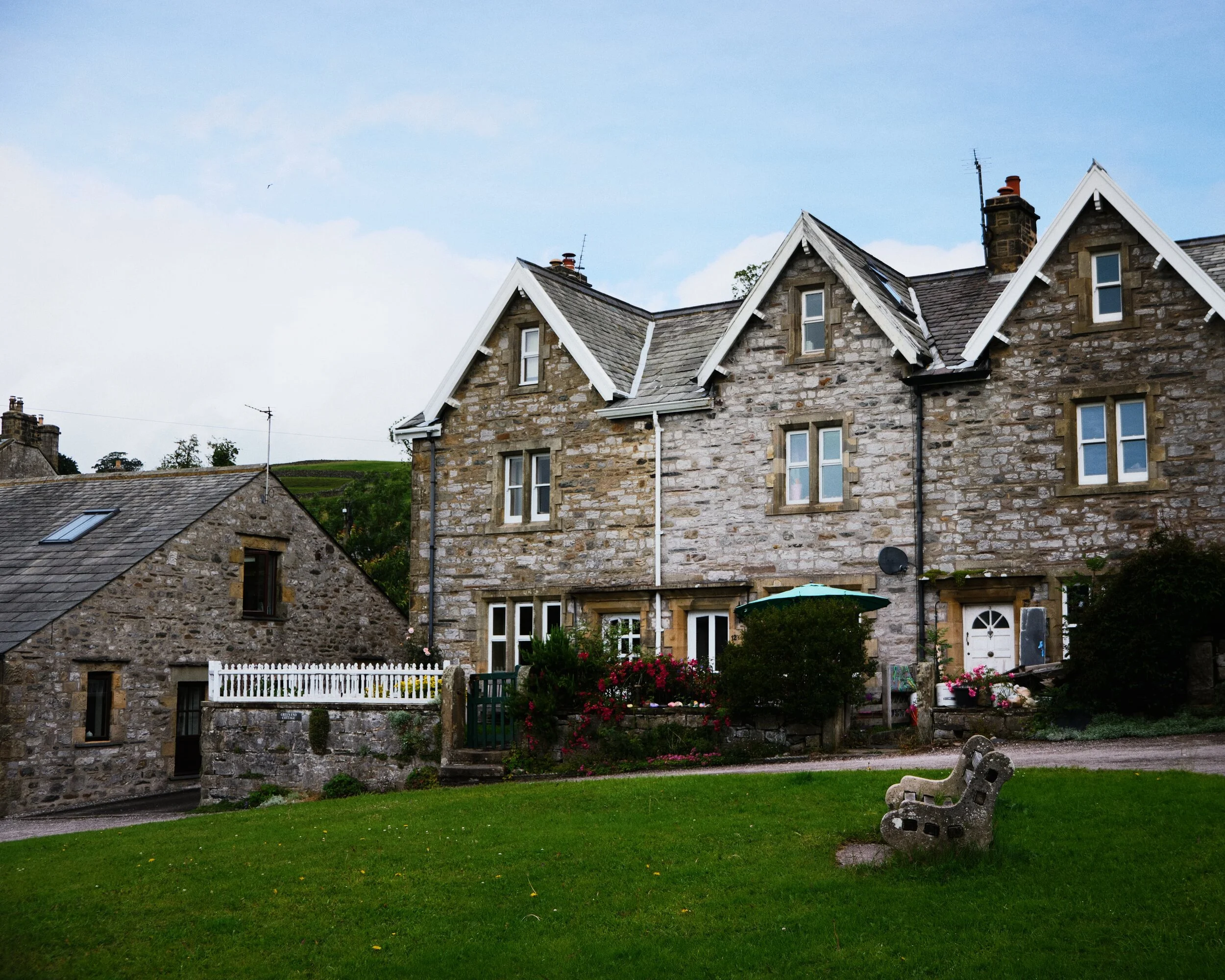
Lisabet and I took a week’s summer break, based in a small farm cottage not too far from Berwick-upon-Tweed, Northumberland. We enjoyed lots of hiking this holiday, and as this is Northumberland and the Scottish Borders, that meant plenty of coastal action, beaches, cliffs, the lot.
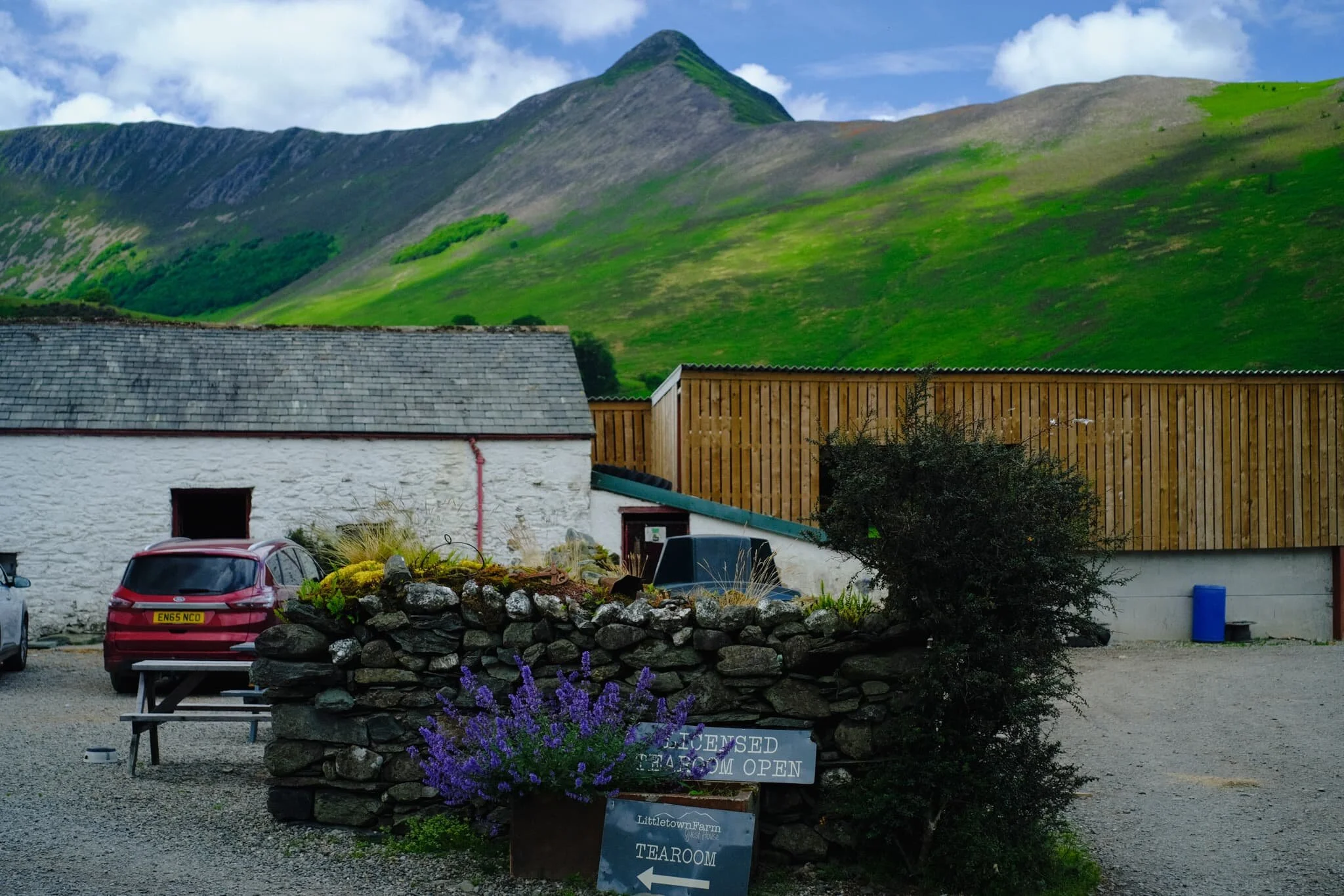
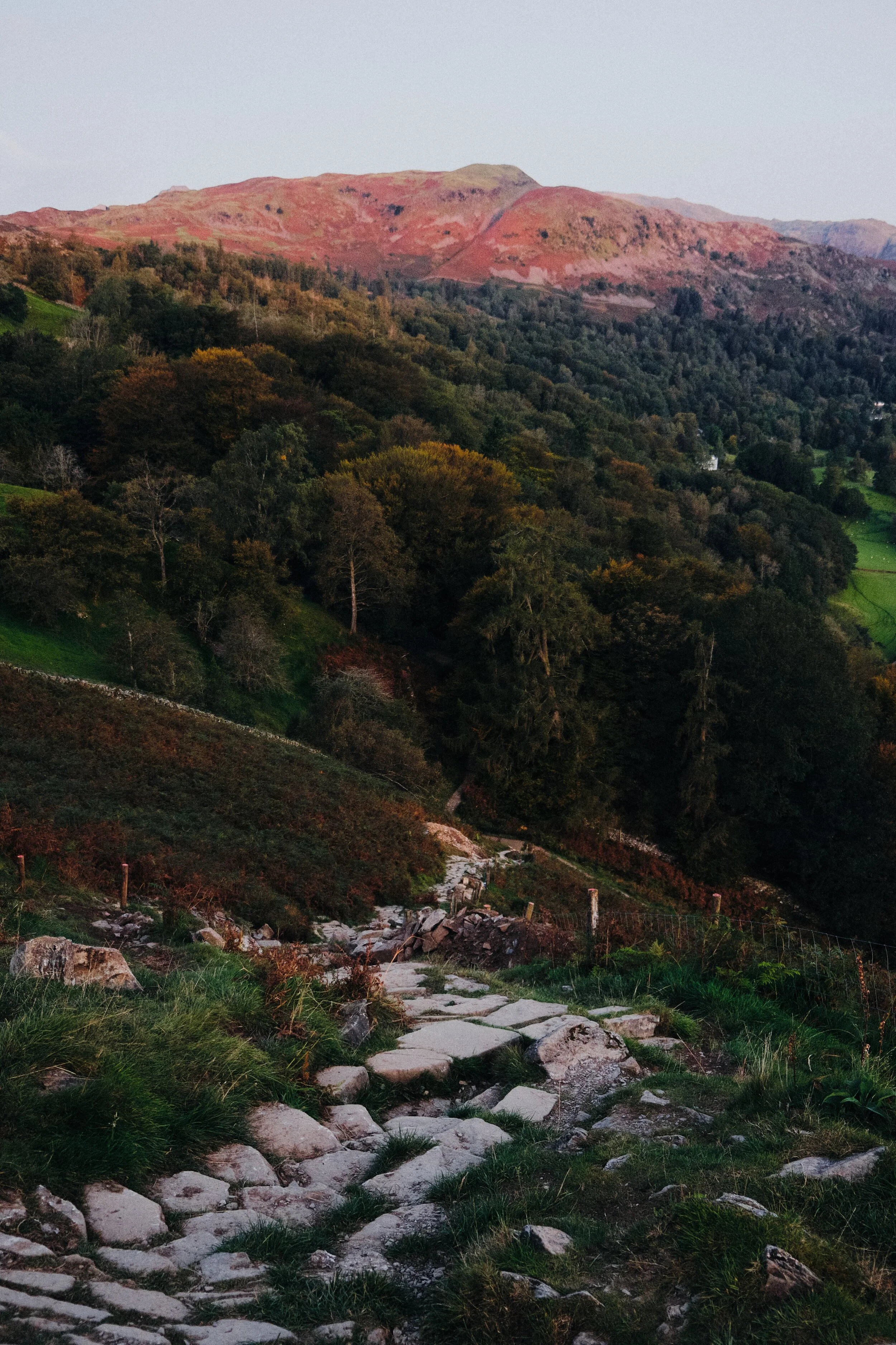
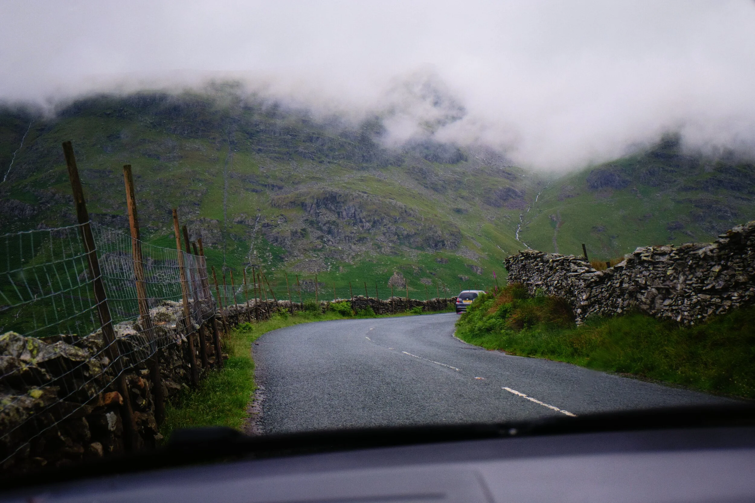
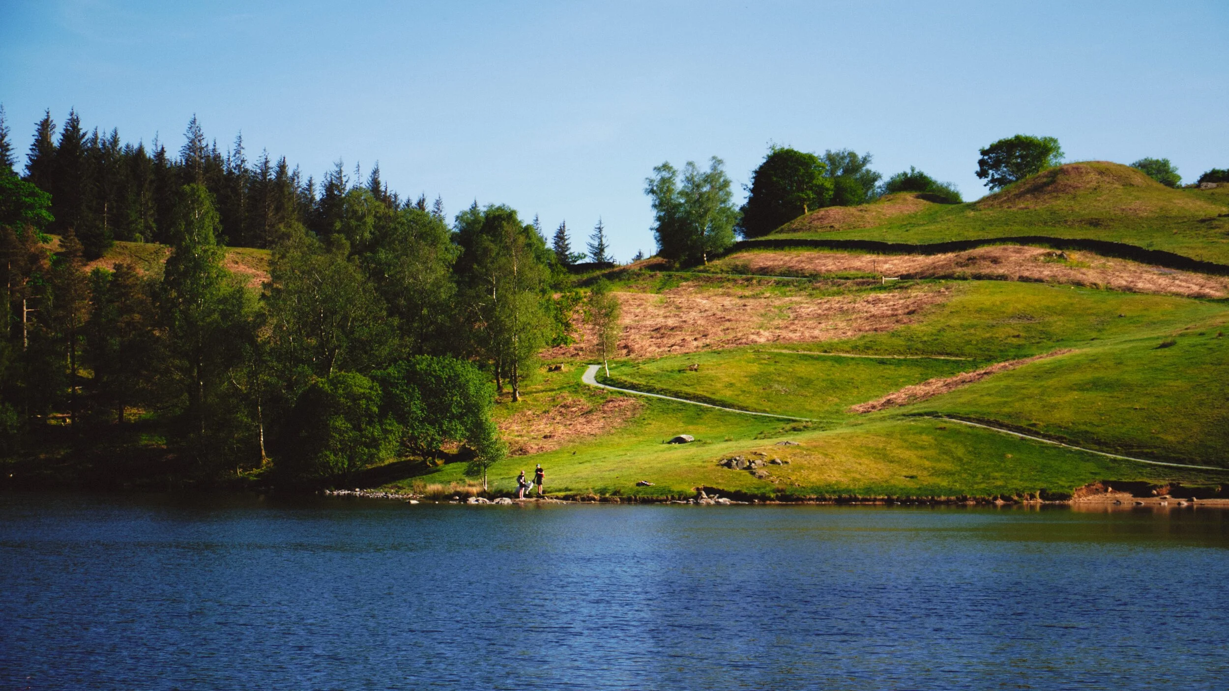
On the Sunday following the Saturday, we threw caution to the wind and visited the Lake District for a solid hike.
Signs were looking good that, for a Sunday morning, the Lake District wasn’t looking too busy (use Safer Lakes to check the busyness of Lake District car parks). We drove to Keswick and plotted a hiking route from the town onto the Cumbria Way towards the Lingholm Estate, where we’d pause for refreshment. Then we’d continue on the Cumbria Way towards the foot of Catbells, and break off into the Newlands Valley, terminating at Little Town and circling back all the way to Keswick.
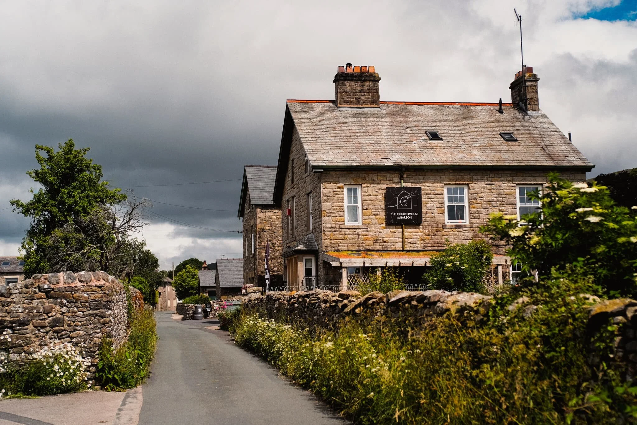
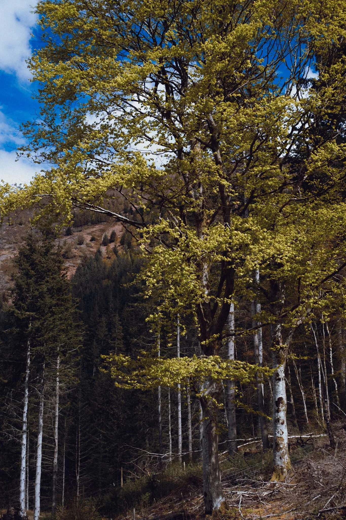
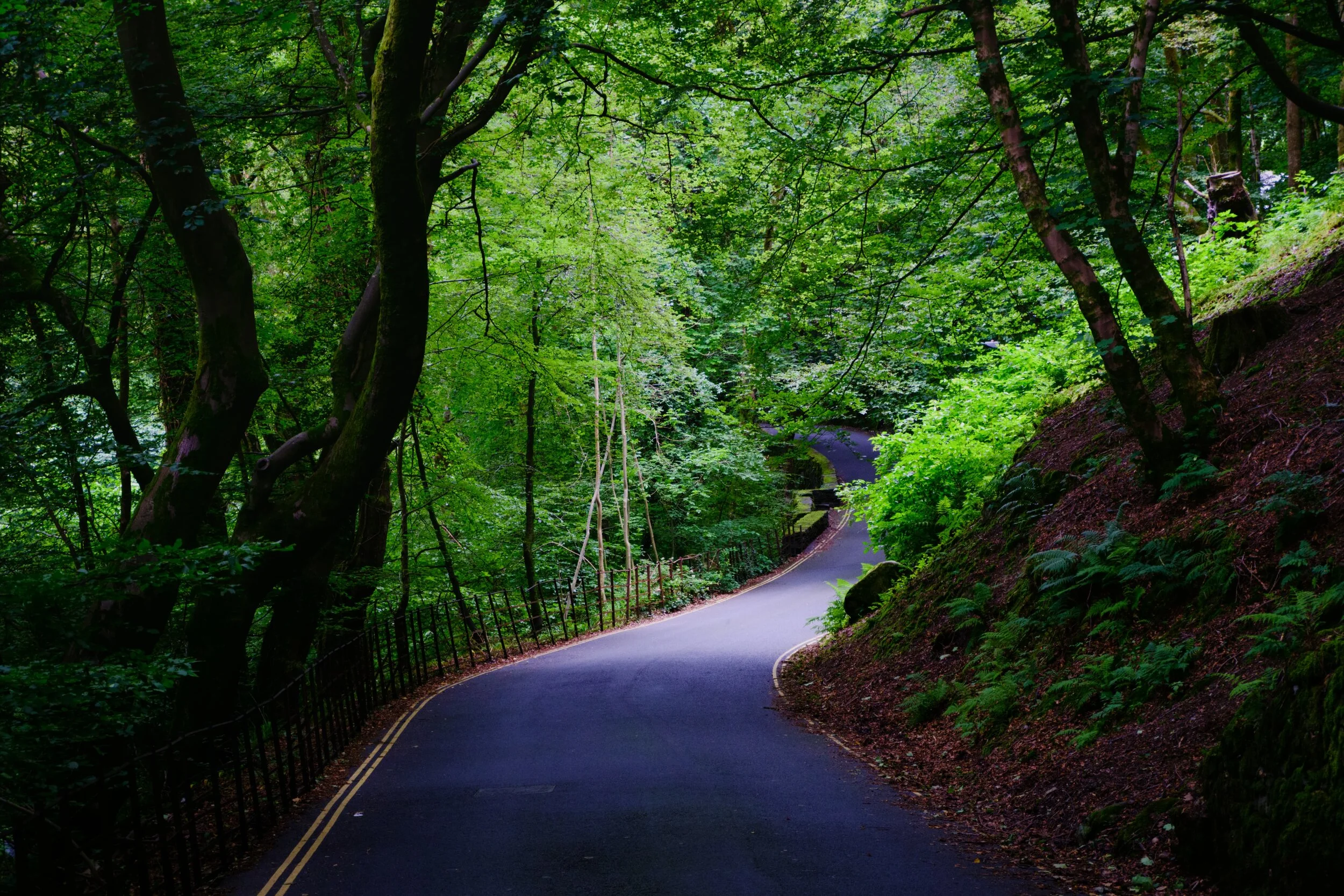
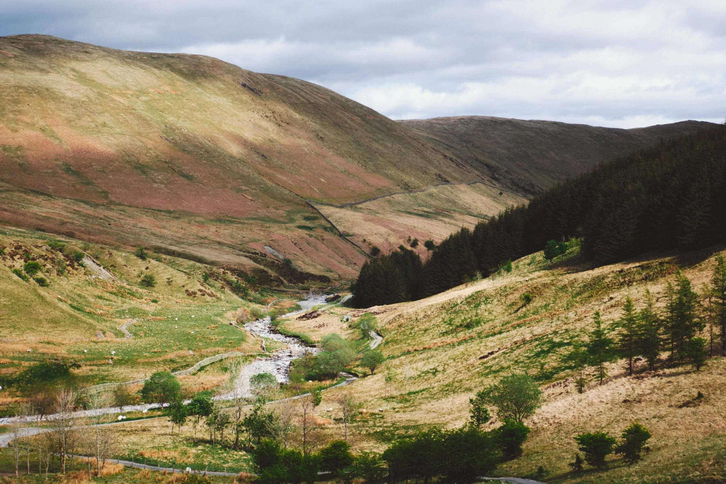
With the summer heat increasing once again, it was time to revisit a favourite of ours: Barbondale.
The last time we hiked around the area was May last year (2020). One year and a month on, tree felling operations in the area are still very much in action. I wonder why a lot of the woodland in the valley is being cut down and replanted? It is quite sad to see.
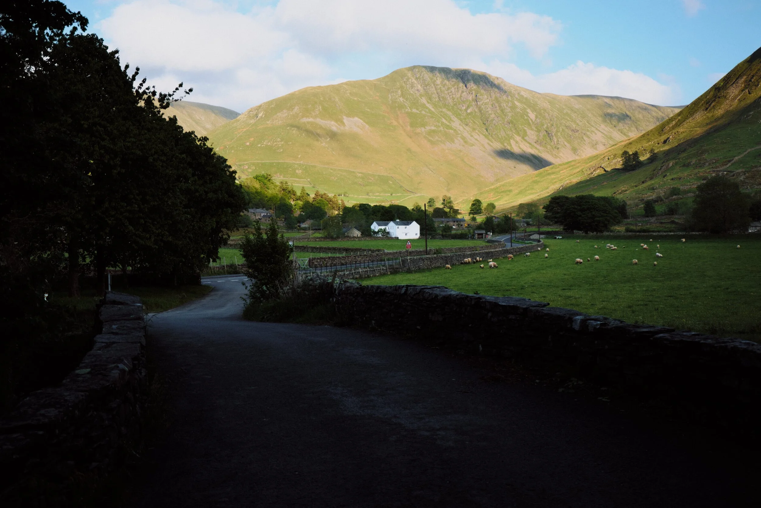
We kicked off Father’s Day weekend by revisiting the Mosedale valley in the Northern Fells of the Lake District.
The last time we hiked Mosedale was back in March of this year, during a visit to my Dad’s. It was our first time in this quiet valley and we were floored with the sights and views. The nice weather probably helped.
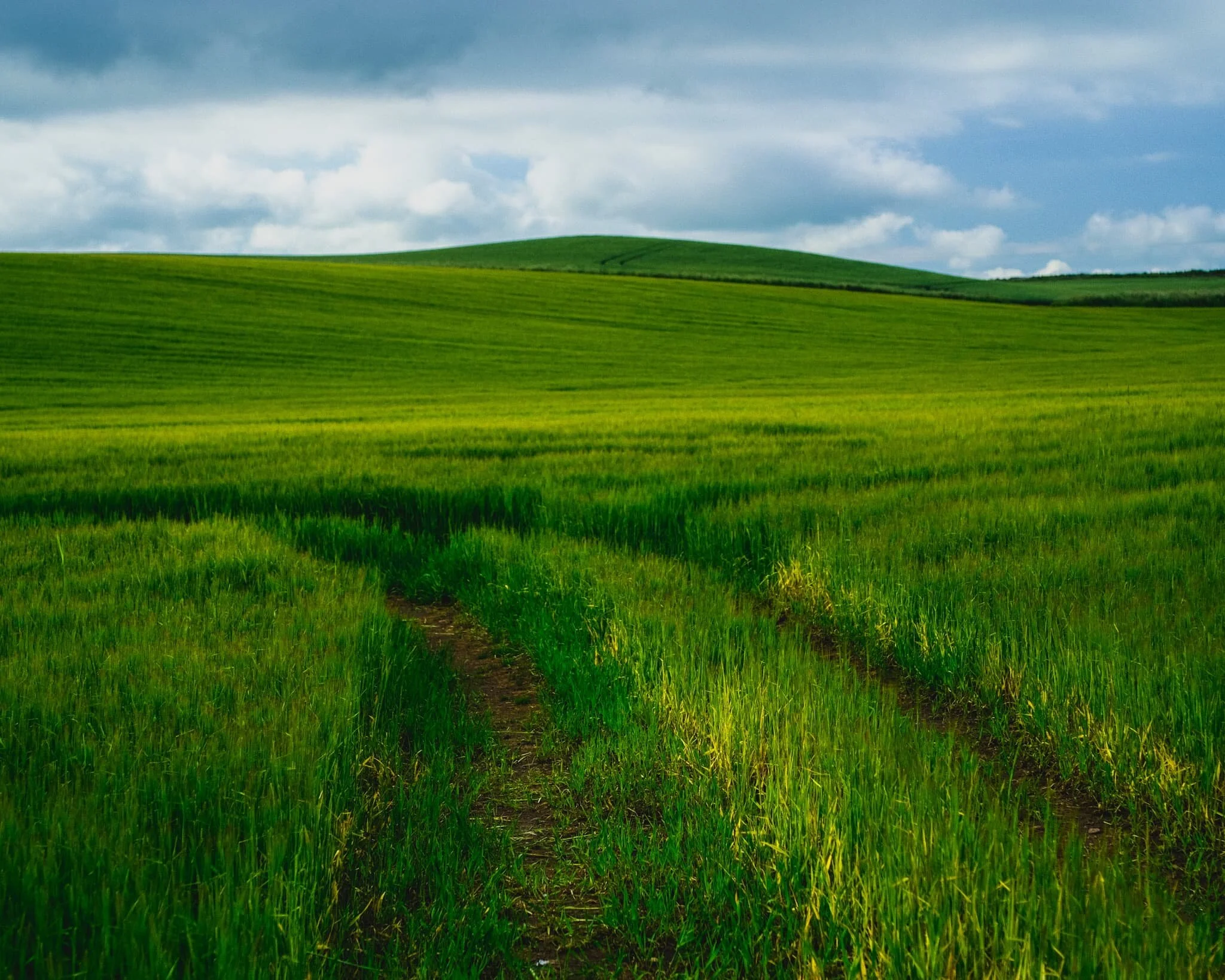
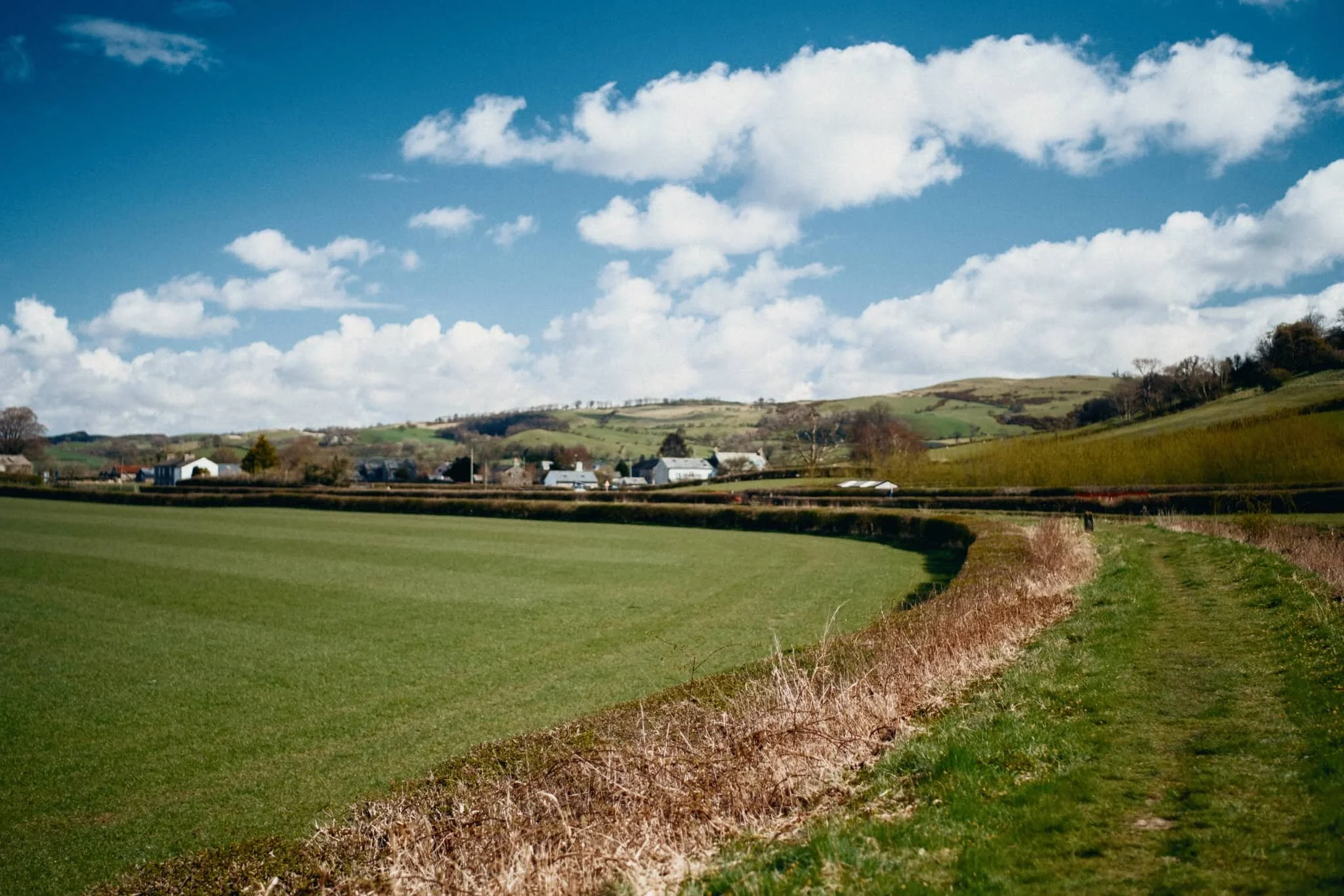
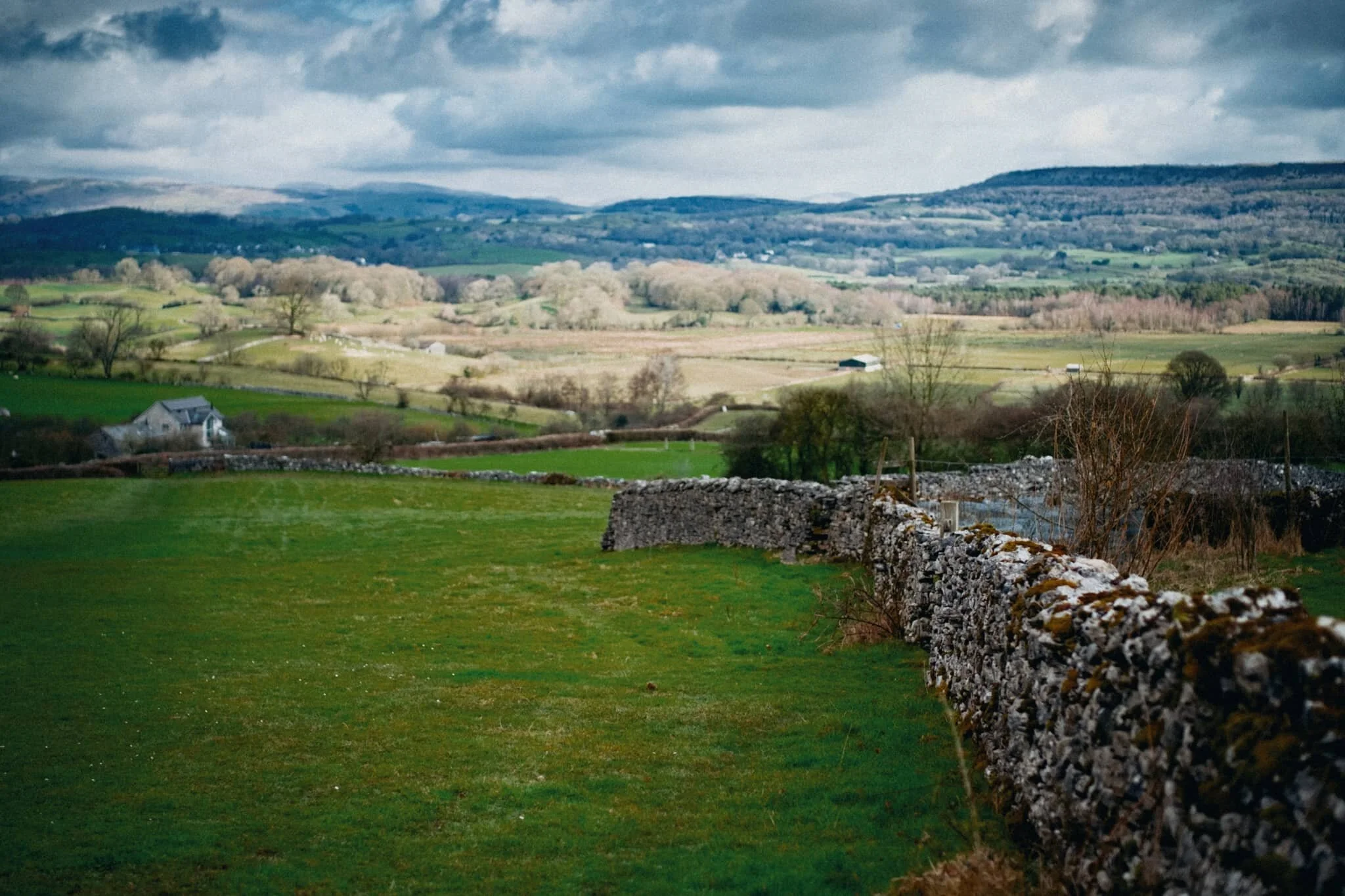
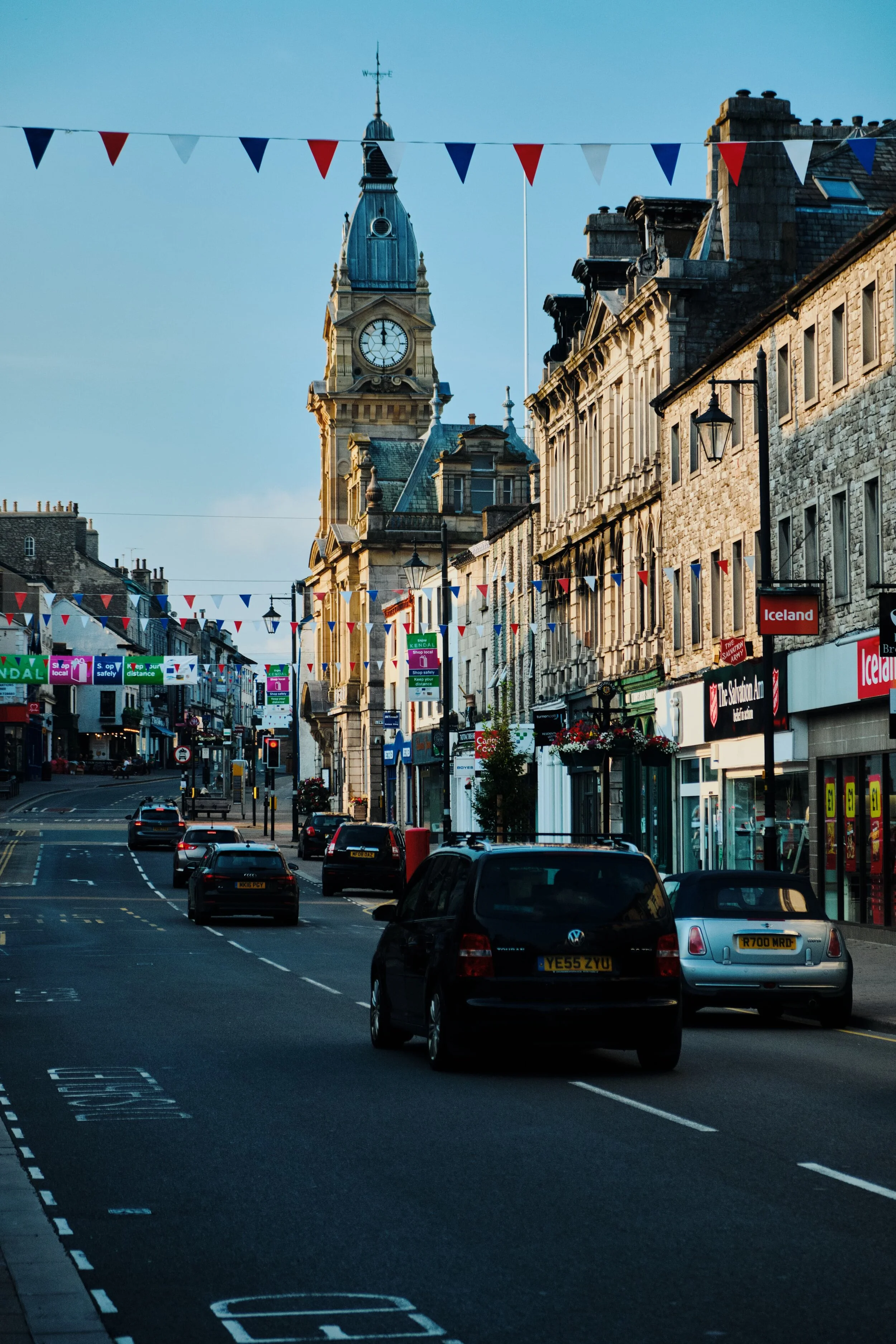
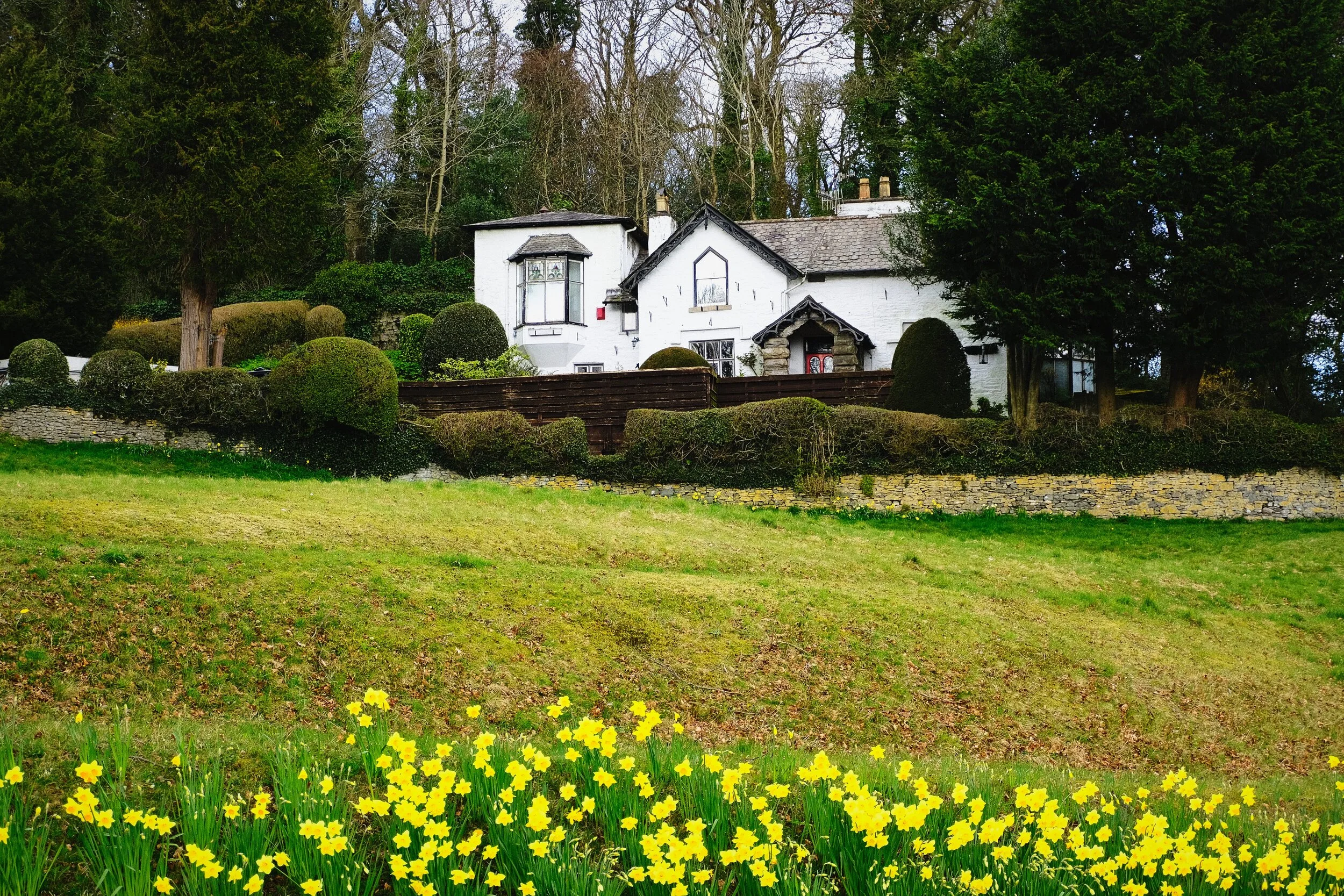
Sometimes, as an Englishman, you just need to have a proper English Countryside experience.
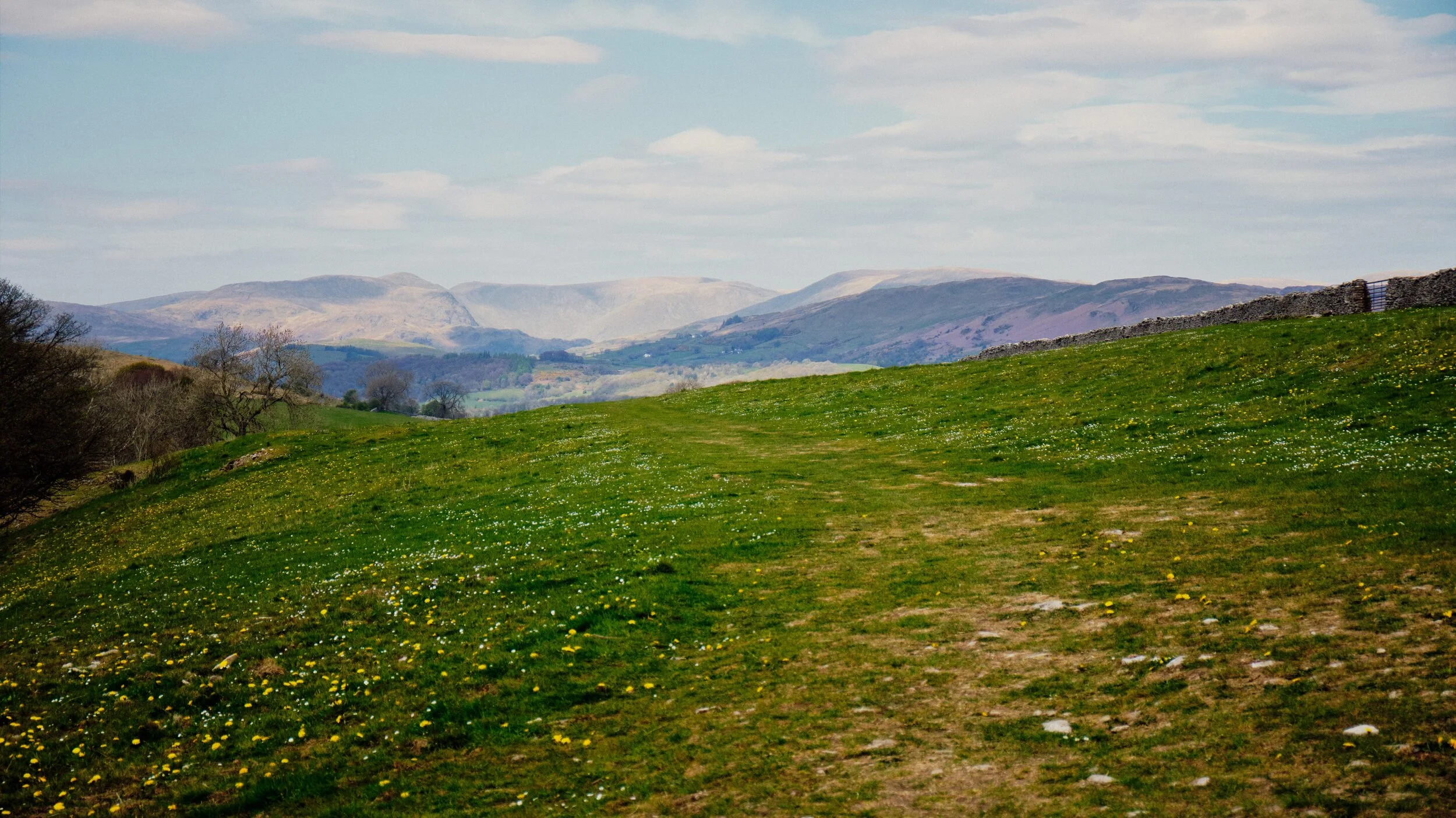
For one reason or another, I’ve not been feeling 100% mentally and emotionally this week. Saturday arrived as a glorious summer’s day. We knew the Lake District would be absolutely heaving with people. Instead, we opted for a local 9km walk around the Cunswick Fell area.
Let’s move away a little from the landscapes and nature.
Lisabet and I recently had occasion to enjoy an outdoor swimming session with esteemed outdoor and wild swimming guide Suzanna Cruickshank. Not only was Suzanna a total delight, with the patience and compassion of a saint, but the weather couldn’t have been better with clear skies and 20+ degree sun. We were guided on a swim in Bassenthwaite Lake, which thankfully allows for a gentle drop into the water unlike most other lakes in the Lake District. The experience was exhilarating, fun, and freeing.
Summer has well and truly arrived.
Following on from our little hike around Stenkrith Park and the Lune Gorge, Sunday greeted with us with clear blue skies and 20+ degree sunshine. That’ll do, nicely.
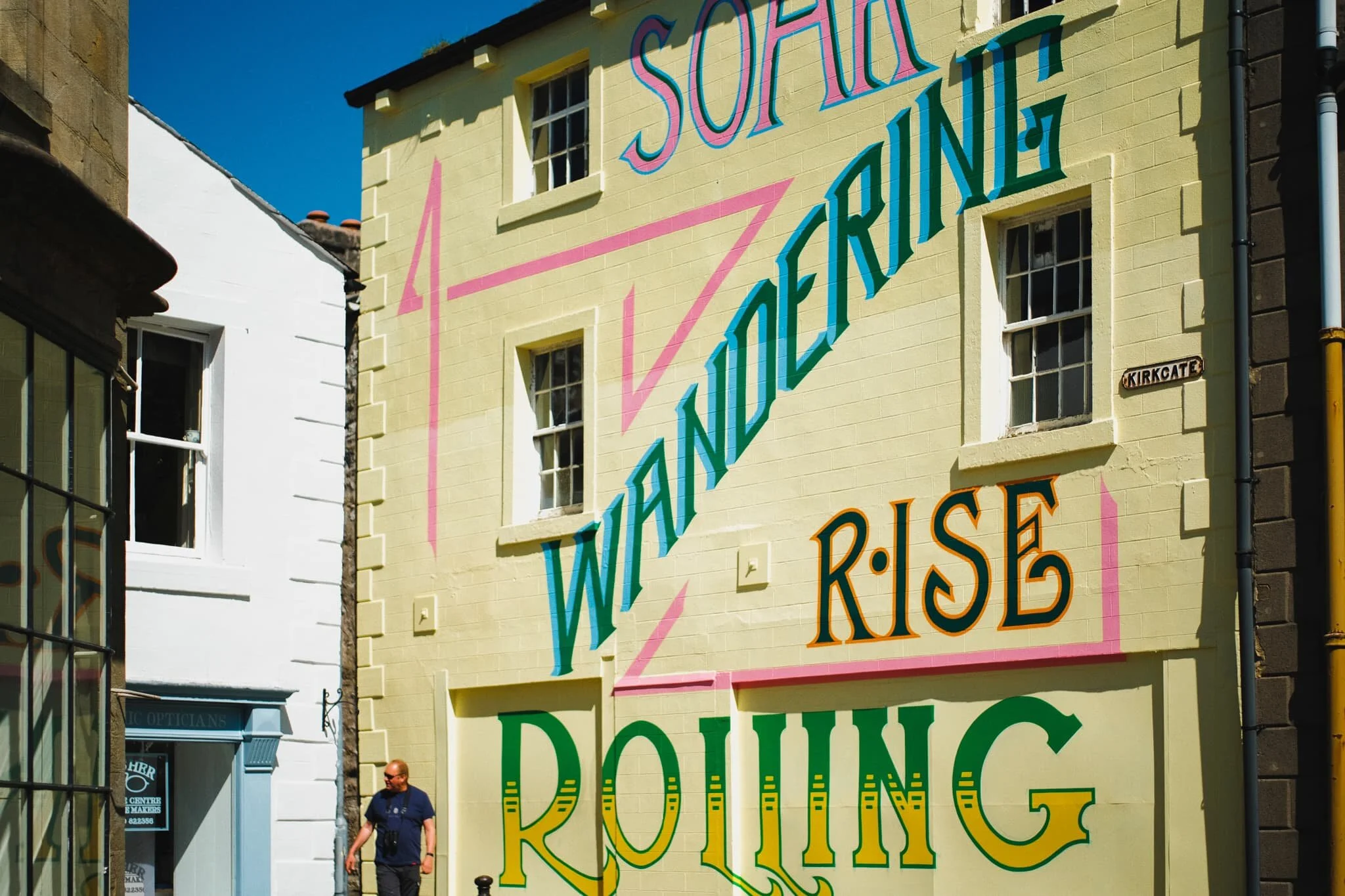
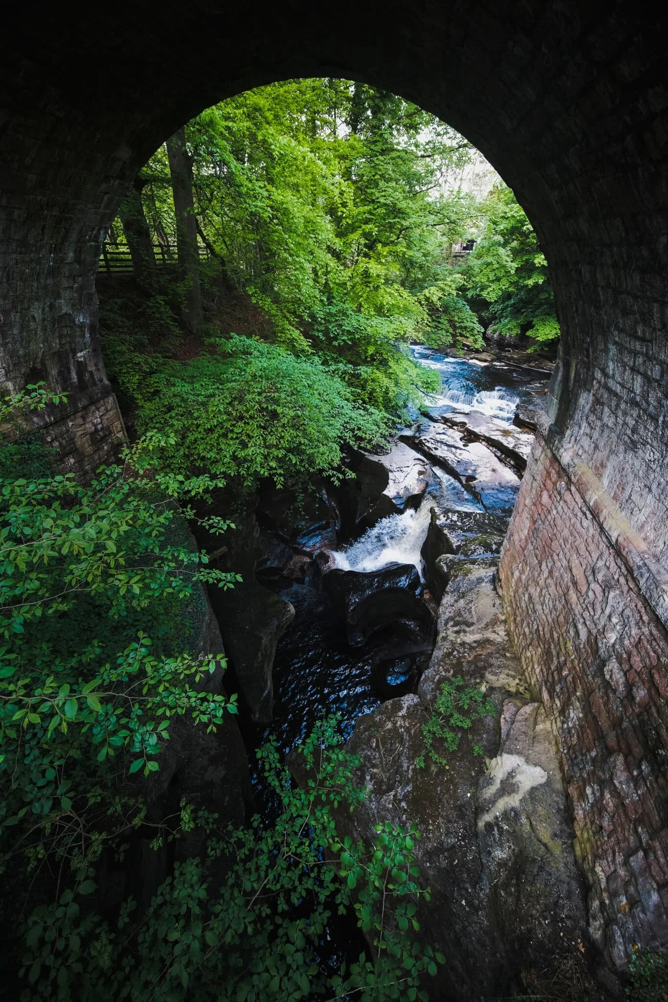
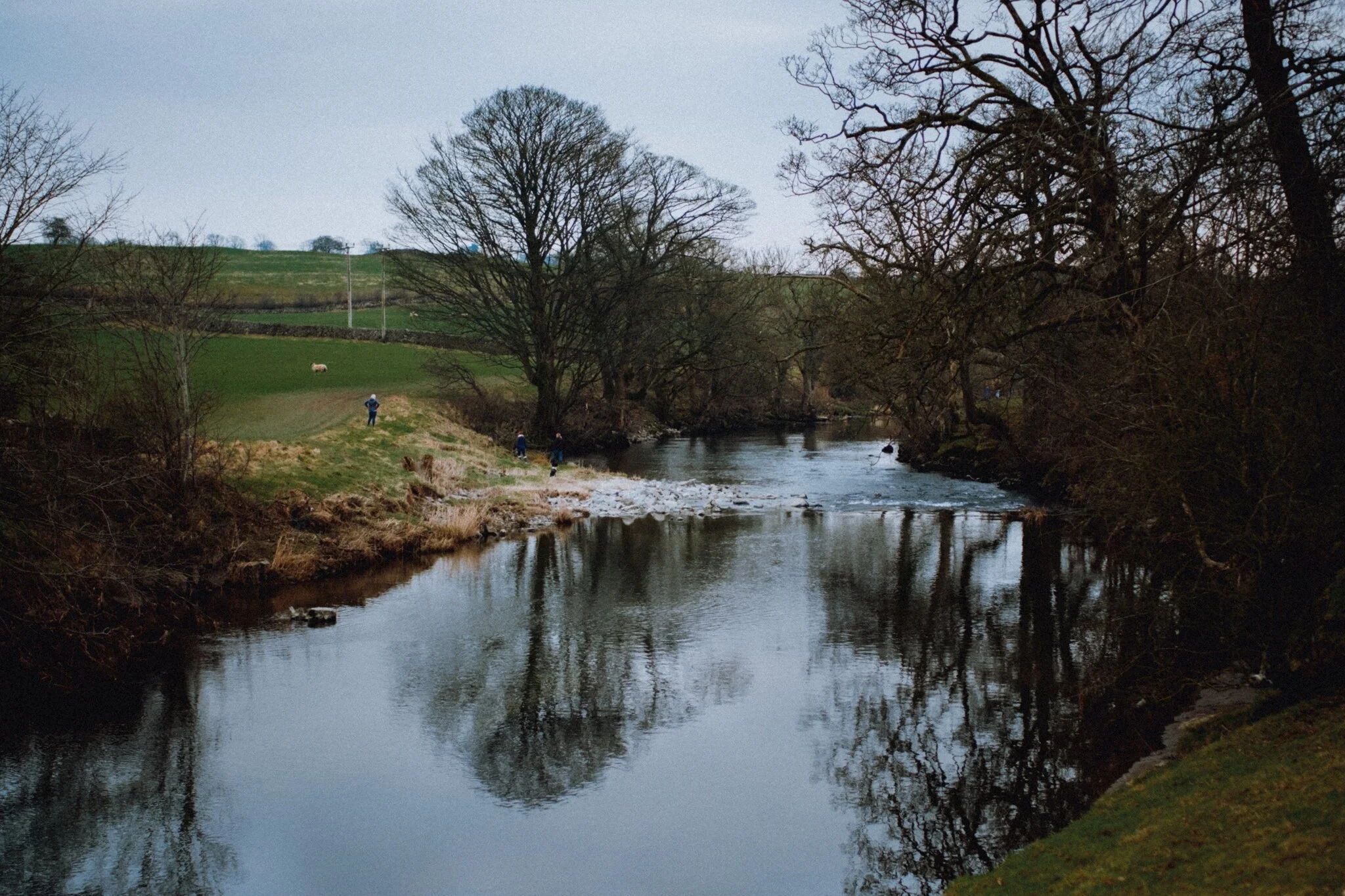
Woohoo, Spring Bank Holiday weekend!
On the first day of our 3-day weekend, we ventured northeast towards the bonny Cumbrian town of Kirkby Stephen. Aware of the rush of people heading into the Lake District, we’ve decided to largely stay out of Cumbria for this Bank Holiday. Near Kirkby Stephen is Stenkrith Park, which I’ve written about before. Here one can enjoy the incredible sights of the River Eden and the limestone gorge it’s created, then follow the Viaduct Trail for more glorious views and scenes.
We finally got the opportunity to explore one of the Lake District’s “hidden” valleys.
I’ve had Swindale bookmarked in my Pinterest for years now. What drew me to the area was looking at maps of the valley’s head, appropriately called Swindale Head. Here you can find a series of cascades and waterfalls dropping down 300 ft of crag, known as Forces Falls.
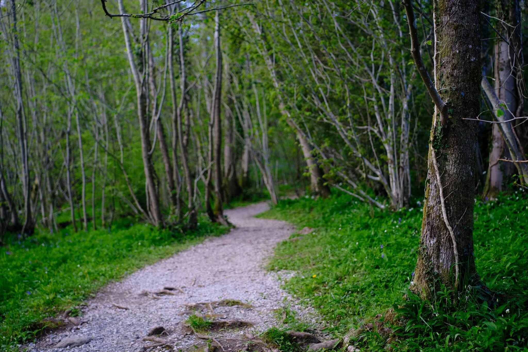
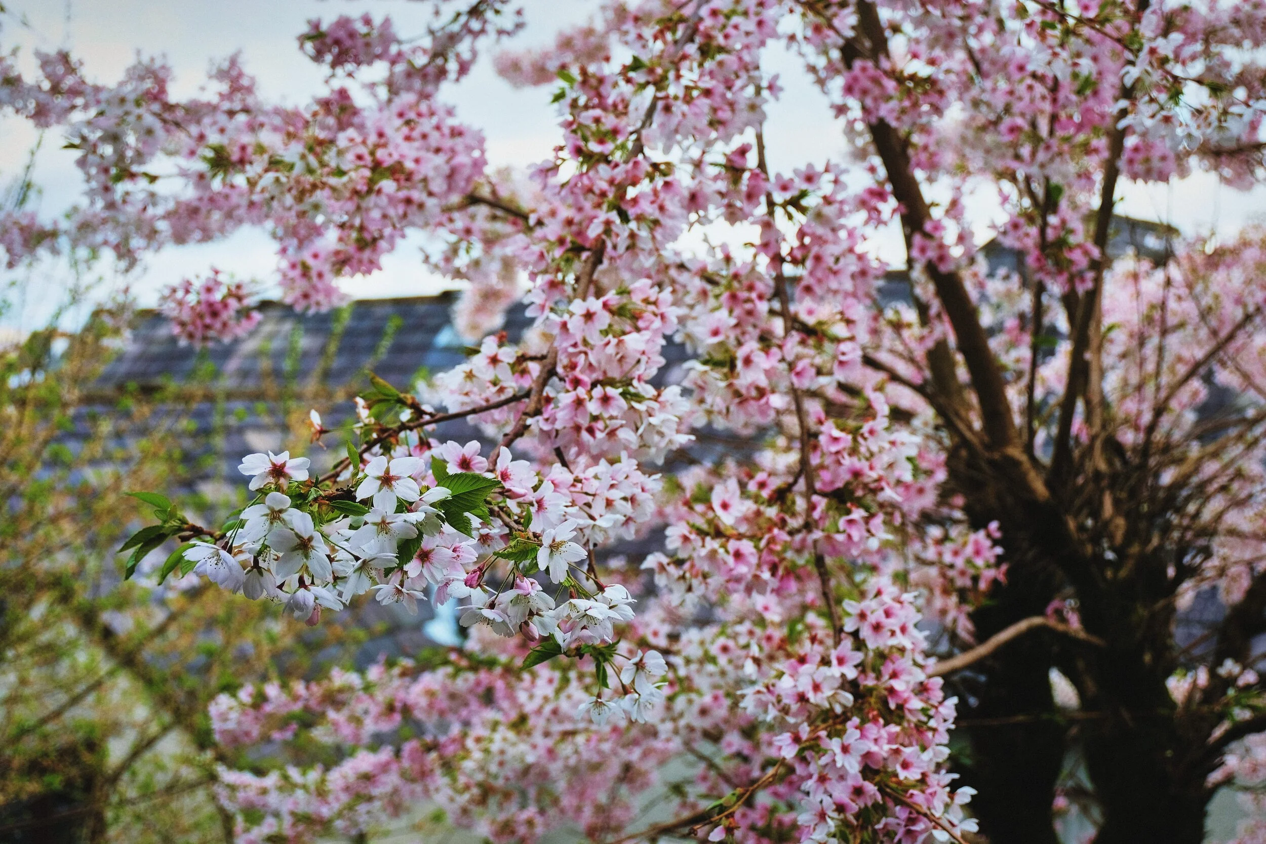
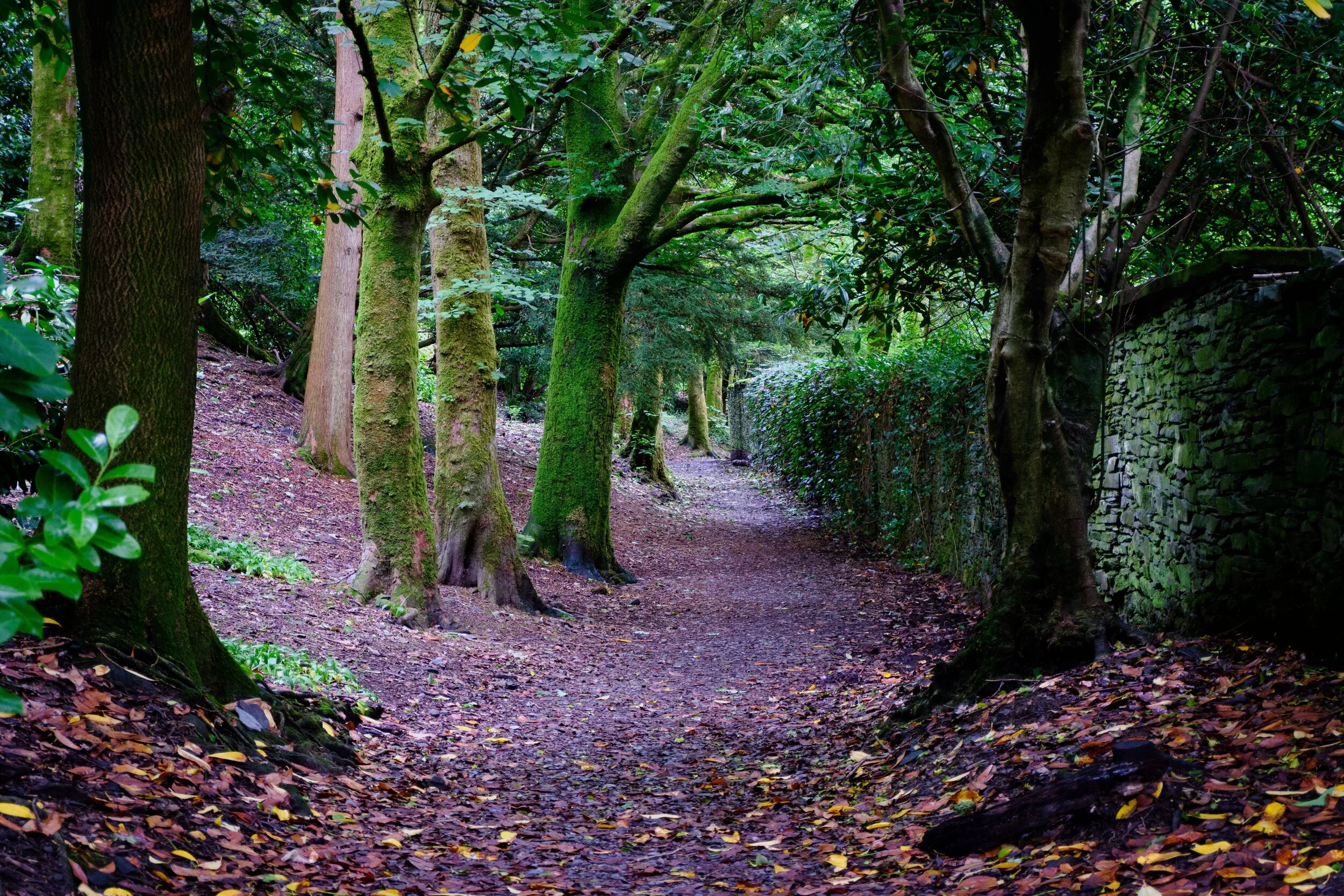
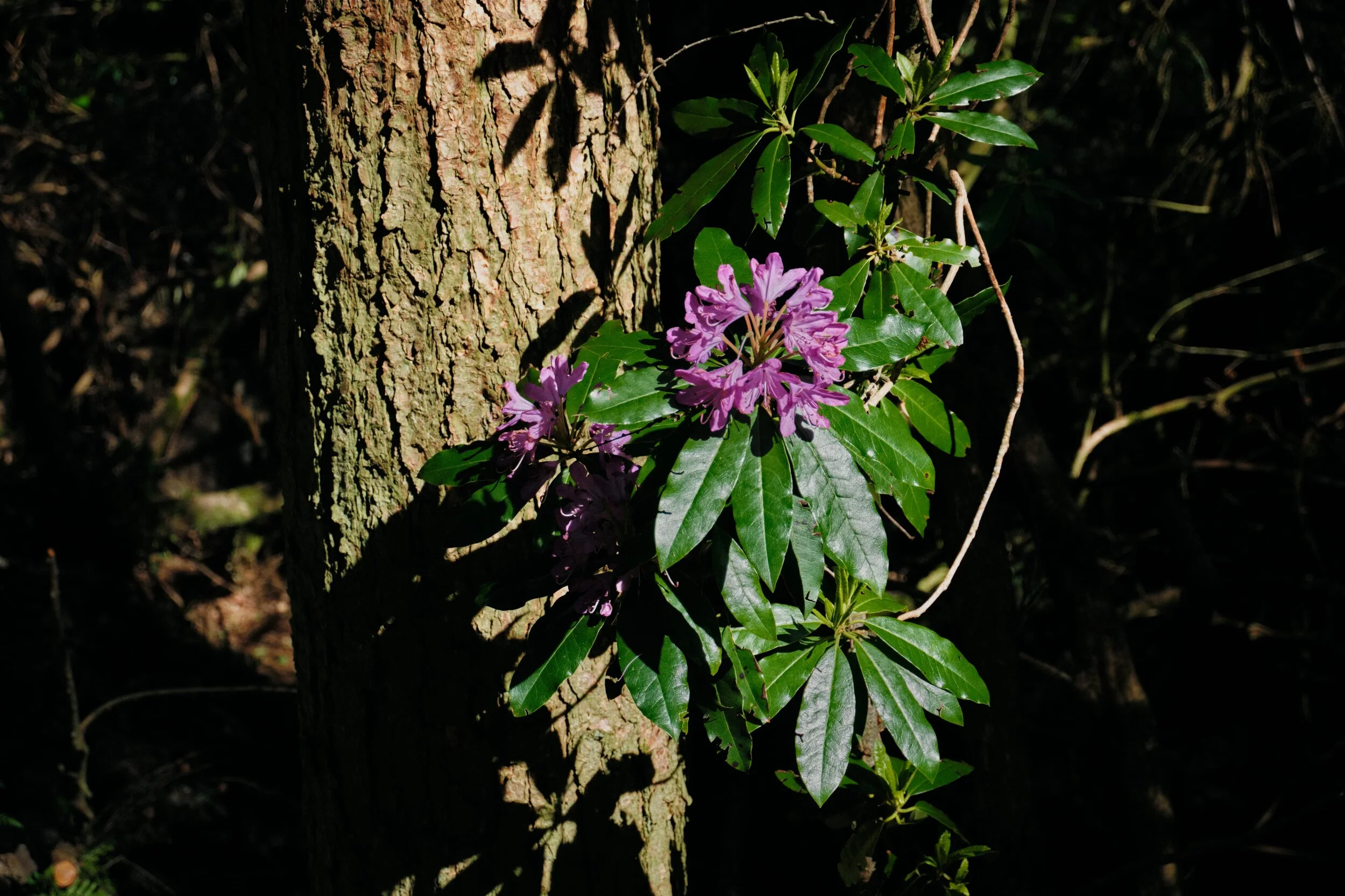
It’s taken a little longer, but the bluebells have finally arrived.
After work recently, Lisabet and I hopped into the car and drove just a few miles up the A591 to Staveley, a Lake District village near Kendal. We had been recommended a walk near the village from my boss, due to the woodlands of bluebells in the area.
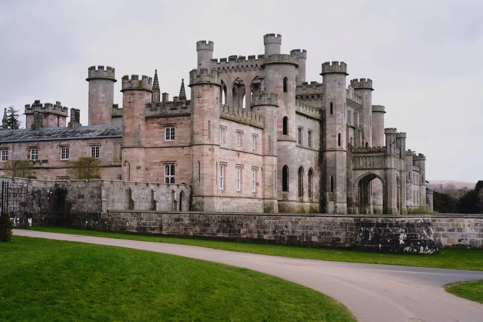
Everything is starting to look proper lush.
After a completely washed out Saturday, today looked significantly more promising. Lisabet had found a 7.5-mile circular hike around the Lowther Estate that utilises a section of the Ullswater Way, so that’s what we did.
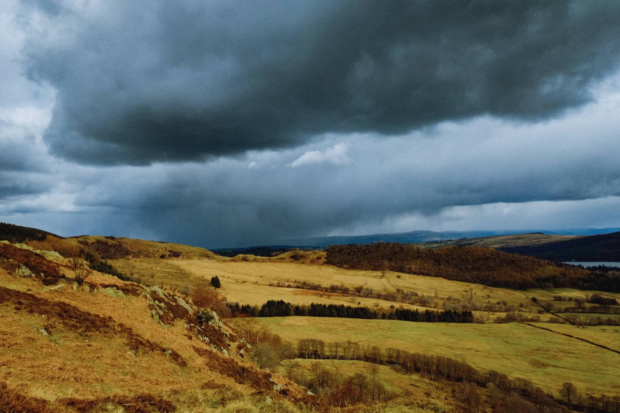
After an unusually dry and cold April 2021, the rain has returned.
This Bank Holiday Lisabet and I planned on a long hike through the Mallerstang valley in the Yorkshire Dales, a favourite of ours. However, reading all the weather radars and forecasts indicated a lot of rain was on its way through South Lakes and the Yorkshire Dales. By contrast, the northern Lake District looked pretty good. So we changed plans and embarked on a hike up Dodd (502 m/1,647 ft), a small fell that came highly recommended by a friend of mine.
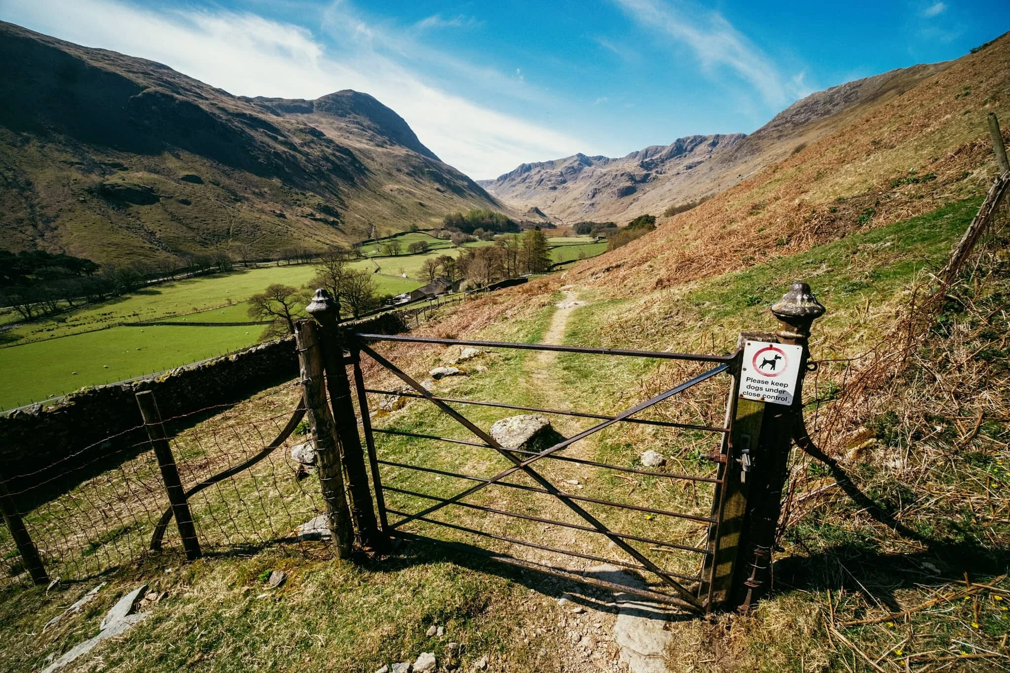
Grisedale has to be in my top 3 favourite Lake District valleys.
I have a fairly troubled history with this place. The last time both Lisabet and I visited it was the middle of summer on a clear and hot day. We hiked all the way from the foot of the valley to Grisedale Tarn and back down. About 7 miles and 1,300 ft of ascent. In mid-20s heat, with no wind or clouds. Whilst being 23/24 stone. I suffered on that walk, and stumbled a lot on the way back down, which angered me.
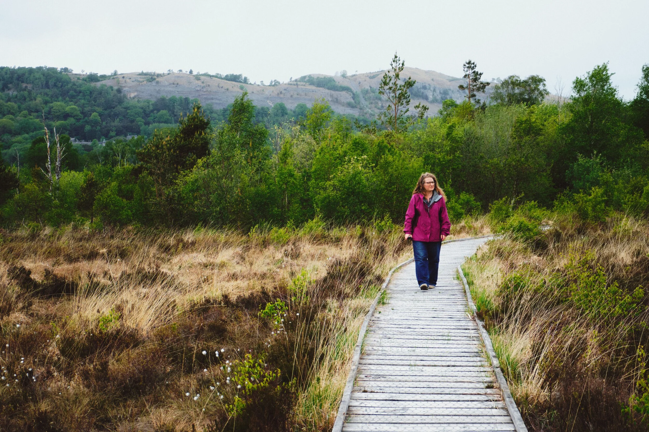
Time for somewhere a little different.
Cumbria being what it is, a sparsely-populated county full of nature, there’s a fair few Nature Reserves never mind the actual Lake District National Park. We’ve explored a few of them previously, for example Foulshaw Moss and Watchtree. This time we ventured south of Windermere and Newby Bridge, beyond the pretty village of Haverthwaite.
Today was a little more low key.
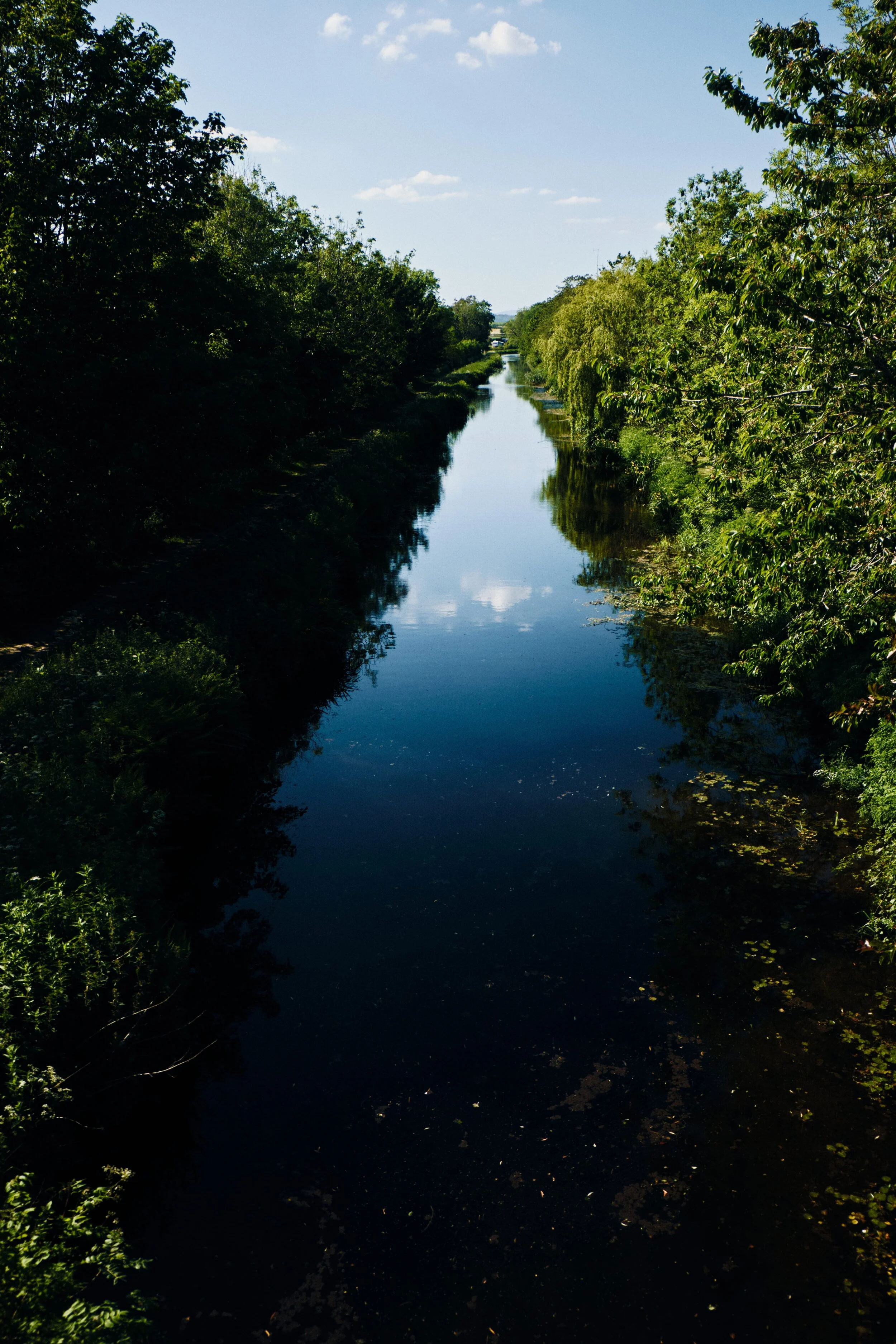
The last time Lisabet and I walked the “Northern Reaches” of Lancaster Canal was back in May/June of 2020. You should check those posts out for more of the history of Lancaster Canal, with greater detail about the Northern Reaches.
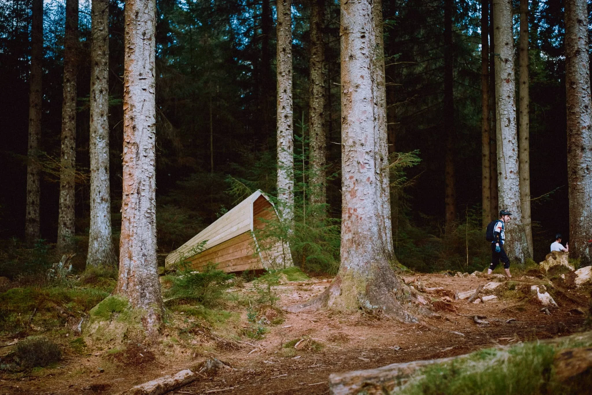
Welcome to Grizedale Forest.
After a morning of joint optician appointments, the day was looking fine and ripe for some hiking. Where would we go? Lisabet suggested Grizedale Forest, which I immediately leapt on. She’s never been to the area, and the last I visited was so long ago that I cannot summon any memories of the place.
It’s time to say goodbye to our extended Easter break.
Not including everyday walks to and from local shops, we’ve managed to clock up nearly 39 miles or 62 km of hiking.
Spring conditions are somewhat changeable at the moment.
Lisabet and I have been somewhat fortunate with this week-long extended Easter break. The first few days were relatively balmy for Cumbria, peaking at around 15°C. By Good Friday an “arctic blast” was arriving from the north, and temperatures quickly dropped by around 10°C or so. Despite the swing in climate conditions, the sky has remained consistently free of clouds.
Happy Easter, everyone.
I hope everyone has had/is having a safe and enjoyable Easter. It’s certainly helped that most of the country has experienced relatively dry, bright, and clear conditions during the Easter break.
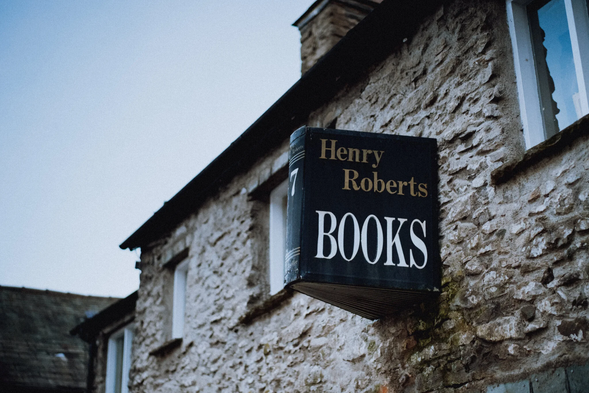
We’ve neglected the Howgills for too long.
On this Good Friday we elected to stay away from the Lake District, expecting visitor numbers to sharply increase. We did want to stay within the same council area, though. So we ventured east over the M6 and into Sedbergh, the beautiful bookish town at the foot of the Howgills.
It’s been quite a few years since we’ve been to Easedale.
In fact, looking through my archives, it’s been four years and a month. Today, Lisabet and I decided we were due for a revisit.
Step 1 of the UK Government’s Spring 2021 COVID-19 plan has been completed.
From Monday 29th, more people can now meet outside, outdoor recreation activities are permitted again, and the “Stay at home” ruling has relaxed to “Stay local”.
I’ve often gazed longingly at Whitbarrow Scar from afar.
Finally we decided to clamber around it.
Whitbarrow (215m/705ft) is a limestone hill, much like its neighbour Scout Scar, with whom I’m much more familiar with. Whitbarrow is further west of Scout Scar across the Lyth Valley, but covers a much larger area. When viewed from the A590 south of the fell, Whitbarrow presents some sheer and imposing cliff faces that I instantly fell in love the first time I saw them. I resolved to one day wander around the contours of Whitbarrow. Today was that day.
Spring has sprung.
After a relatively dry and bright week, we were very much hoping for similar if not better for the weekend. Saturday came around and we were grateful. A proper spring day.
Step 1 of the government’s Spring COVID-19 Response Plan is in action.
Students have gone back to school and in theory by the 29th of March people will be allowed to meet outdoors in bigger groups.
We’ve definitely had better light conditions recently.
Nevertheless, Lisabet and I embarked on a solid 15 km hike today. From the front door, down the A6, through Helsington Laithes up to Scout Scar, south towards Helsington Church, through Berry Holme Farm, across the A591 to Hawes Bridge, and back north through the fields to Kendal.
My Dad’s been vaccinated.
This is a relief for me as Dad’s a Type II Diabetic and thus Clinically Extremely Vulnerable.
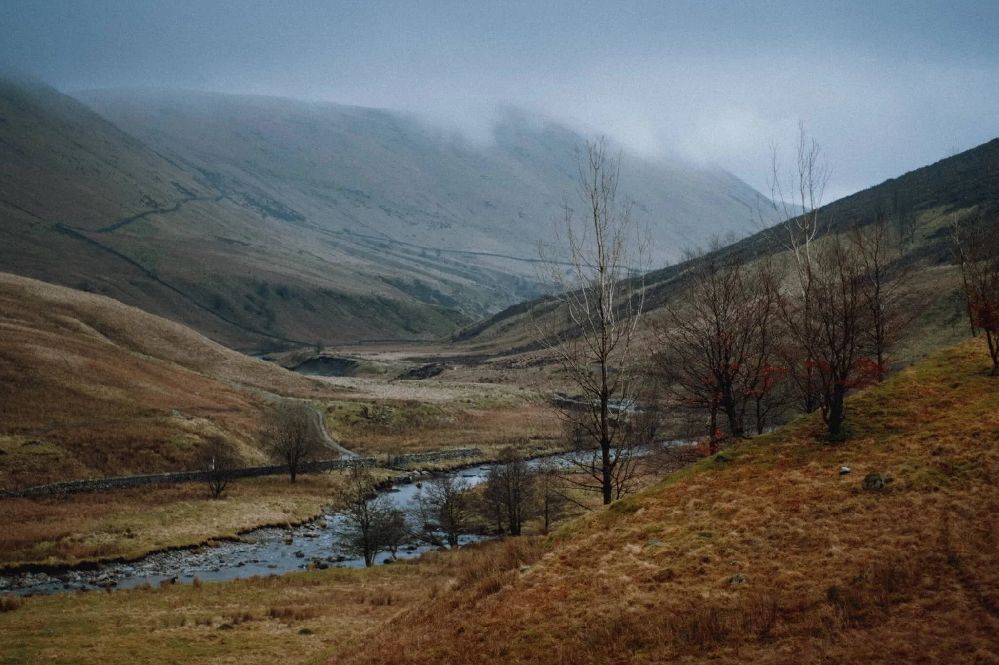
As he’s in our Support Bubble we went to check in on him this weekend, spending a large part of the day in the valleys of the Northern Fells near where he lives.
The Four Step Plan to “normality” has been announced by the government.
From the 8th March 2021 students will return to schools, colleges, and universities, and there will be a small loosening of social contact restrictions. Then from 29th March 2021 there is a further easing of social contact restrictions, primarily around meeting people outside. Outdoor sporting recreation will be allowed again, and you can start to travel within the country.
Today, it really felt like spring is on its way.
This week has been extremely wet, Saturday in particular, so it was a veritable relief when Sunday emerged with blue skies and bright sun. We quickly took the opportunity to get outside for a solid wander towards, and around, Scout Scar, clocking up nearly 8-miles of hiking all in all.
Here’s one from the archives.
Back in September/October 2017, Lisabet and I took a 2-week holiday and split it into two. The first week was spent around the coast of the Scottish Borders, centred around Cove Harbour. The second week we crossed Scotland east to west and took a ferry over to the Isle of Arran.
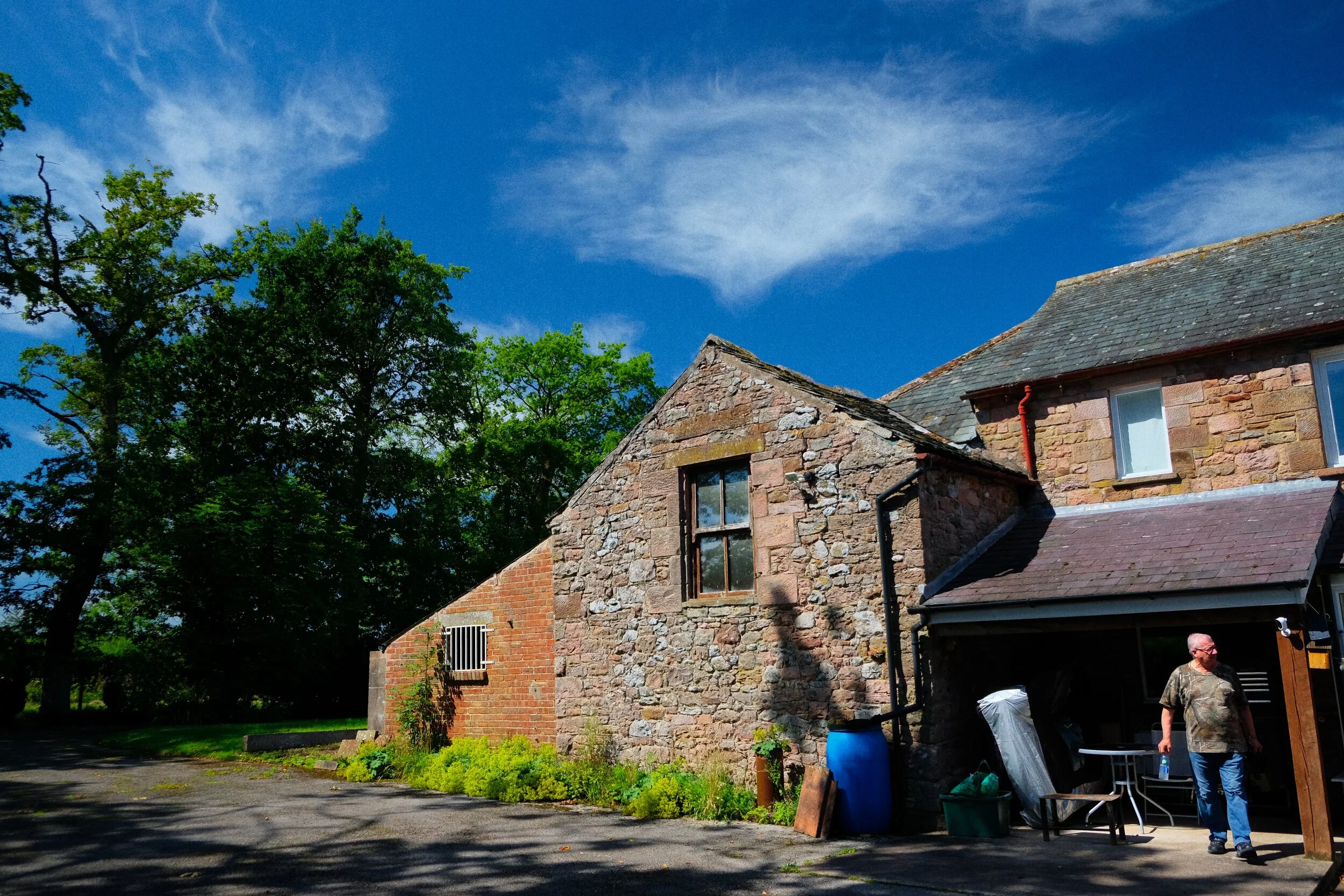
Today it was time for something a little different.
It’s been about a month since I last saw my Dad, and during that time a 3rd National Lockdown came into effect. My Dad’s in his 60s, lives alone, and has Type II Diabetes, so he’s in our “bubble”. So we thought it we were overdue for a visit, and zipped up to North Cumbria to check in on him, and get some exercise in whilst there.
It’s amazing the difference 24-hours can make.
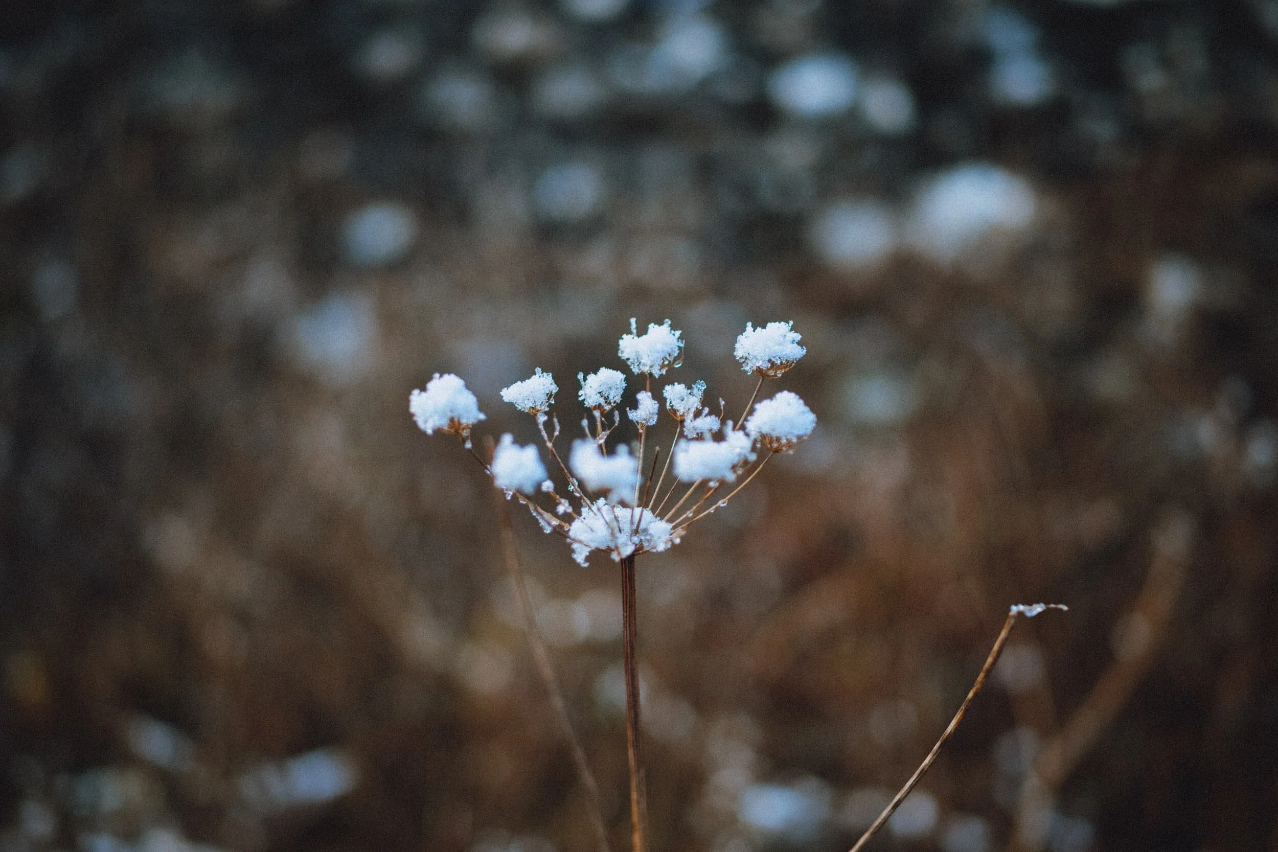
Yesterday we were hiking through mist and fog with a landscape covered in frost and snow.
Today a lot of the frost has melted, the sun was out, and the atmosphere was crystal clear.
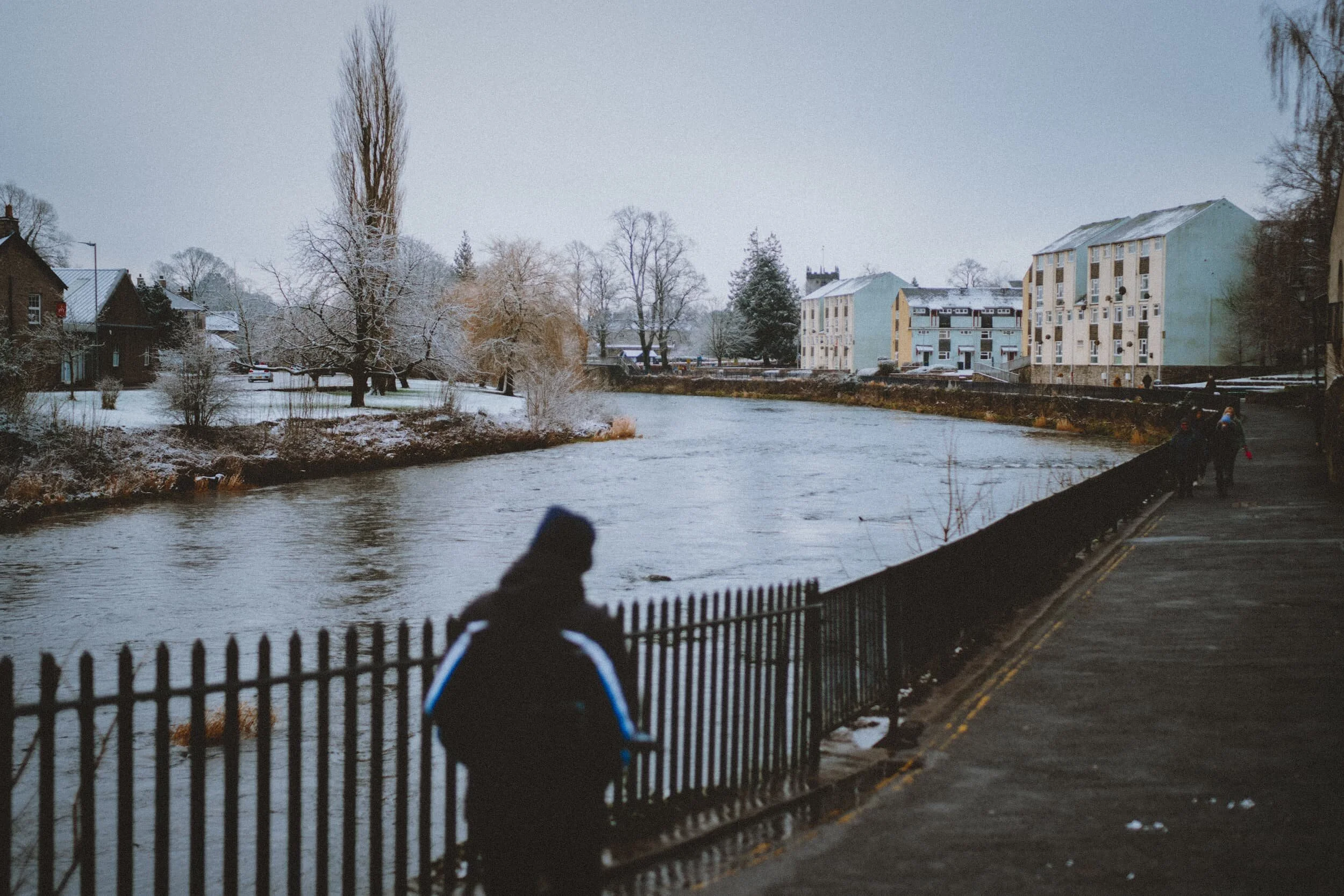
Welp, despite Storm Christoph’s best attempts, snow and ice have returned.
The rain finally left Britain, with parts of North England and the Midlands getting flooded. It filled us with trepidation, having experienced our home being flooded during December 2015’s Storm Desmond. Thankfully, though the River Kent did get high, no serious flooding was reported in Cumbria this time.
After the recent wonderful wintery scenes of snow in and around Kendal, things have somewhat changed.
Storm Christoph has arrived over the British Isles, as well as all the flood warnings. Whilst we’re not expecting Storm Desmond-levels of rain, there will be enough to induce mild panic and anxiety within us Desmond-survivors.
The Pandemic Peregrinations are back.
On the 4th of January 2021 the UK entered its 3rd National Lockdown due to rising COVID-19 cases and a new—more infectious—variant ravaging its way through the nation.
Before the current cold snap arrived, Christmas was looking rather wet and miserable.
So on post-Boxing Day (is that a thing?) Lisabet and I decided to throw caution to the wind and attempt a hike up and around Dalton Crags.
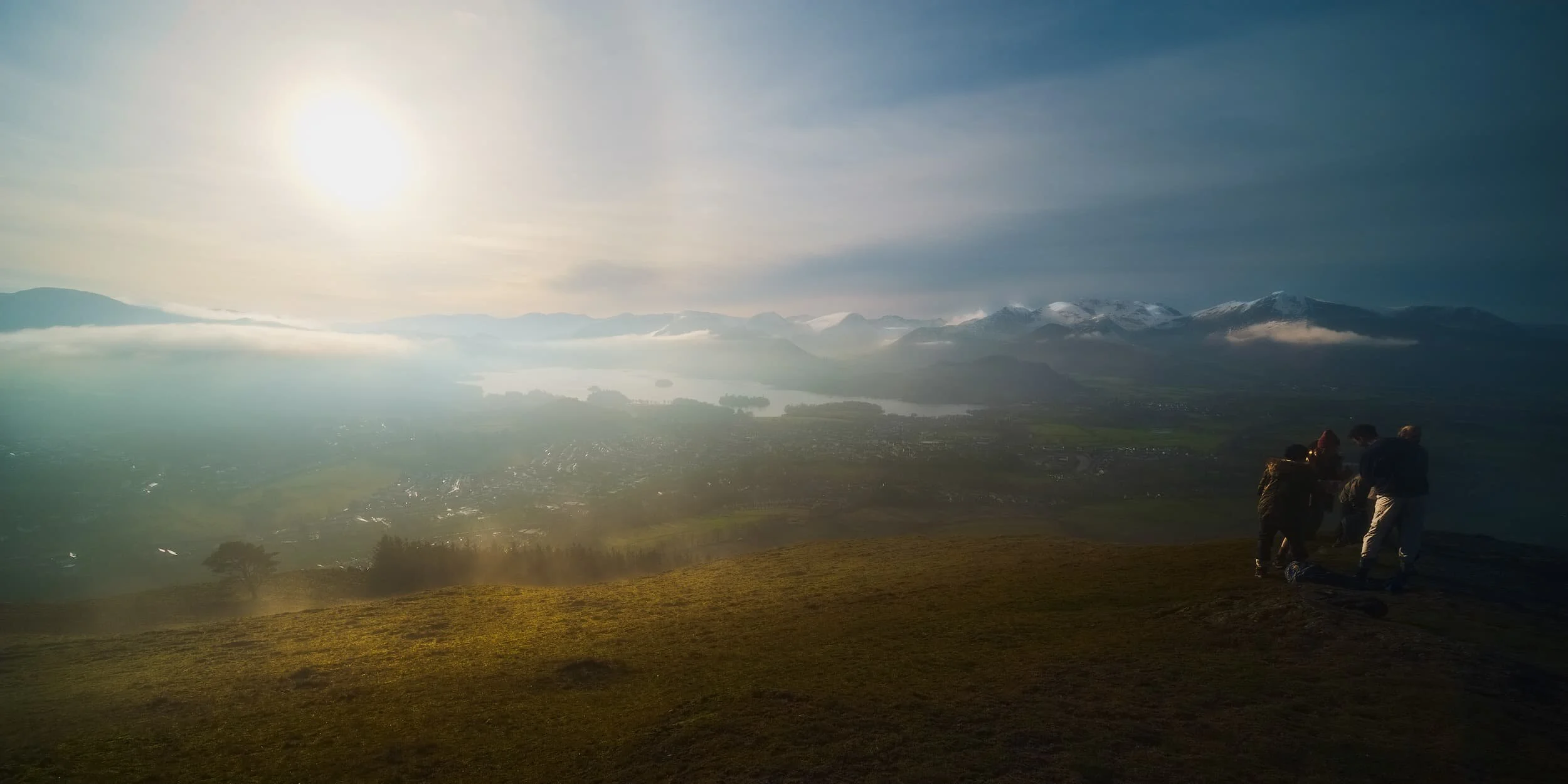
It’s really starting to feel like winter in the Lake District now.
As the weather improved over the Christmas Break, Lisabet and I decided to embark on a hike up a fell we’ve never done before: Latrigg.
Happy Boxing Day everyone.
One of the nice things about editing these photos from Skye is that I get to revisit this wonderful place all over again. I can send my mind right back to October 2020, place my two feet in the scene, and immerse my visual memory in the whole experience.
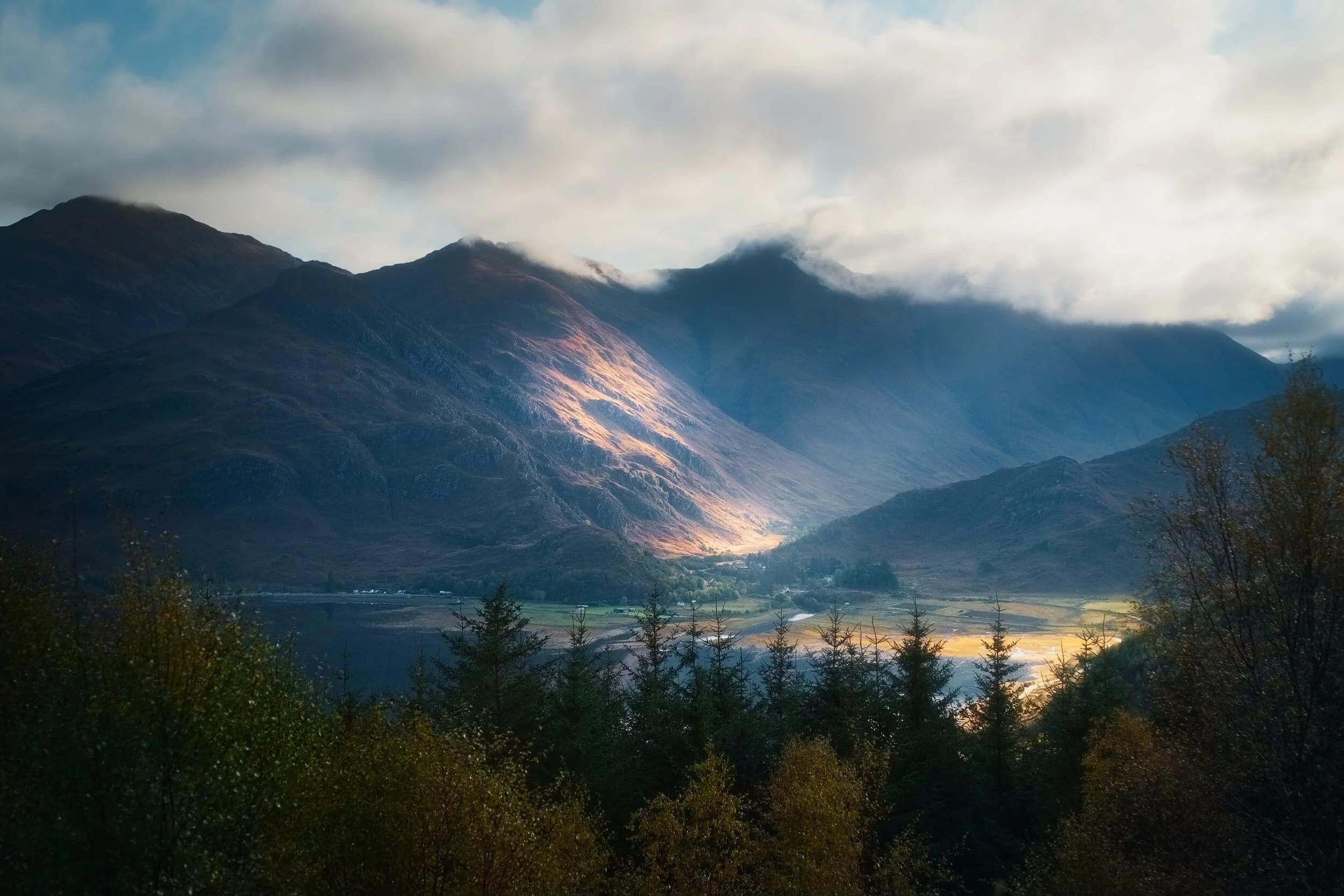
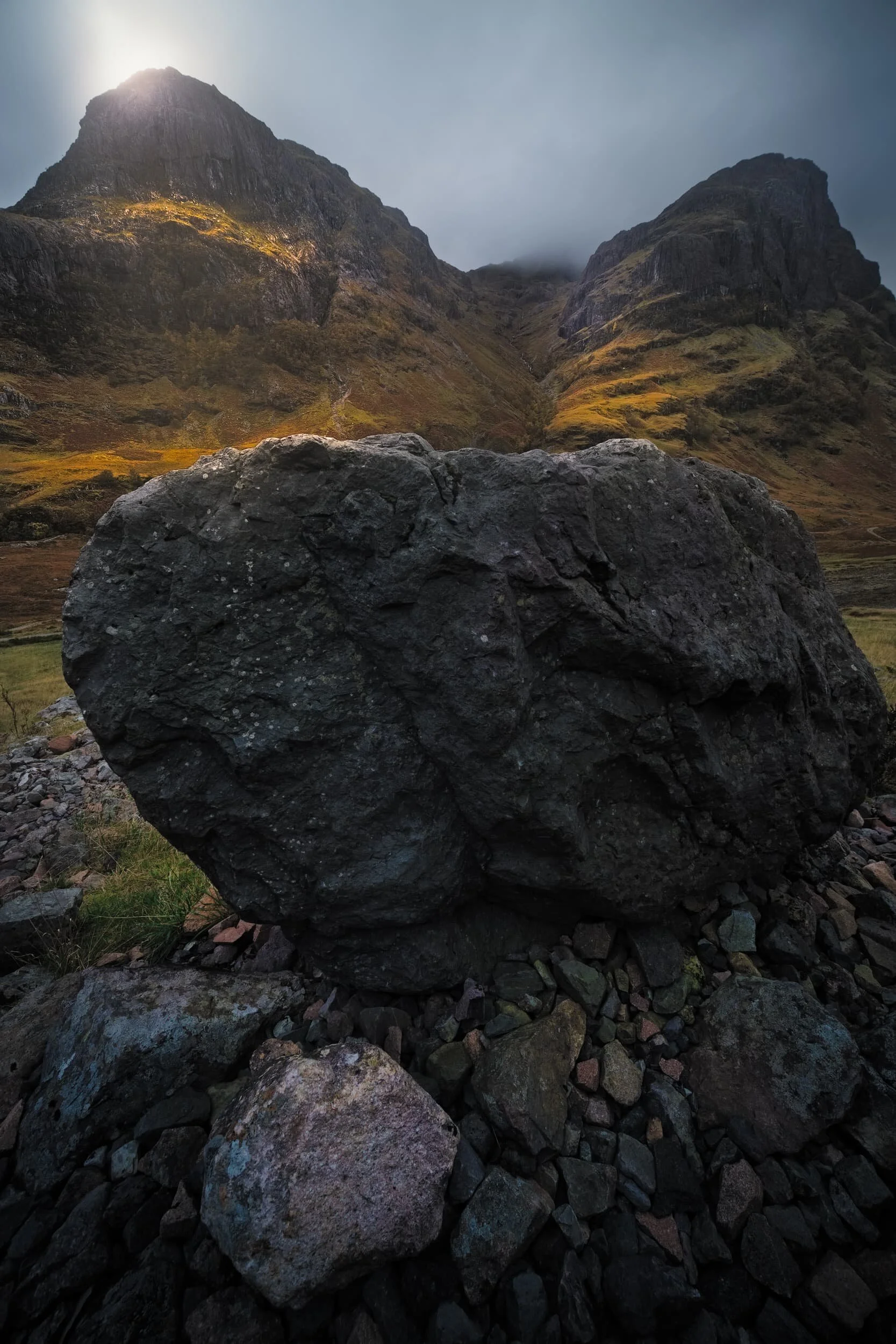
Glencoe is a place that fills me with total awe every time I visit.
Whether we’re heading towards the Isle of Skye or venturing further north towards Torridon and beyond, I always appreciate a “pit stop” around this epic place.
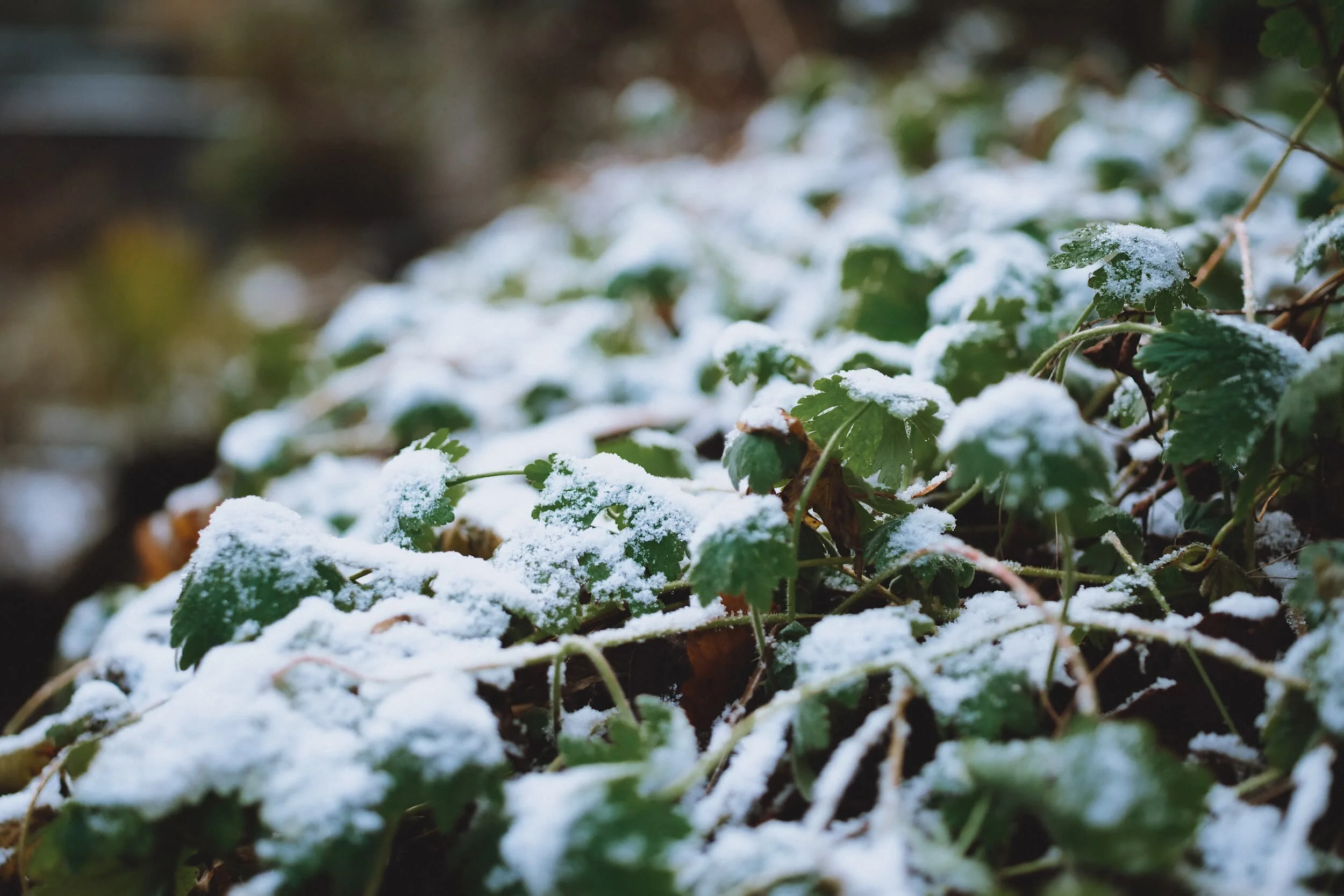
Winter has arrived.
We’ve been watching as temperatures in Cumbria have steadily dropped from the tens to near freezing point.
By around the 3rd December snow started to fall across the high fells of the Lake District and the Yorkshire Dales, followed by some ground level snow on the 4th.
At Duntulm one can find the ruins of Duntulm Castle, the 17th century seat of the chiefs of Clan MacDonald of Sleat.
Duntulm (Dùn Thuilm in Scottish Gaelic) was originally a fortress built and inhabited by the Picts, an ancient Gaelic tribe. Then, like much of Great Britain, the Vikings arrived and claimed the site for themselves. Duntulm, and the rest of the Trotternish peninsula, was hotly contested and changed hands frequently until the 16th century when the Lord Of The Isles, Donhall Gorm (“Blue Donald”) seized the area, and started making improvements to the fort.
The Isle of Skye is, of course, an island, but it’s also home to lots of satellite isles in its waters.
Most of these tiny isles can be found in Loch Bracadale, a sea loch off the coast of Northwestern Skye. It contains isles such as Harlosh Island, Tarner Island, and Wiay. In addition, there is a fourth island that’s actually accessible by foot from the mainland of Skye, but only at low tide.
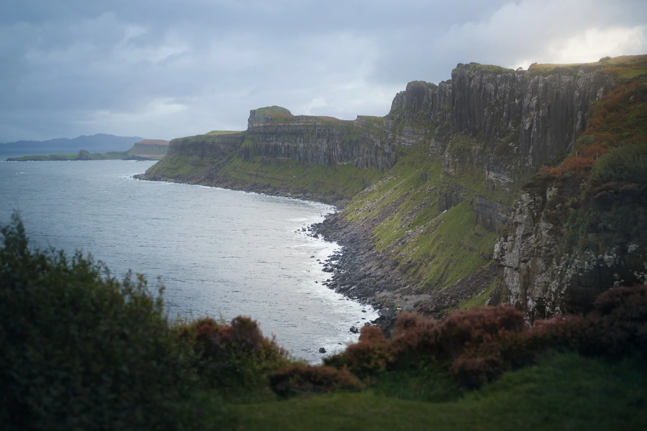
For obvious reasons most people focus on the Storr or the Quiraing when it comes to the Isle of Skye’s Trotternish Peninsula.
But there is so much more to see.
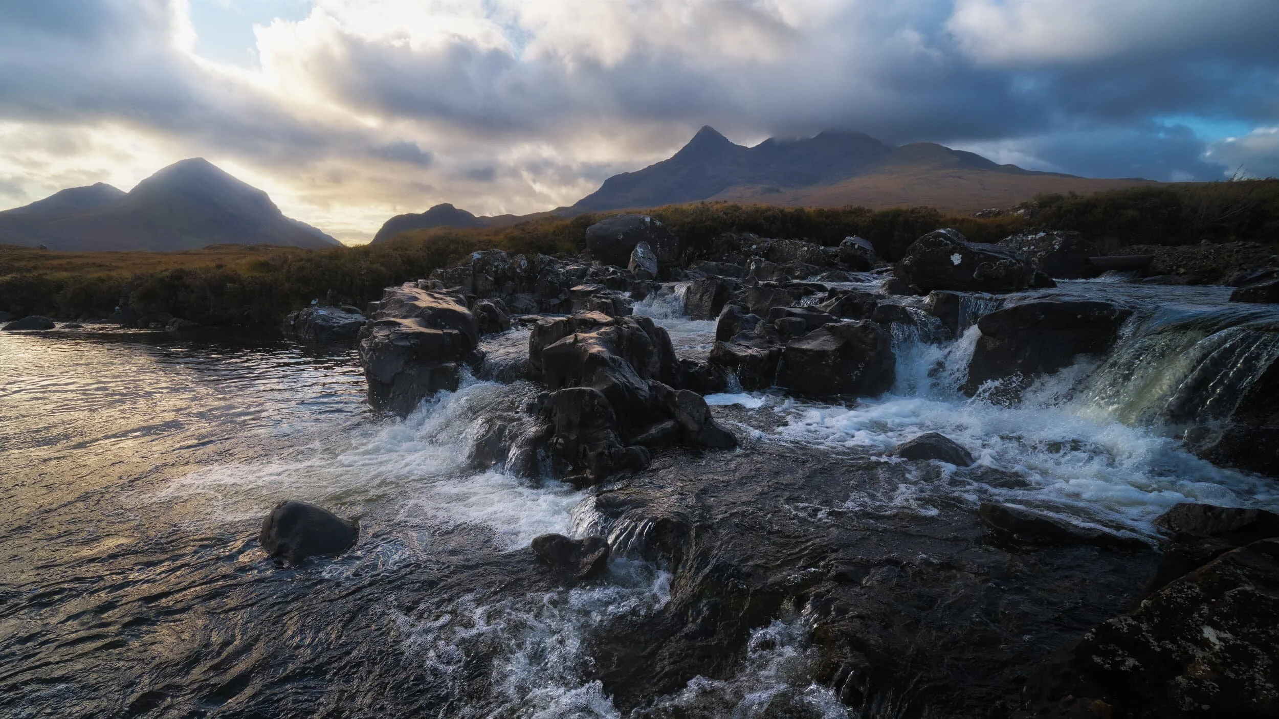
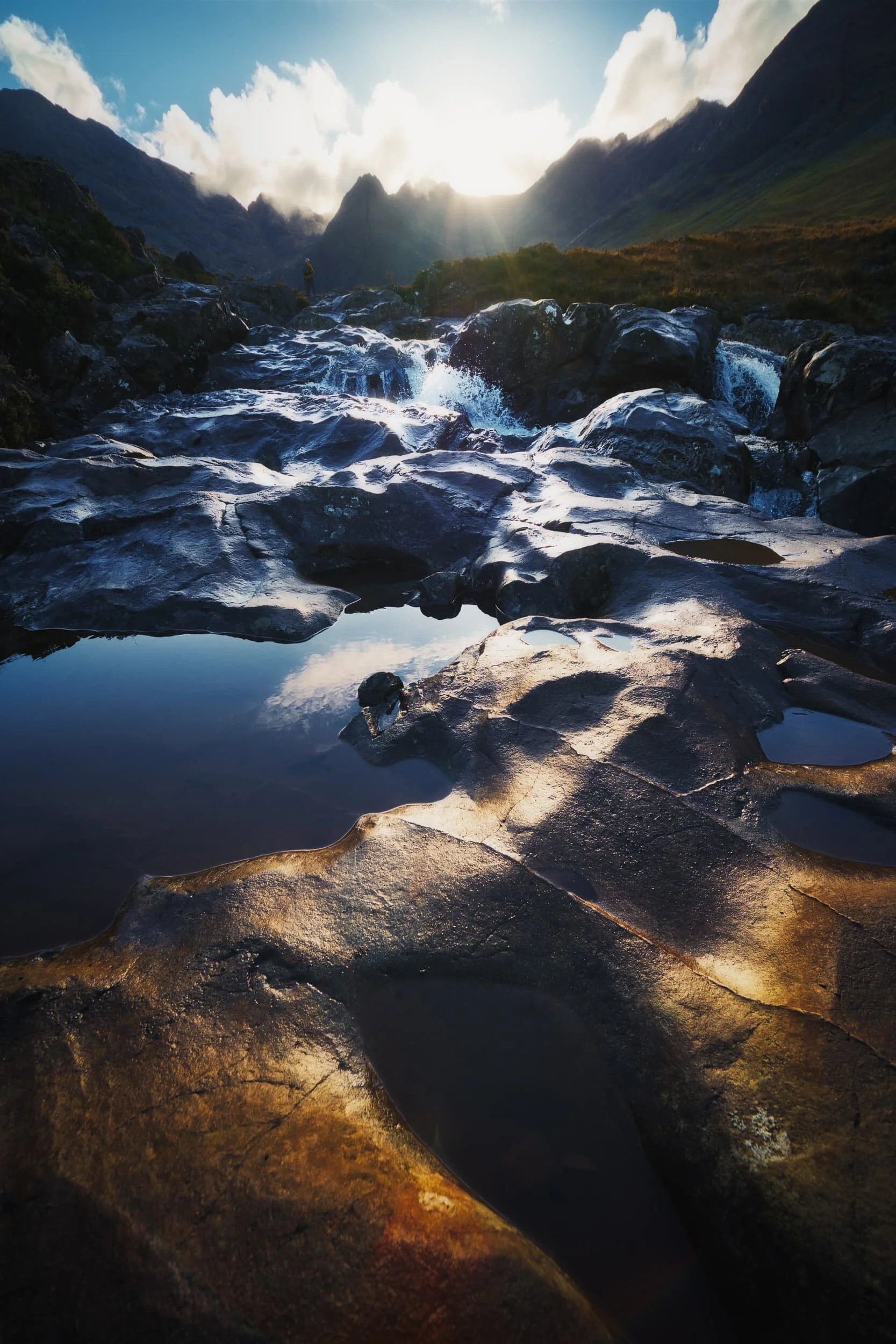
One of my favourite places on Skye is Sligachan.
It’s also a source of frustration for me.
At Sligachan one is offered an incredible view of the northern jagged peaks of the Black Cuillins mountain range, particularly the peaks named Sgùrr nan Gilean (966 m/3,170 ft) and Sgùrr a’ Bhàsteir (900 m/2, 953 ft). Every time I’ve been to Skye I’ve tried navigating the various rivers and becks that stream off the northern faces of the Black Cuillins, looking for compositions.
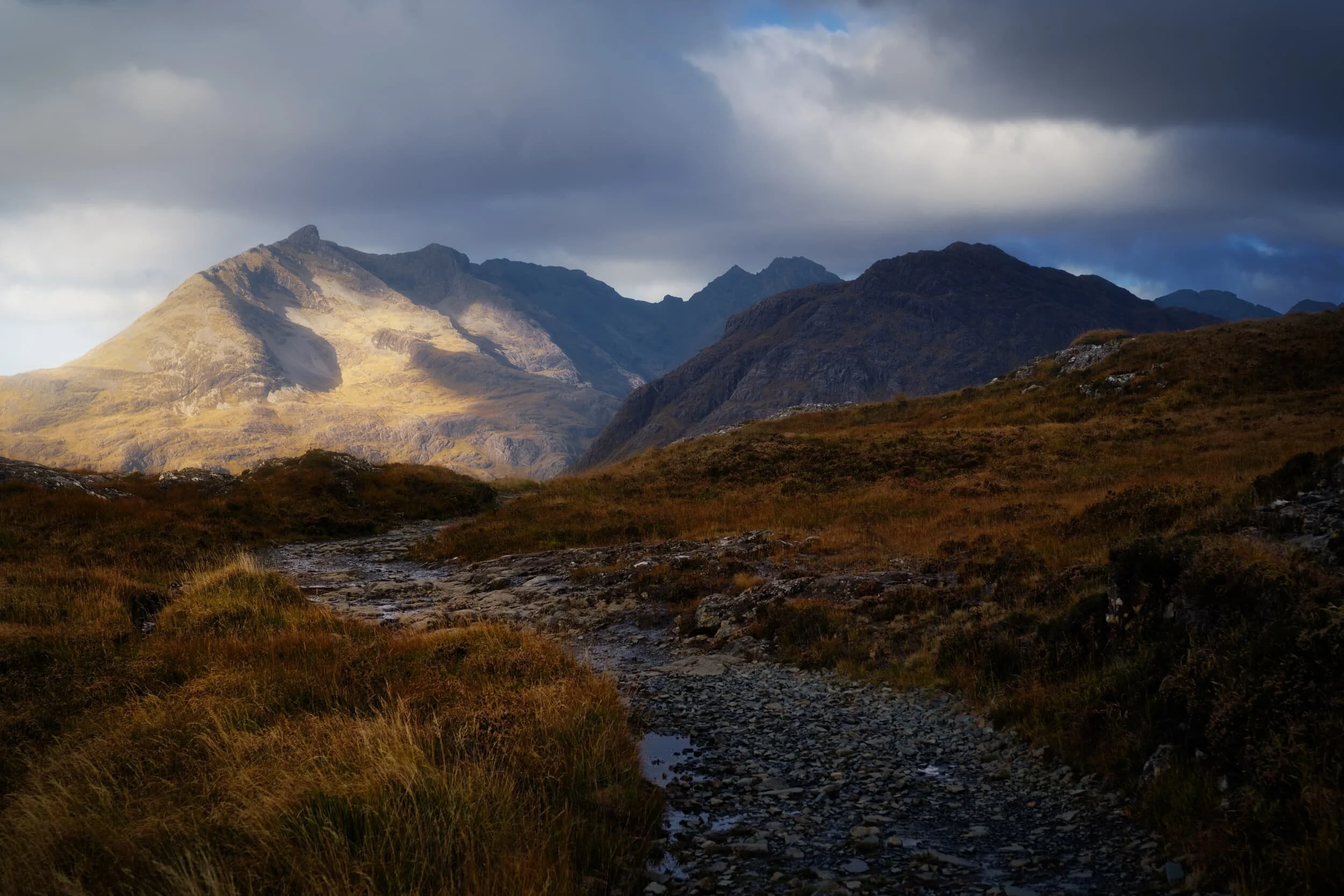
As well as revisiting old favourites of ours on Skye, we also wanted to check out unfamiliar territory across the island.
A new, to us, hike we bookmarked was located on the Strathaird peninsula of Skye, perhaps more widely accessed for getting to Elgol. We did revisit Elgol again, but on the way back we stopped at a parking layby near Kirkibost for a hike up and over the Strathaird peninsula towards an isolated little bay called Camasunary.
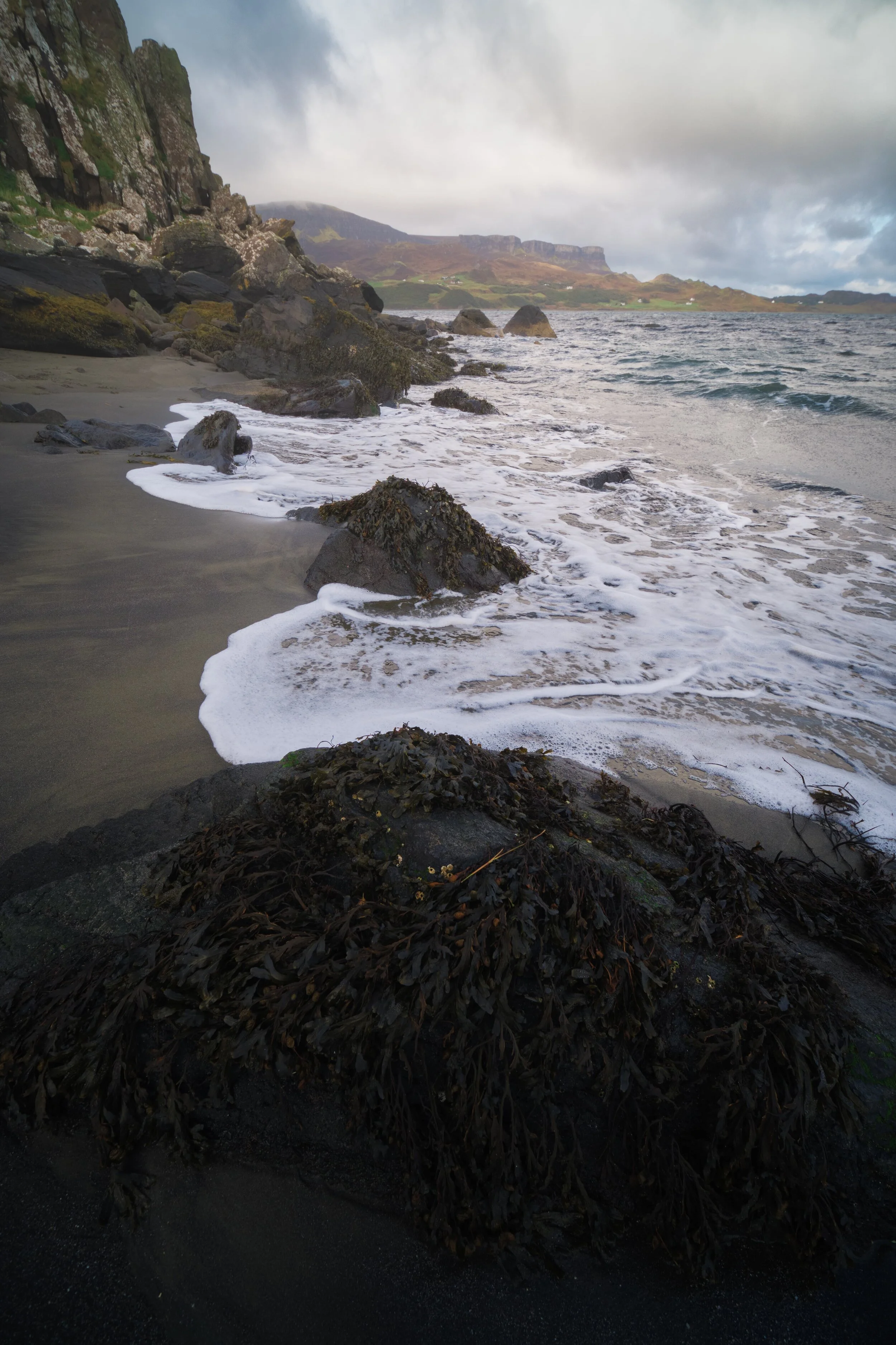
When you think of Skye, do you think of dinosaur fossils?
Probably not.
Much like Cornwall’s famed Jurassic Coast, Skye has its own version at An Corran beach, Staffin, on the Trotternish Peninsula.
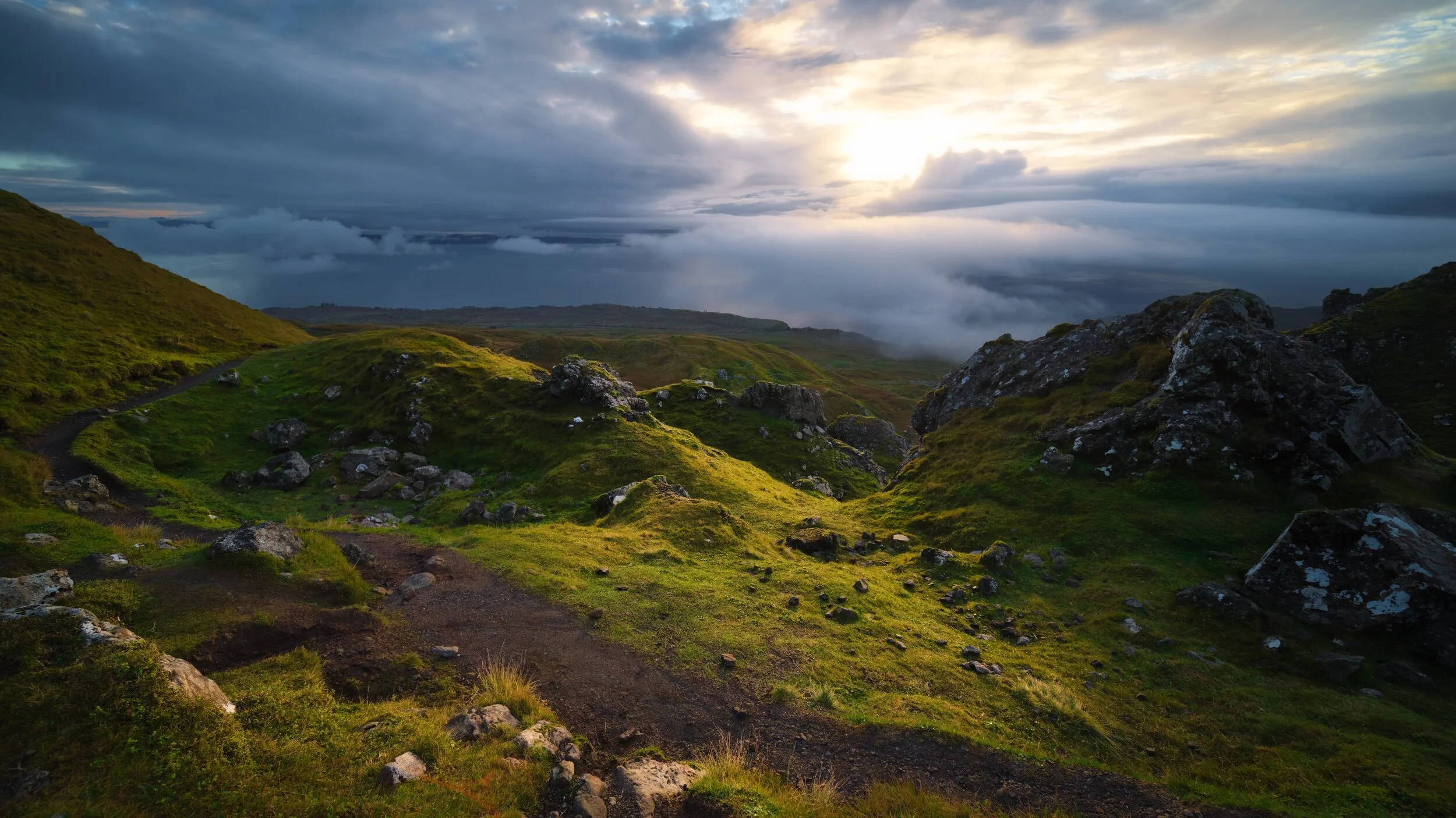
Alongside the Storr, the Quiraing is one of those places on Skye that ignites your imagination and takes your breath away.
Much like the Storr, the Quiraing is part of the Trotternish landslip, the longest such feature in the British Isles. Whilst the Storr marks the highest point of the Trotternish landslip, the Quiraing marks the northernmost summit at Meall na Suiramach (543 m/1,781 ft). The Quiraing is also, unlike the Storr, still slipping; apparently the road at the bottom of the Quiraing near Flodigarry requires repair every year as the land continues to move.
Skye has one or two “hotspots” that are perhaps vastly more popular for visitors than other areas around the island. The Storr might be considered one of those hotspots.
There’s something truly magical about the Elgol coast on Skye.
Firstly there’s the frankly ridiculous view you’re treated to as you descend the narrow winding road to the shore, which arguably is what makes most people fall in love with Elgol. I know that’s what it did to me, back in 2013, when I first explored this tiny coastal village.
Hello, readers! It’s been a while.
We’ve just returned from a fortnight around my favourite place on this earth: the Isle of Skye, Scotland.
This is the fourth time we’ve been to the island now; the last time was in 2019 (last year), which was an… interesting time for us as I was diagnosed and then hospitalised with Type II Diabetes.
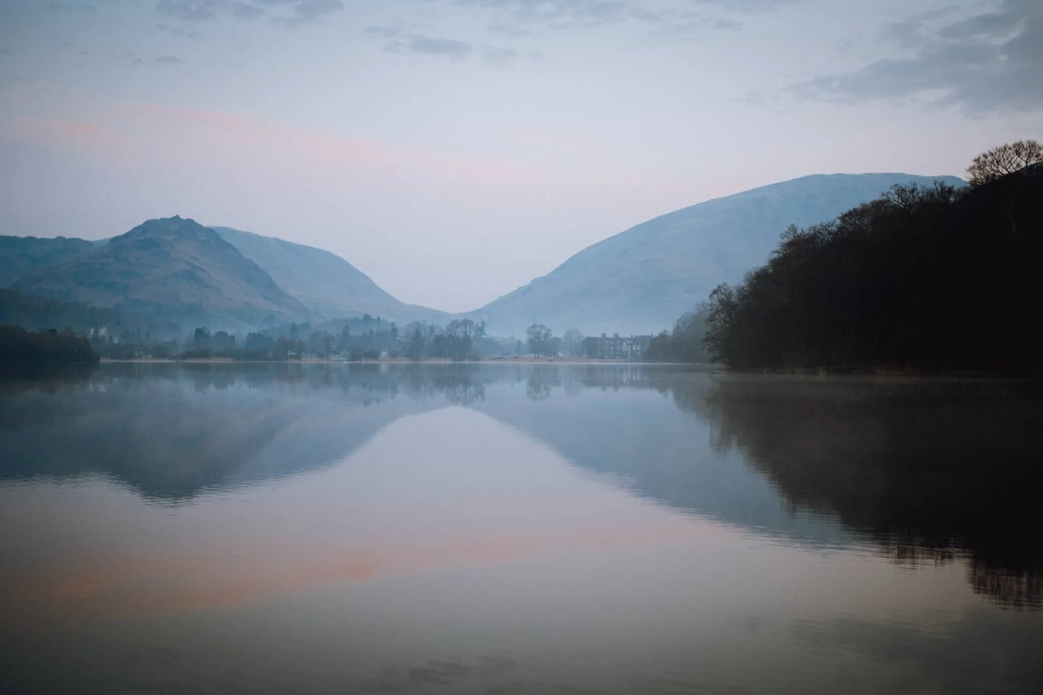
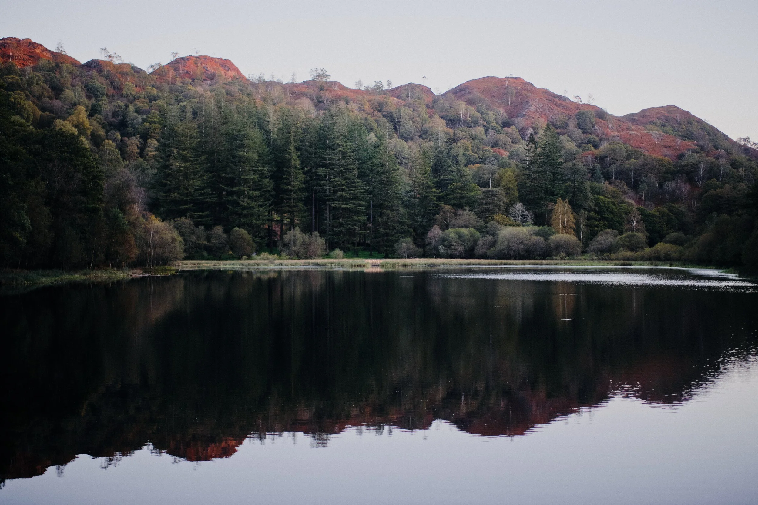
Our new jam is sunrise hikes.
After summiting Loughrigg Fell as the sun rose up last weekend, we ventured out for another sunrise hike. This time we started from Yew Tree Tarn near Coniston, and hiked up through the woods in a ravine called Glen Mary to find a delightful succession of waterfalls called the Tom Gill falls. Following the gill, you eventually pop out at Tarn Hows, where we were greeted with crystal-clear reflections and the sun rising up above the surrounding fells.
The River Eden has carved out some wonderful geology.
If you’re a frequent visitor of my website (hello!) you’ll have read me writing about the River Eden’s geology specifically around Mallerstang and Wetheral.
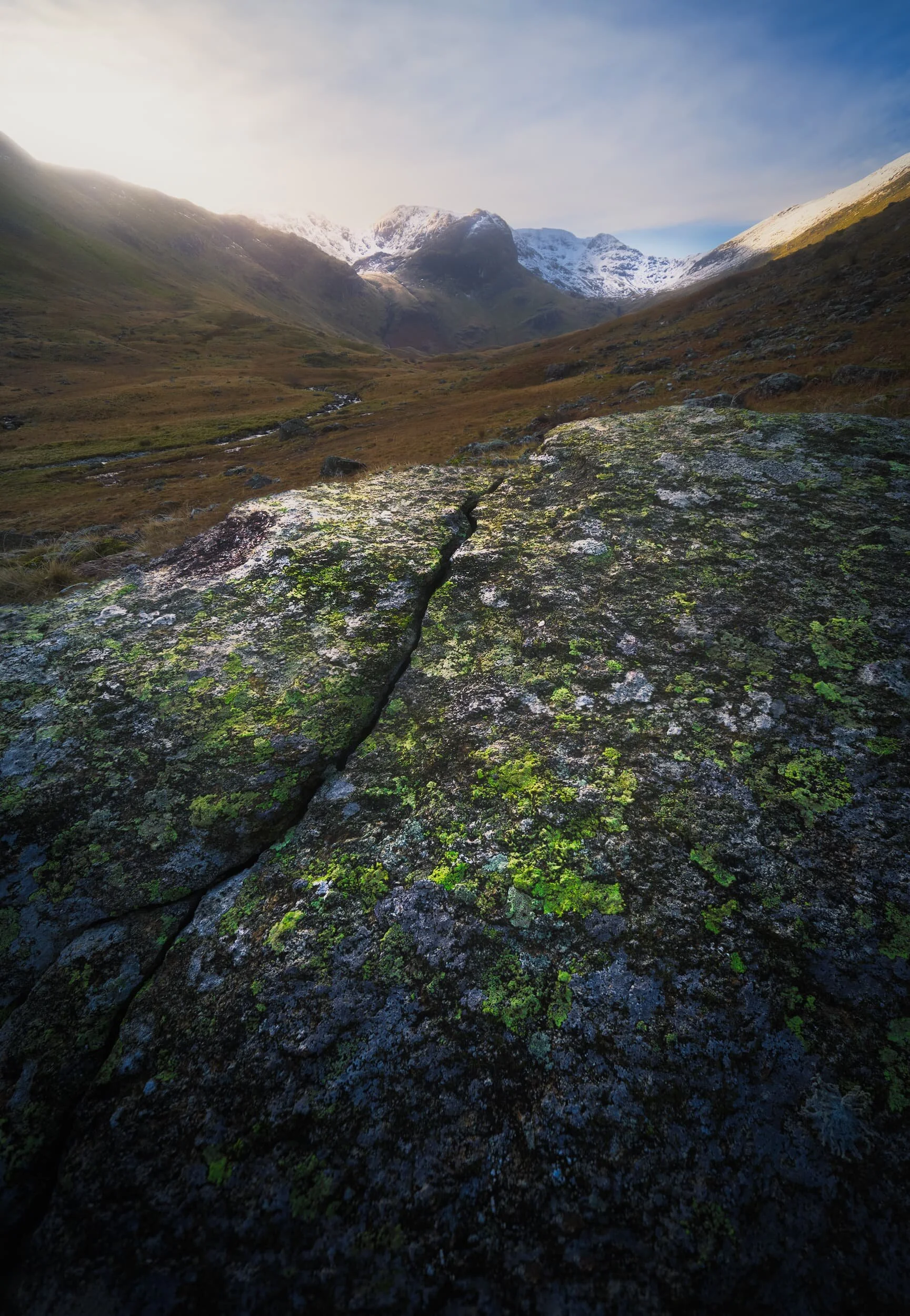
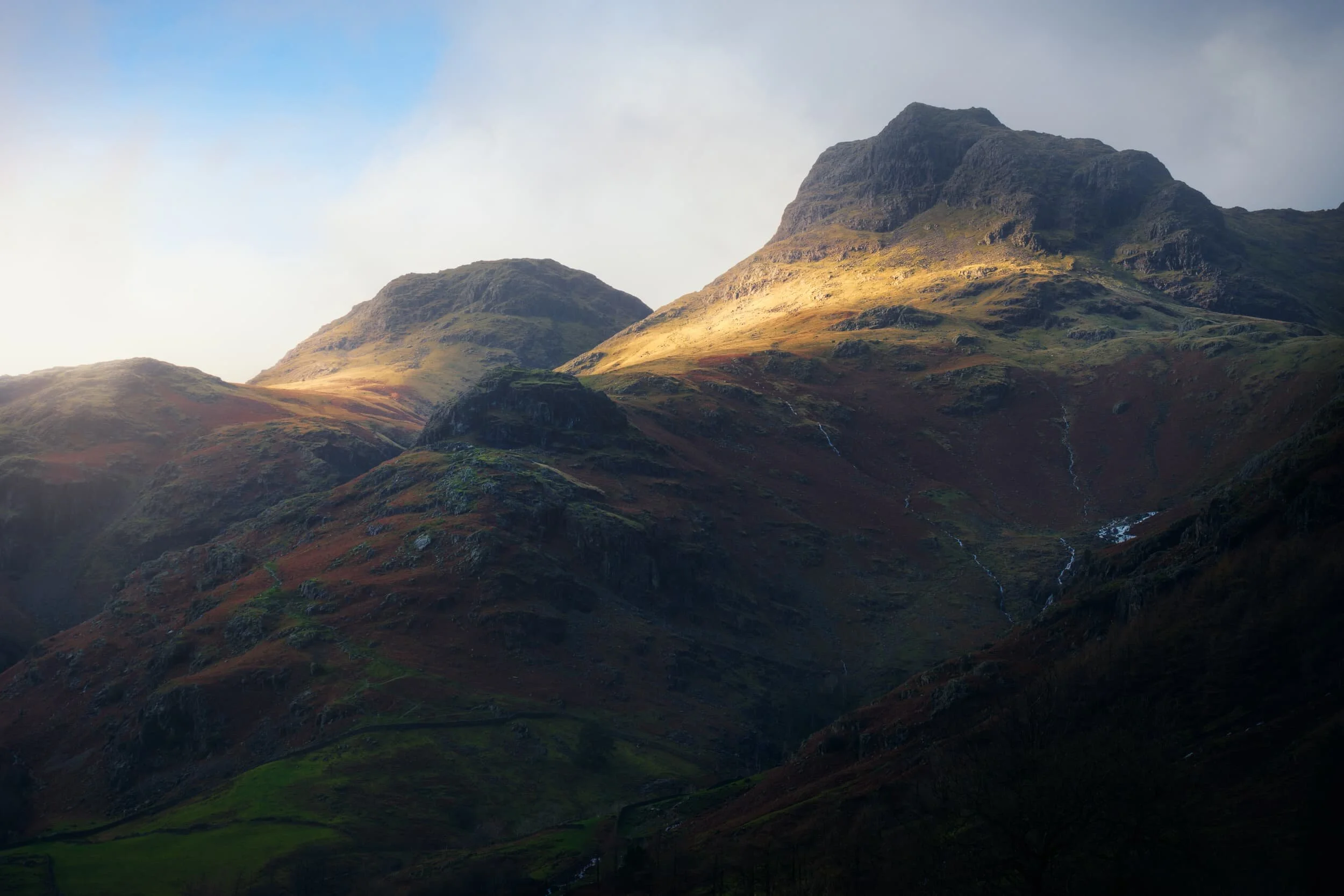
There are several Wainwrights—that is, Lake District peaks written about in Alfred Wainwright’s seven-volume Pictorial Guide to the Lakeland Fells—that are considered key or “core” Wainwrights.
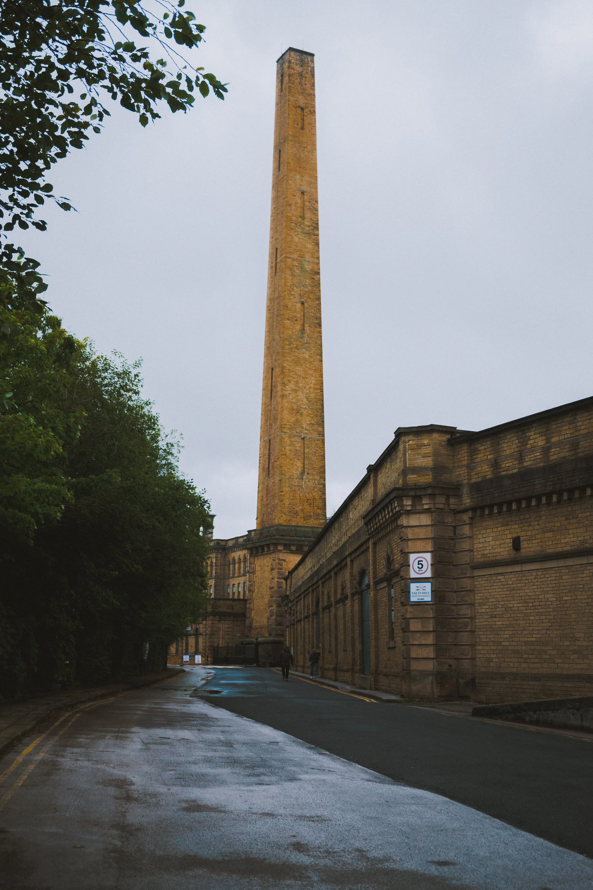
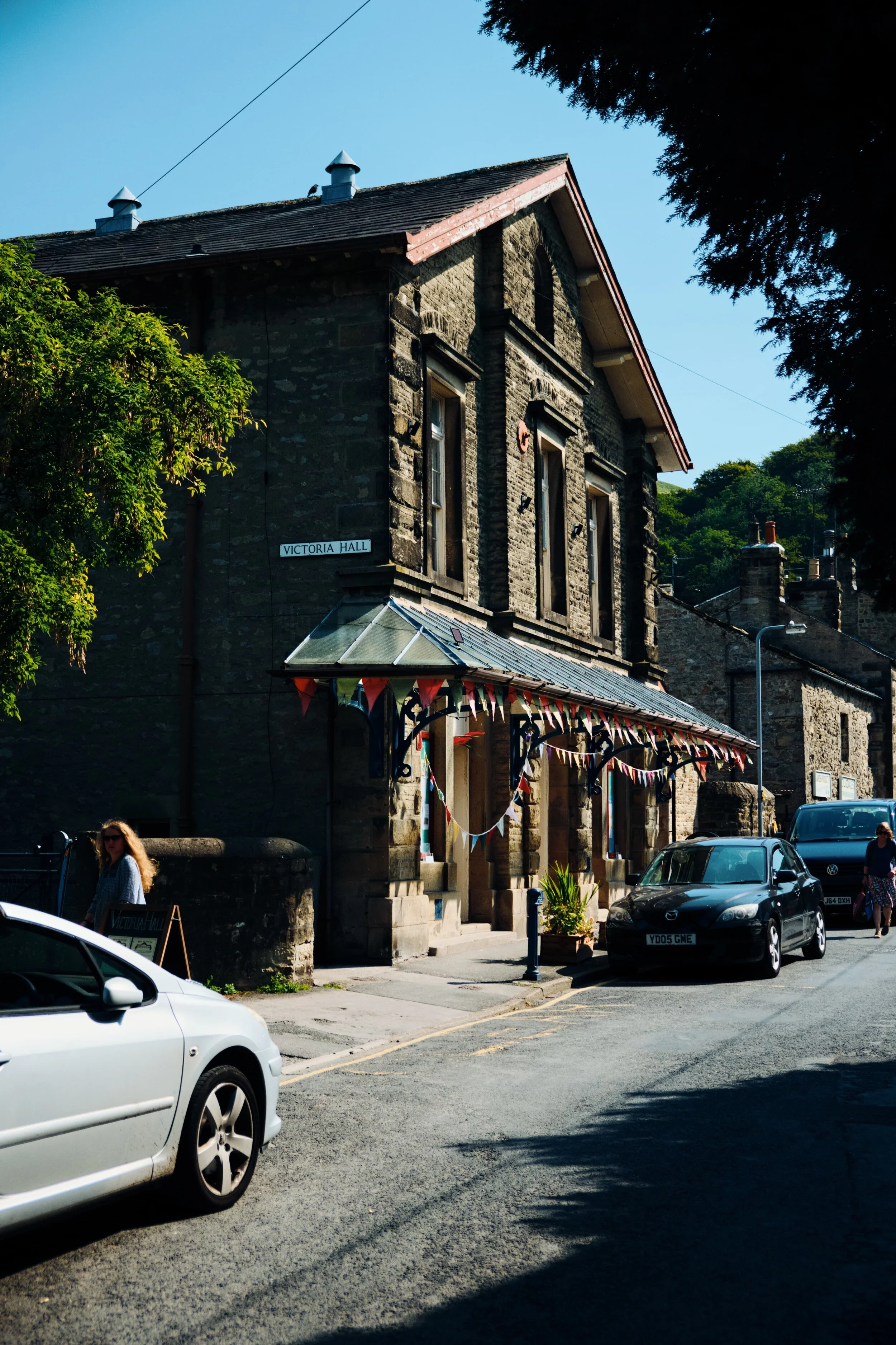
Building a business was very different in the Victorian era.
In 1850 a Titus Salt sought to build a textile mill big enough to consolidate all the textile manufacturing processes in one place. His competitors were running a variety of mills in Bradford and Salt did not approve of the appalling working conditions, unsafe practices, and level of pollution in the city.
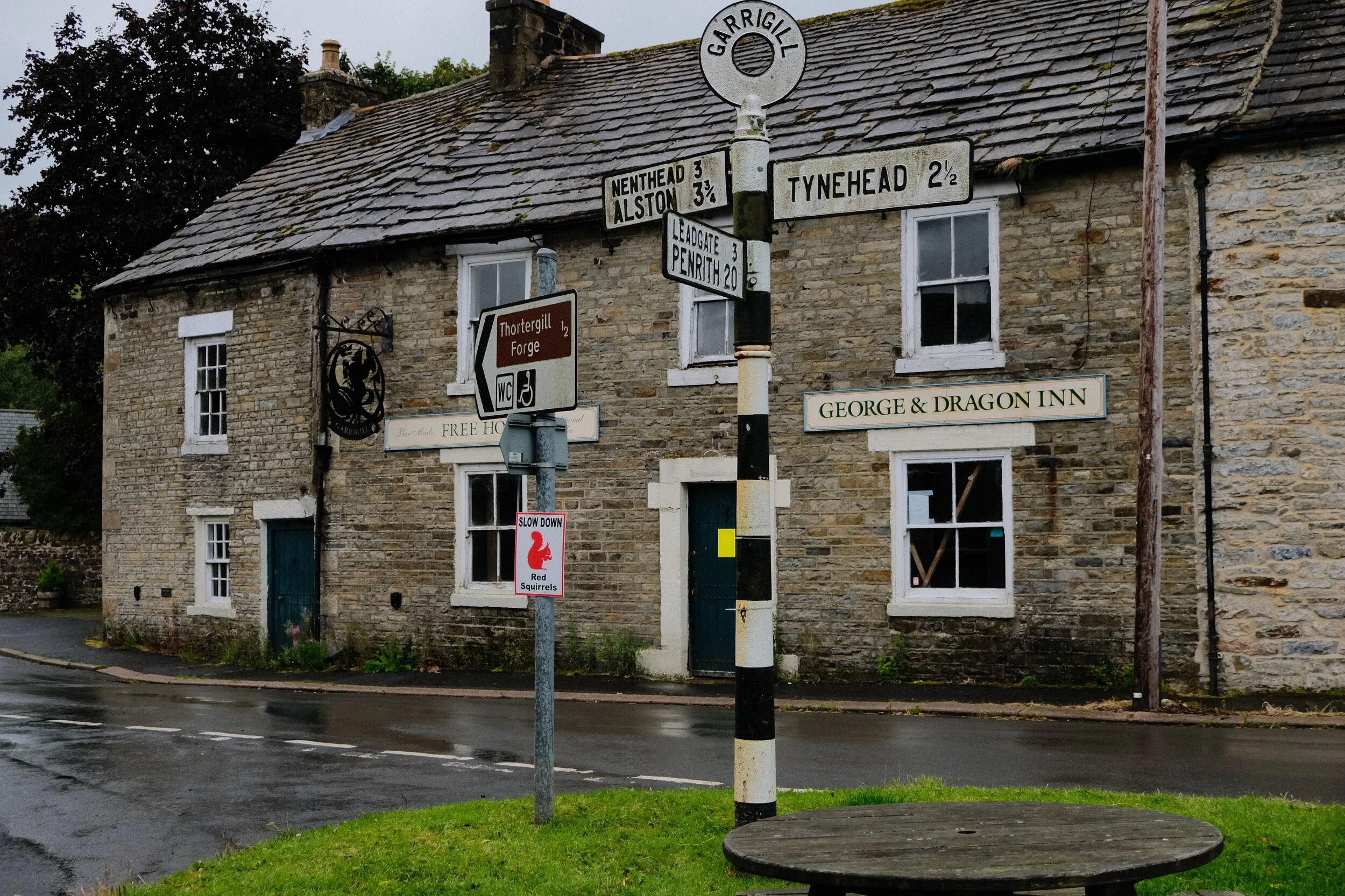
One of my favourite things to do is to show my Dad new places to hike and photograph.
So on Sunday my Dad came down to visit and we headed out to Mallerstang—perhaps my favourite Yorkshire Dales valley—for a hike full of vistas, beautiful light, and pretty waterfalls.
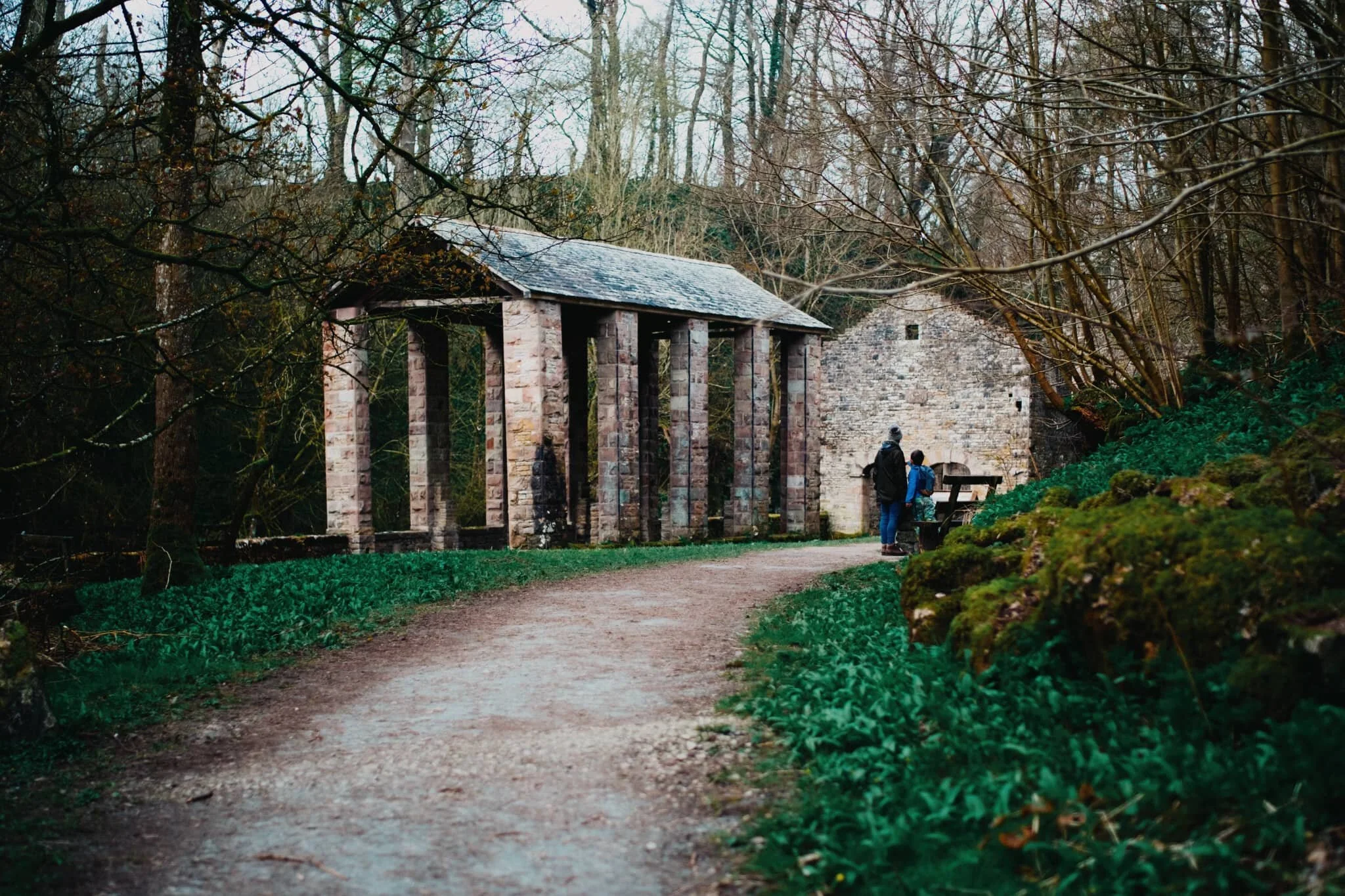
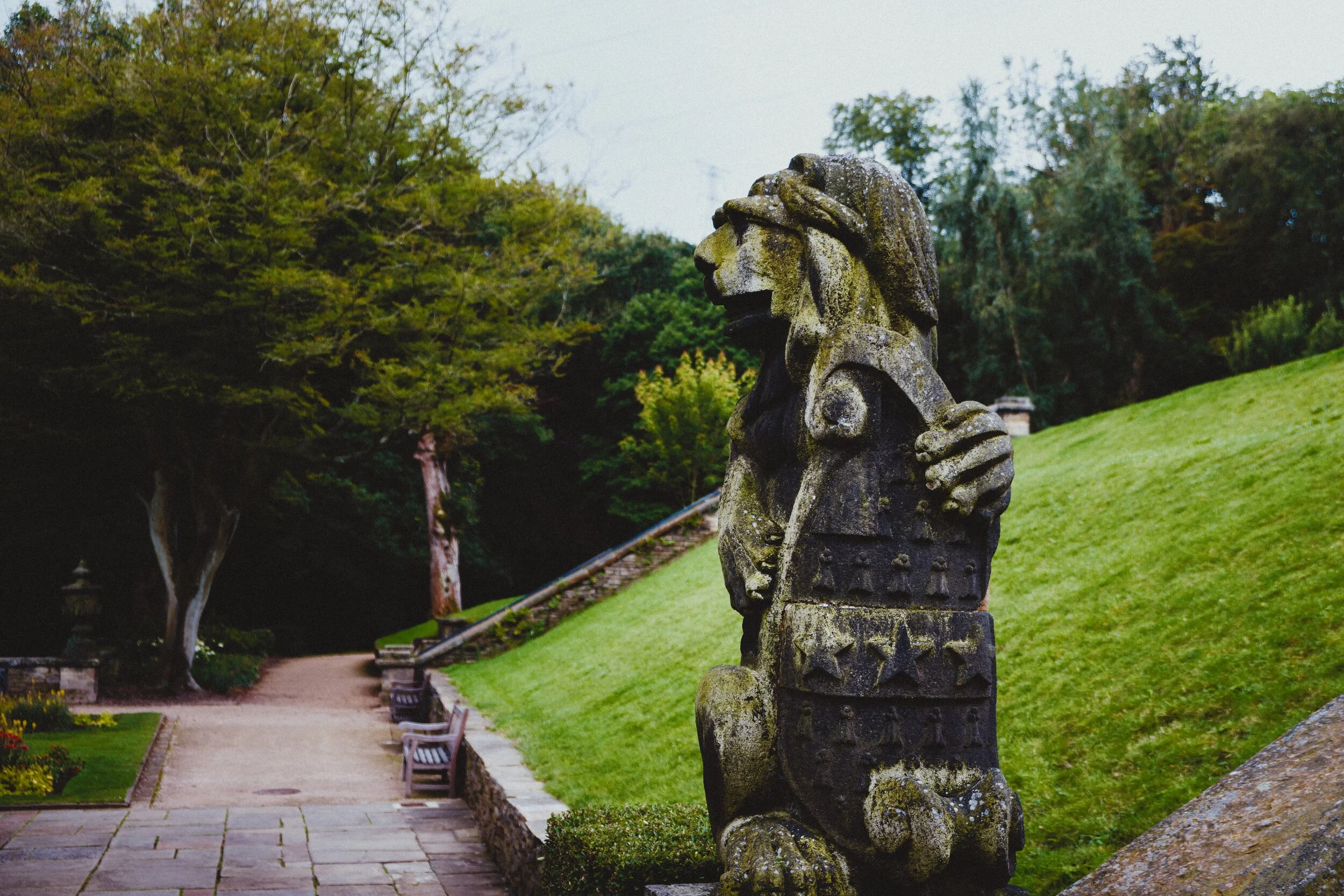
There are some seriously old buildings in Britain.
We didn’t have an exact itinerary for our recent mini-break but we were given a strong recommendation—by my employer—to check out Shibden Hall, just outside Halifax in West Yorkshire.
On the final day of our mini-break we decided to enjoy a proper good hike around Upper Teesdale.
We’ve been to Upper Teesdale a few times before, mostly for quick excursions to the epic High Force waterfall. But now we’re fitter and healthier, we felt capable of more, so we parked at the Bowlees Visitor Centre and took in lots of waterfalls around Upper Teesdale.
We finally got a week off.
The pandemic, and its subsequent lockdown, has been pretty intense for me and Lisabet. I took on extra roles and responsibilities, with less available work time, and Lisabet’s job changed fundamentally. And we continued working throughout the lockdown.
The sweltering heat of July is giving way to the rain and thunder of August.
A lot of this week—especially in Cumbria—has consisted of heavy downpours, with some lightning thrown in for good measure. This has made getting out for some solid hiking rather difficult.
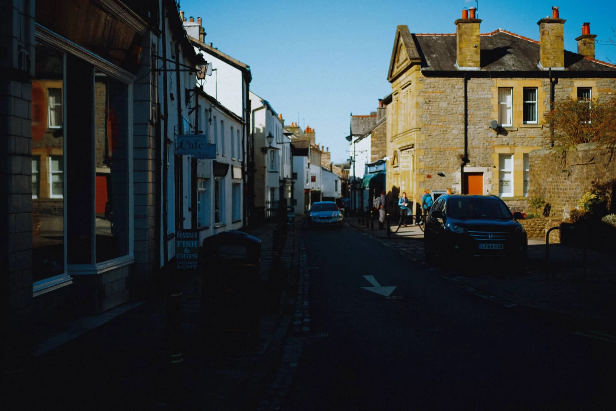
I do have a strong affinity for Settle.
There’s not many other places I’d rather live in; I consider myself, on a daily basis, to be very fortunate to live in Kendal as it is. But if I had to live somewhere else, Settle would definitely be a top contender.
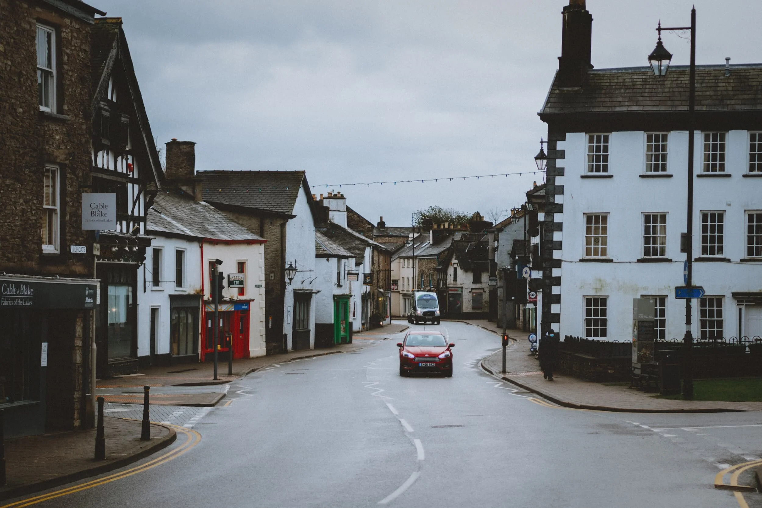
A-Level results for 2020 have been released.
You can read the news if you like about all the controversy regarding this year’s A-Levels, especially due to the global COVID-19 pandemic. The news tires me, personally. I was more interested in seeing my town come alive with mid-late teens celebrating and commiserating in equal measure.
The heatwaves have returned.
After a pretty damp July, at least in Cumbria, we’ve recently experienced temperatures approaching 30°C. Lisabet and I decided to take advantage of this Glorious Return Of Summer by paying my Dad another visit.
With the easing of lockdown restrictions in the UK, it’s my experience that tourism in the UK has never been busier. It’s likely a result of a declining aviation industry and the extra hassle involved in holidaying abroad.
We seem to be going through a session of revisiting hikes we’ve not been on in years.
Straight after work one afternoon Lisabet and I had planned on a hike perhaps up to Hayeswater from Hartsop, or into Deepdale to gawp at Greenhow End. But not long after setting off we consulted SaferLakes.co.uk and found that most of the parking around Glenridding and Patterdale was labelled as Busy. We quickly changed plans. Why not jump off the A591 now, head through Staveley and arrive at Kentmere for a walk around this gorgeous and quiet valley?
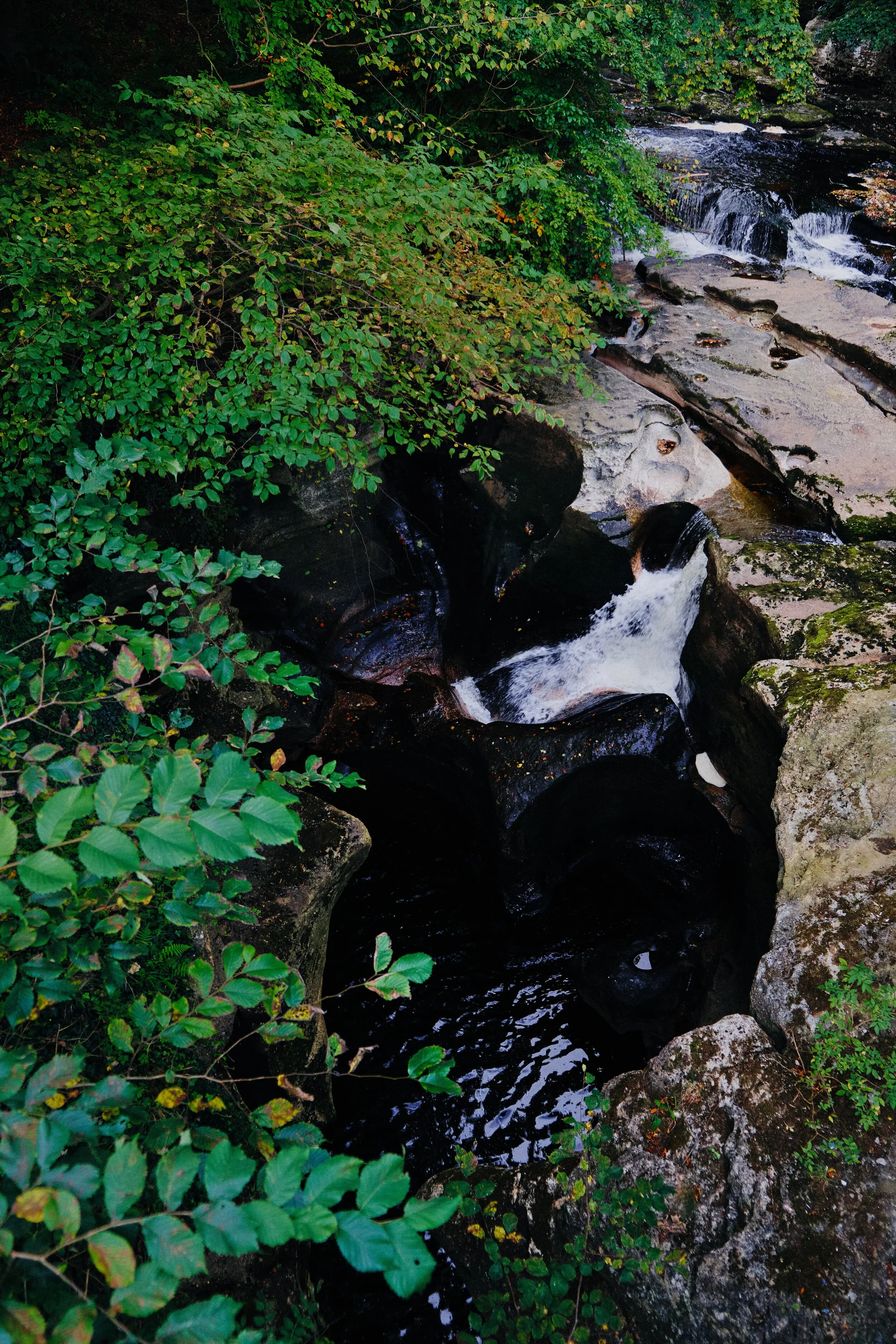
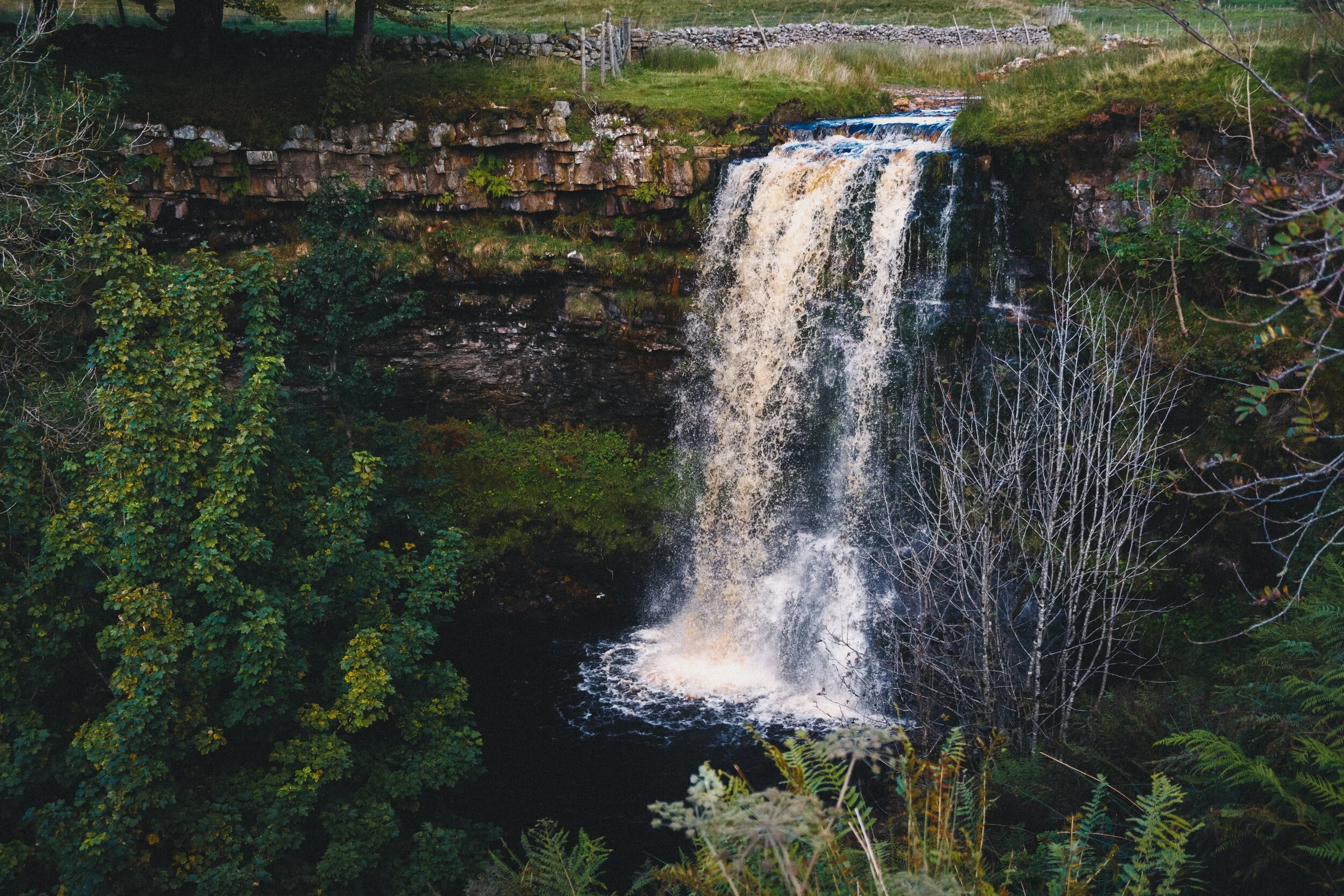
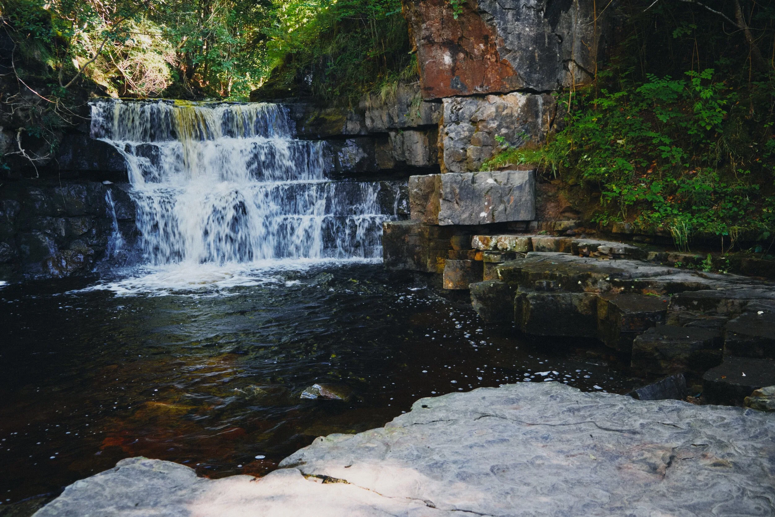
With all the rain falling in the North of England at the moment, it seems a good opportunity to revisit some of our favourite waterfalls.
As I’ve mentioned elsewhere, you’re spoilt for choice when it comes to waterfalls in the Yorkshire Dales. In fact, the Yorkshire Dales is home to the highest unbroken-drop waterfall in England, Gaping Gill (if you count the fact that it drops 322 ft into an underground cavern). If you want above-ground only, then the claim is held by Hardraw Force also in the Yorkshire Dales, a single drop of 100 ft.
The last time we hiked up High Cup Nick (trying that saying three times fast) was back in August 2013.
Back then I was recovering from a recent mental breakdown.
Swaledale is one the northernmost and remote dales of the Yorkshire Dales.
The last time we visited the valley was back in May 2016, and we only really drove through the valley. In terms of actual hiking you’d have to go back to April 2014, the last time we hiked around Swaledale. Even then, we only did a small walk from the village of Keld to Crackpot Hall and back, just under 2 miles all in all.
Back in 2017, camera nerds (myself included) were very excited by the arrival of Fujifilm’s first digital medium format mirrorless camera: the Fujifilm GFX 50S.
It featured a sensor 1.7x larger than your usual full-frame 35mm digital camera sensor, in a small body, and promised incredible resolution and that oft-desired “medium format look”. And all for considerably less money than the, at the time, current crop of digital medium format cameras.
We’re doing lots of rain dodging at the moment.
But that’s OK, because lots of rain means thunderous waterfalls.
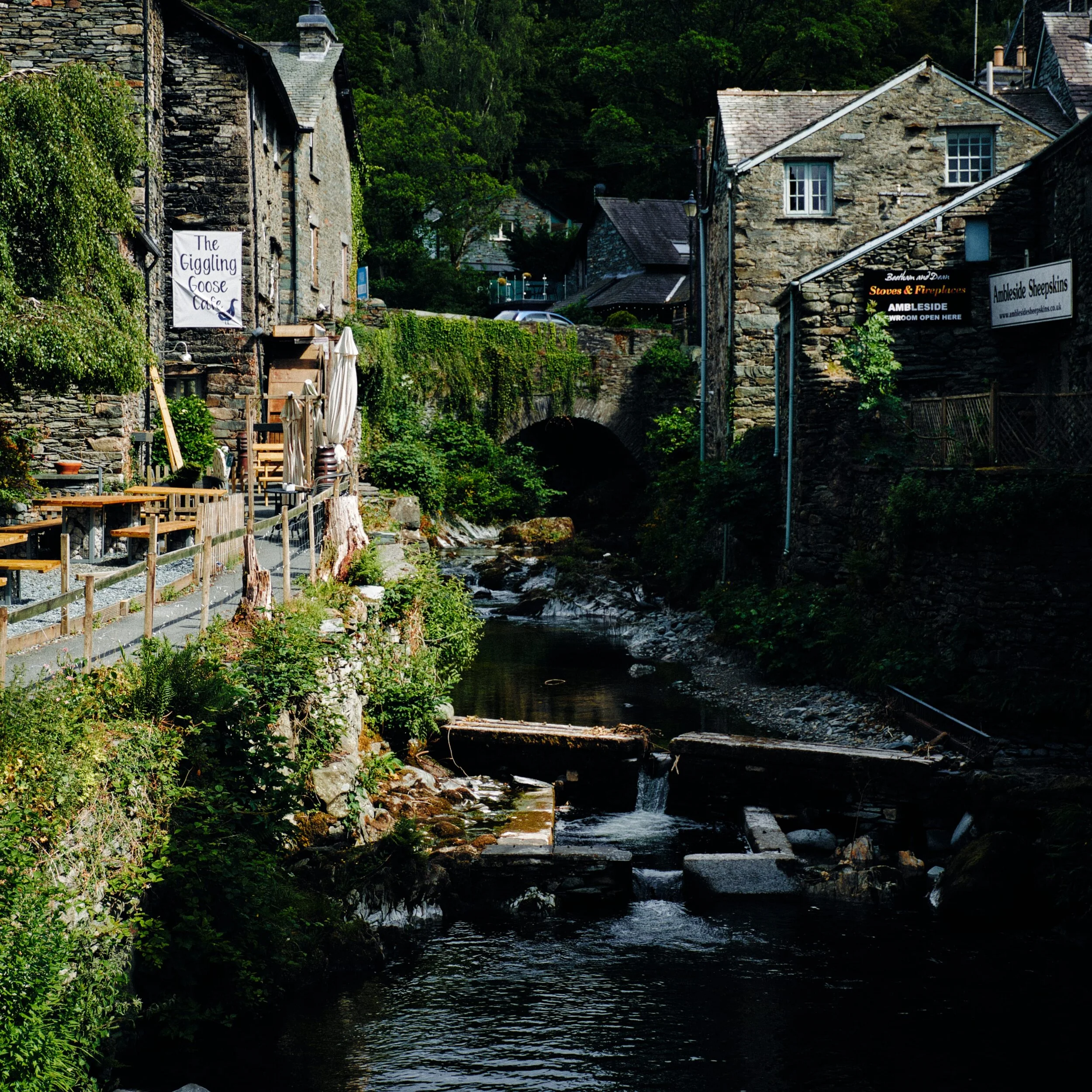
Lisabet and I decided to head straight out after work for a hike around Stock Ghyll Force in Ambleside, before the rain arrived. We timed it well. Five minutes after getting back in the car to head home, the heavens opened and our car was washed.
The weekend has been very wet.
The Met Office have stated that, between 10:00am Sunday 28/6/20 and 10:00am Monday 29/6/20, Honister Pass recorded 212.8 mm of rain, “provisionally a new UK June daily rainfall record”.
In 1930, at the age of 23, a young Alfred Wainwright from Blackburn, Lancashire arrived at Windermere Railway Station, Westmorland, and hiked up the nearby small fell known as Orrest Head (238m/783 feet).
After a seriously dry and hot April/May—as noted by the MetOffice—June has proved to be more tropical and, well, wet.
In the last week or so we’ve had mid-20°C heat combined with thunder and lightning (very very frightening), and heavy downpours of rain.
Lockdown restriction continue to relax in the UK.
From Monday June 15th non-essential businesses can reopen to the public once again, as long as they follow social distancing guidelines. Some of the bigger companies have already started opening up again.
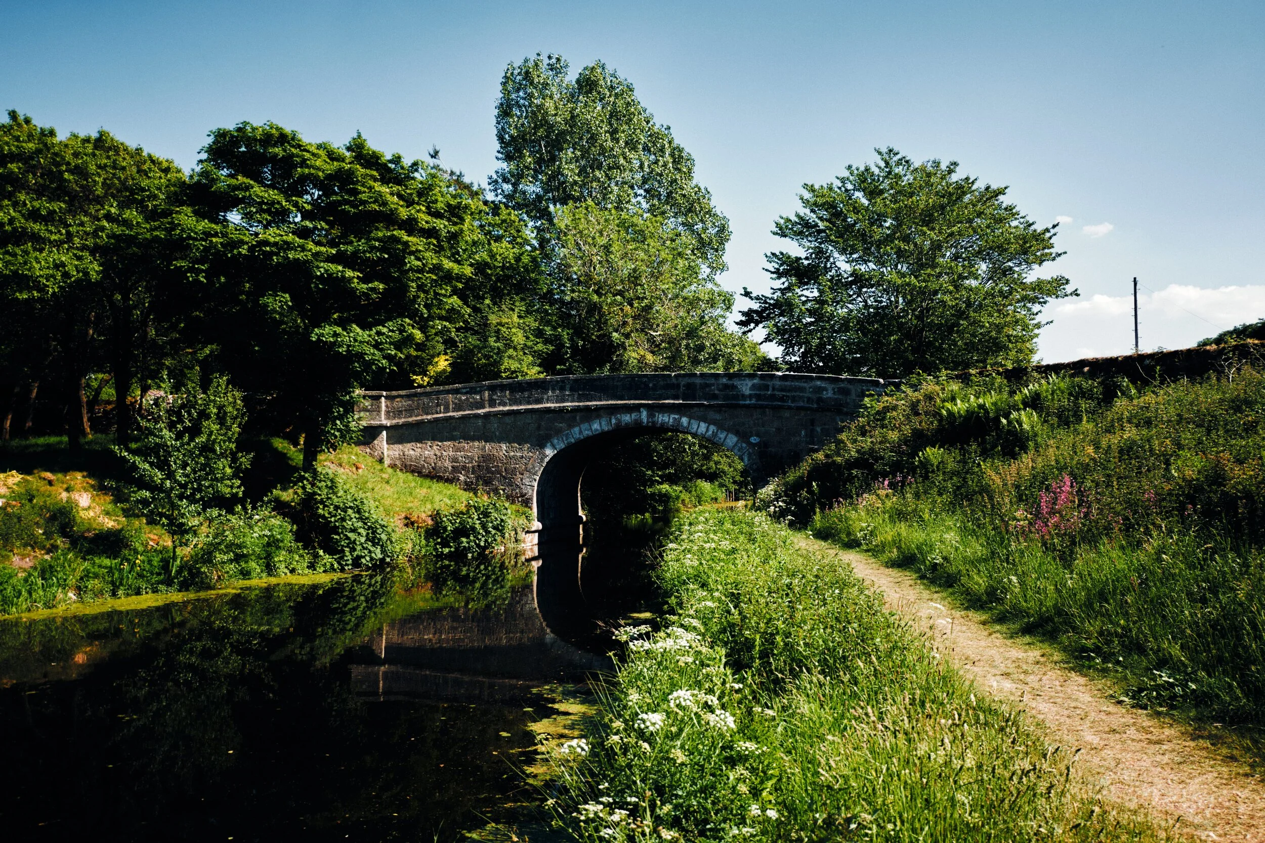
The final stretch of Lancaster Canal.
In case you haven’t seen it you should check out my first photo blog about the Lancaster Canal, which contains the history of this iconic and important canal system.
Over the years I’ve learned that the UK’s canal system is fascinating.
Built primarily as a means to quicky transport raw materials and goods between major manufacturing towns and cities, these days the UK’s canals are largely used for leisure and tourism purposes.
It’s getting hot in here.
The MetOffice confirmed that Spring 2020 has been the sunniest UK spring on record. By 27th May, Spring in the UK had already recorded 573 hours of sunshine, beating the previous record set in 1948 of 555.3 hours.
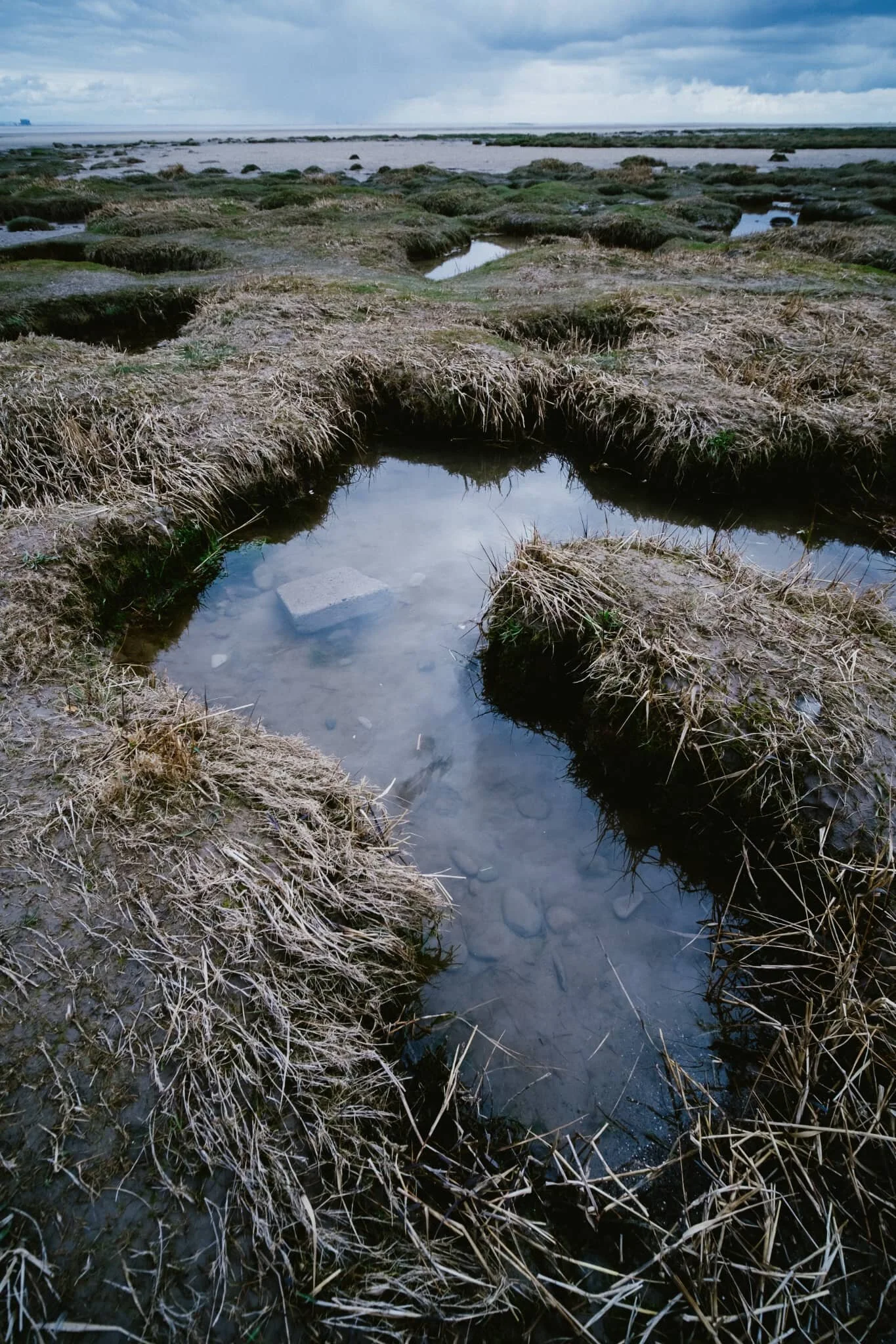
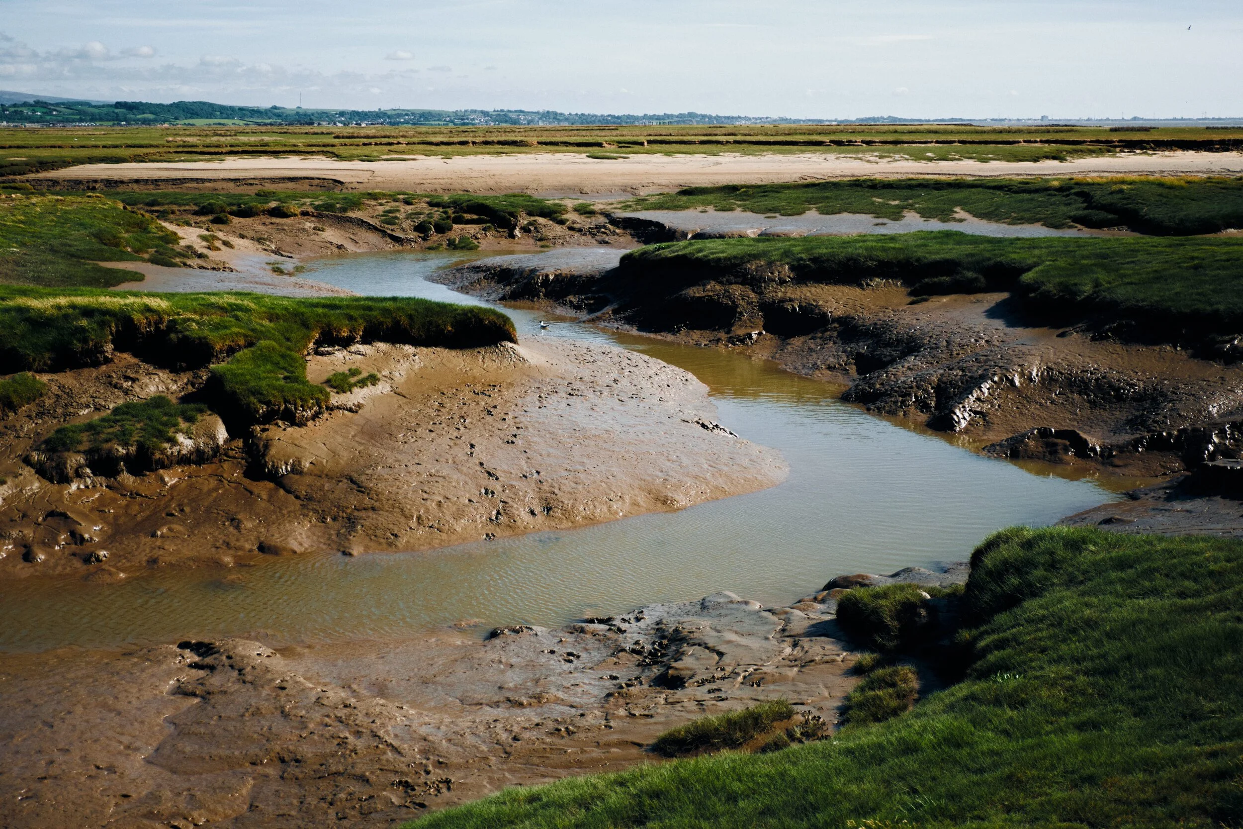
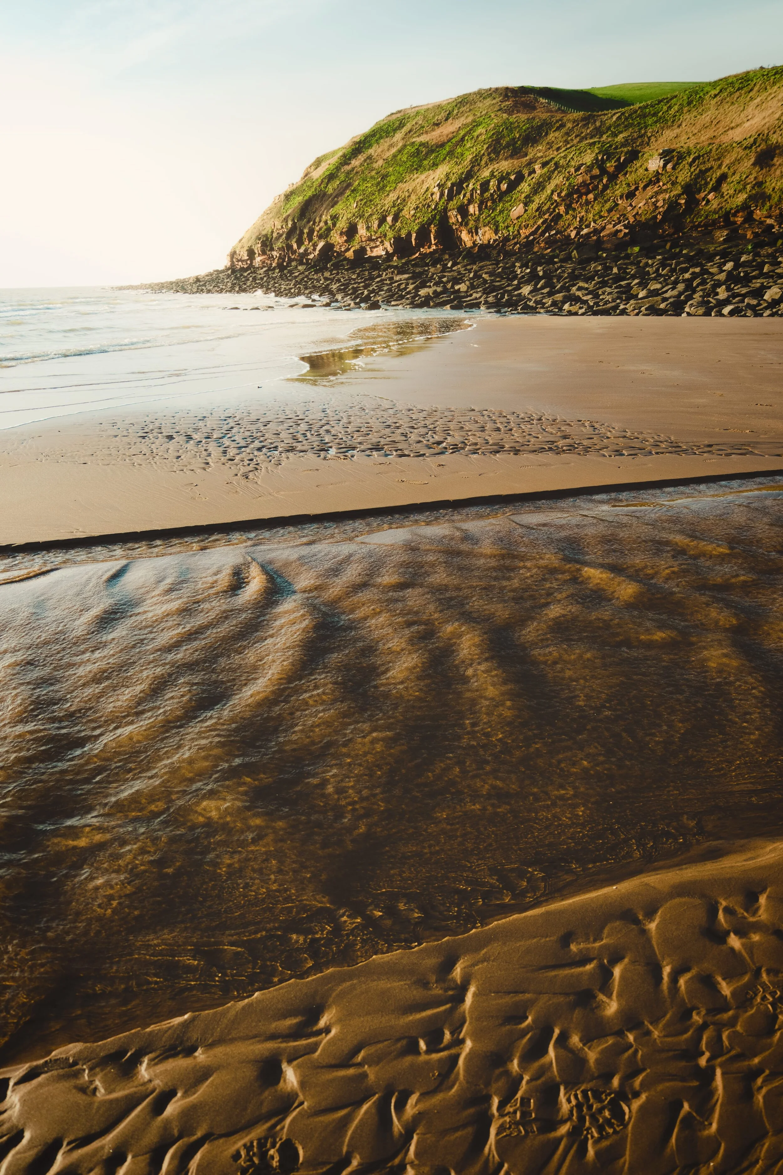
Our native Cumbria isn’t really known for any extraordinary areas of coastline, save for the St. Bees area.
However, if you were to venture just south of border beyond Arnside you’ll enter a gorgeous Area Of Outstanding Natural Beauty (AONB). This is Silverdale, a coastal area of salt marshes, estuaries, Morecambe Bay, and low limestone coastal hills.
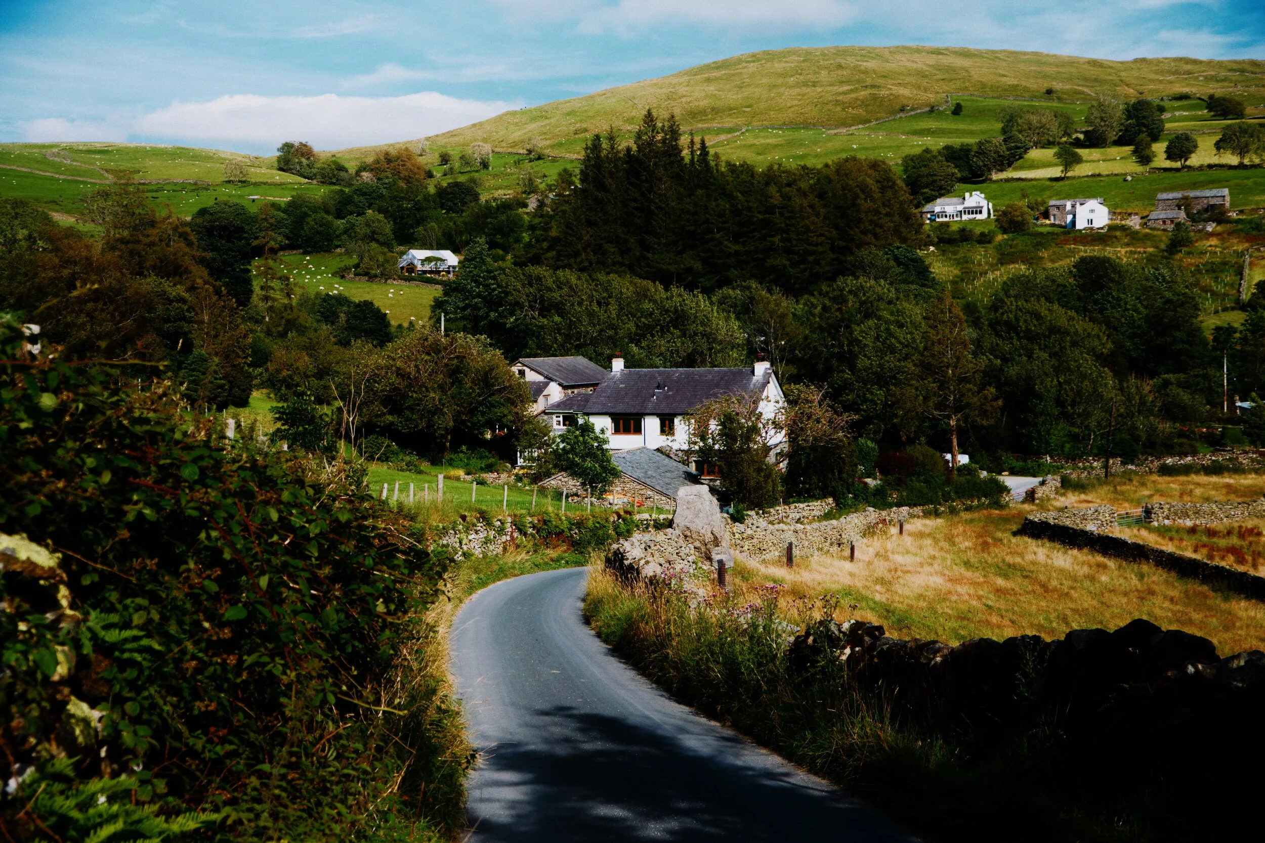
Barbondale holds a special place in our heart.
Lisabet spent many a time in her childhood playing in this valley with her family. It’s also the place where Lisabet’s grandfather’s ashes were scattered.
Brotherswater is one of those Minimum Effort/Maximum Reward places.
There’s a small car park and then five minutes walk along the river you reach this expansive view of the Dodds of Patterdale above Brotherswater. It’s quite a wondrous place.
The weather’s been a bit strange.
April 2020 was the 3rd driest April for Northern England since UK records began (which was 1854). So the landscape is looking pretty parched and in need of a good soaking.
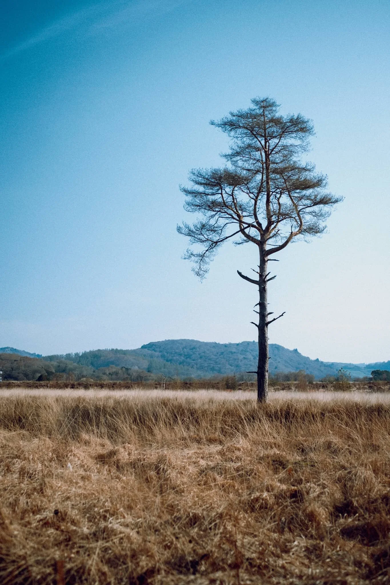
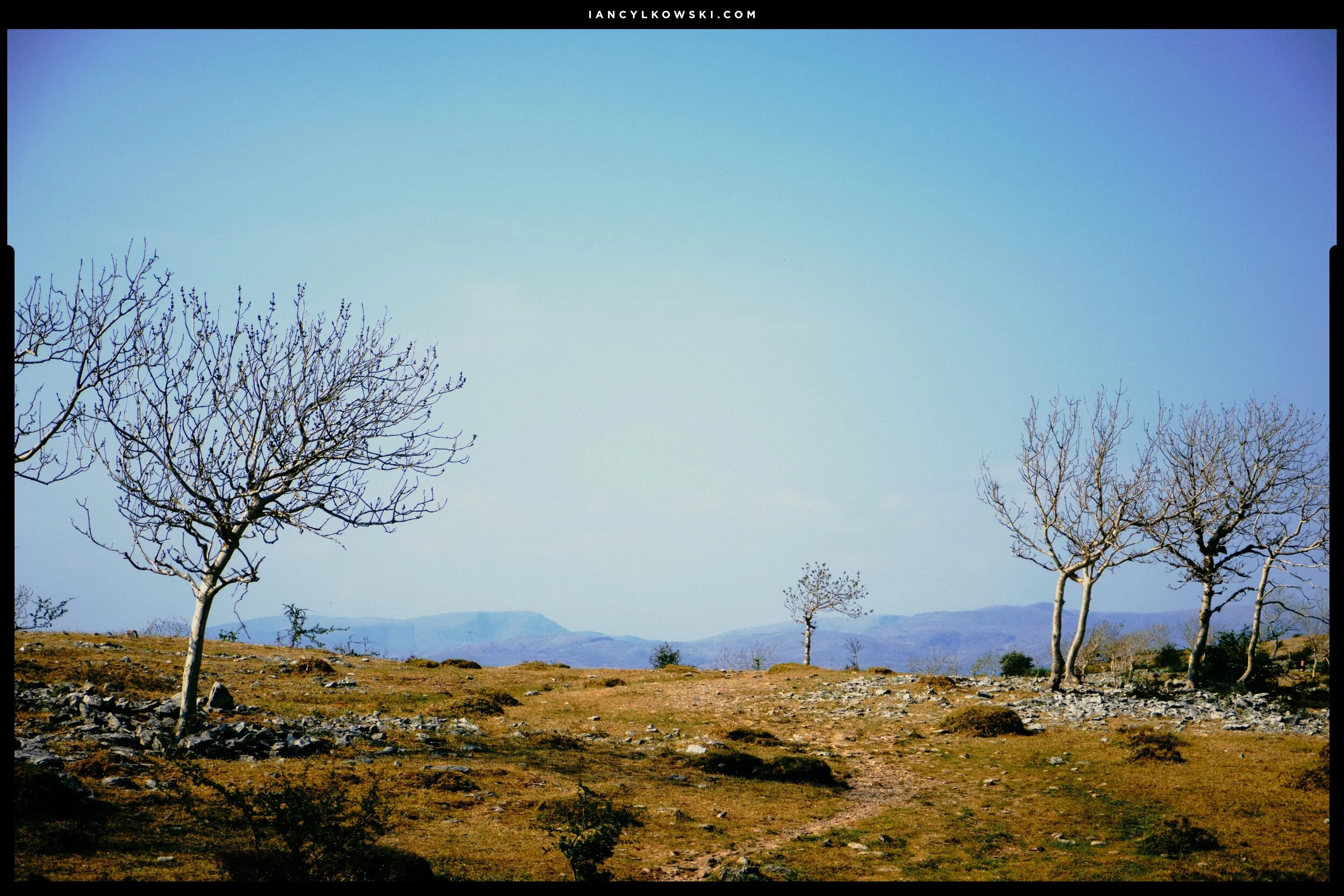
A few days after my 36th birthday, back in 2019, my Dad came up to stay with us (he wasn’t living in Cumbria at the time). One of the places we explored with him was Foulshaw Moss, a raised bog just south of the imposing Whitbarrow Scar. We explored the area and took photos; at the time, I was mainly shooting on my Google Pixel 3XL with a shiny new Moment 18mm Wide v2 lens I’d got for my birthday.
I mostly shot this photograph for the trees on the fell. To me it looks like some ancient woodland god has scribbled her signature across the fell and trees have sprouted in the wake of her pen.
The UK Lockdown has changed.
On Sunday 10th May 2020 the Prime Minister Boris Johnson announced, amongst many things, that there would no longer be travel restrictions for the purposes of exercise. Until now outdoor exercise during the Lockdown was limited to your immediate surroundings.
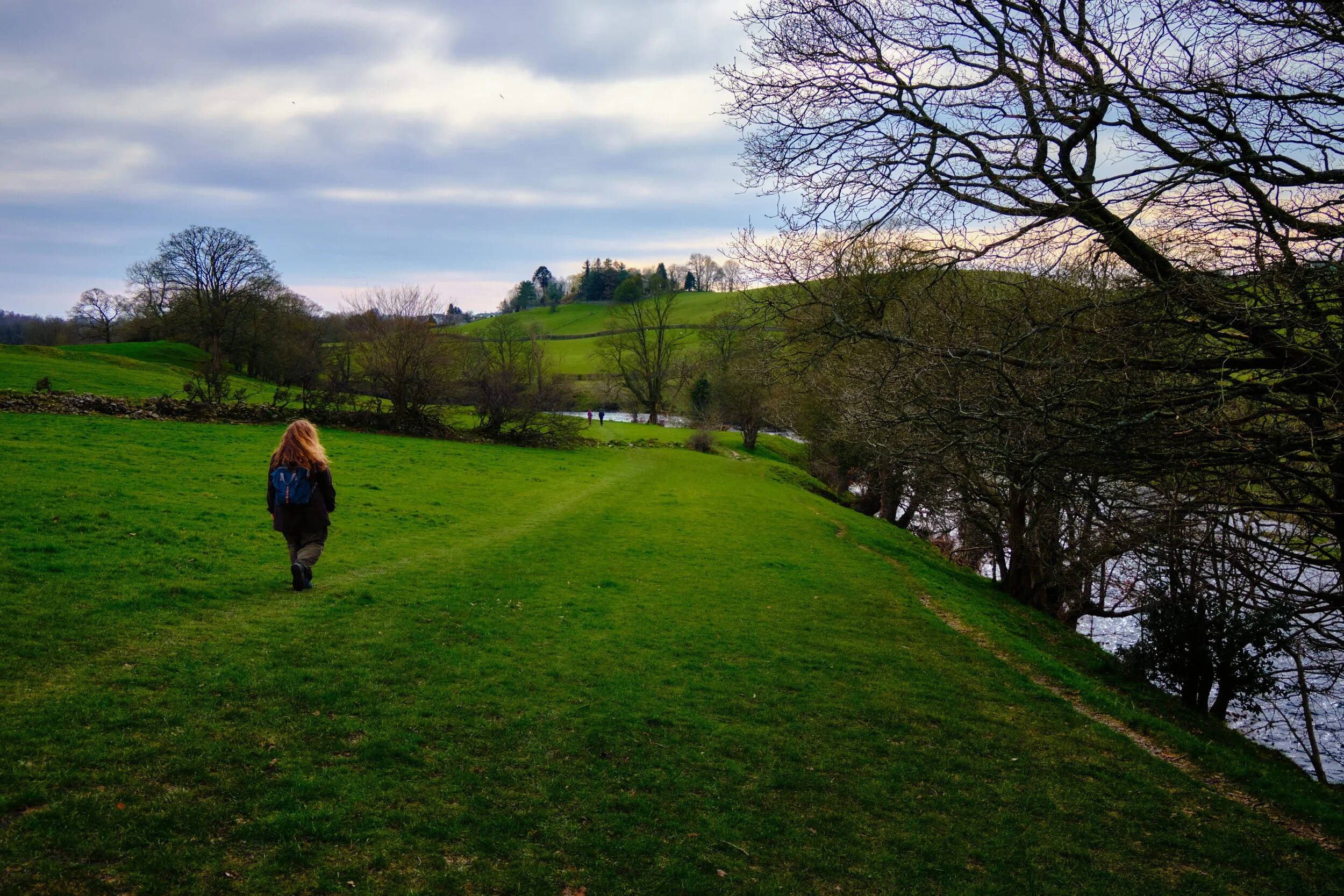
Today it hit 21°C in Kendal. This is where it starts to get sort of uncomfortable for me and Lisabet.
We’re both very much into cool and blustery conditions (by the sea in Lisabet’s case, in the mountains for me). Nevertheless, today we took our Government Permitted Outdoor Exercise to Hawes Bridge, our new local favourite. The gorge is now looking extremely lush, especially when you compare it to the first time we visited the area, less than 2 months ago.
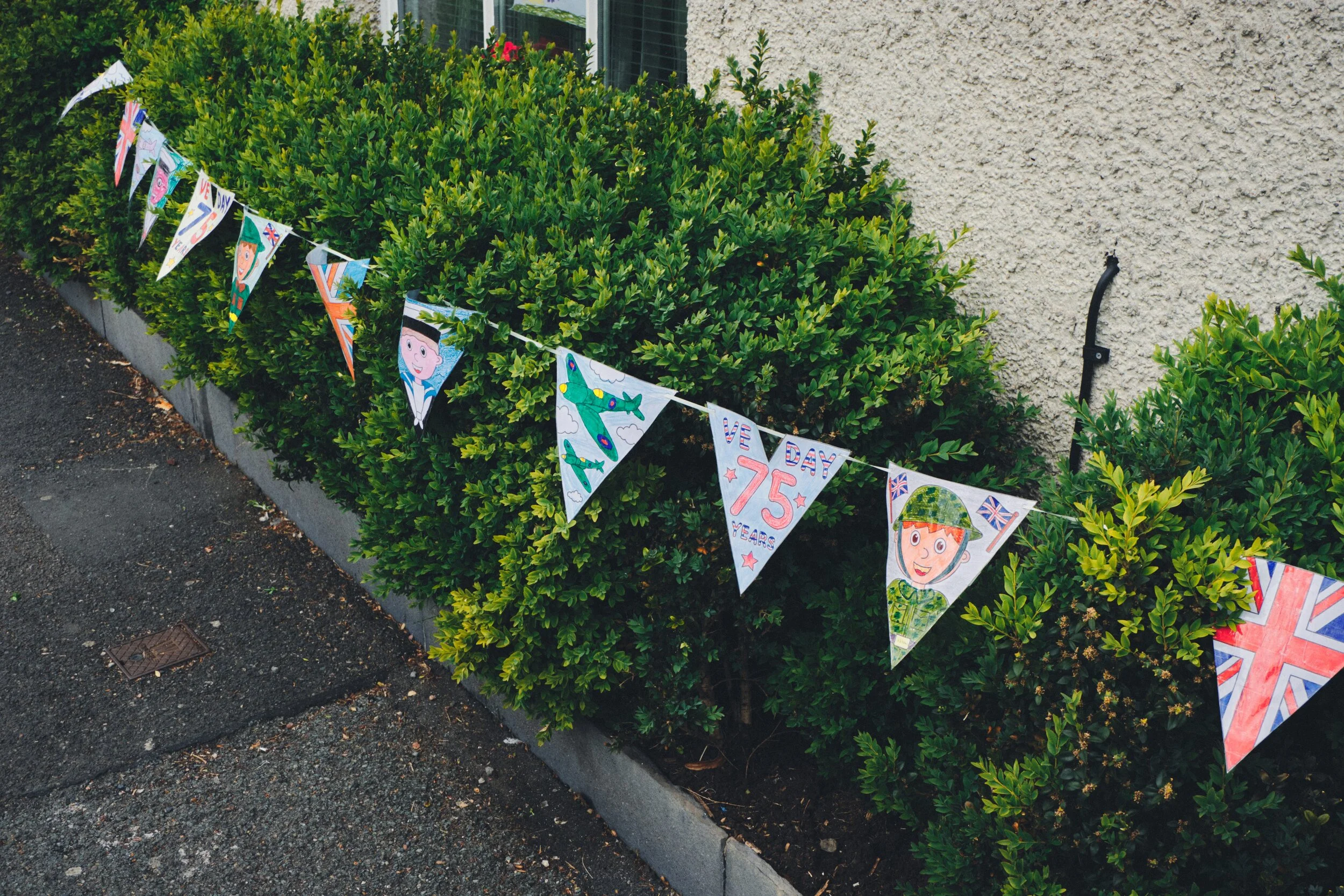
Happy 75th Anniversary of VE Day, that is, “Victory In Europe” Day, when the Allies triumphed over the fascist Nazis. Never forget the sacrifice of those who fought to retain our freedoms and liberties over authoritarian fascists.
Today’s Government Permitted Outdoor Exercise was somewhat shorter, but no less enjoyable.
One of our favourite local hikes we’ve enjoyed since the UK Coronavirus Lockdown has been a circuit up to Helsfell Nab and back, with Serpentine Woods along the way. With the woods looking more lush everyday, and the scenery growing vibrant and brighter, this simple hike really does make you feel very grateful.
Cunswick Hall. What you see has been standing since its modernisation in the 1800s, but there aspects of the property still remaining from the 1500s, including a window which is said to contain the oldest glass in Westmorland. Historically the manor belonged to the Leyburn family.
The weather’s really been glorious in the last week or so. Thankfully, it’s made our daily One Government Sanctioned Outdoor Exercise Session Per Day a lot more pleasant.
The weather was warmer and brighter today, so on our Government Allotted Outdoor Exercise period we ventured up Park Side Road, passed Castle Green Hotel, through Singleton Park, and onwards towards Fisher Tarn Reservoir.
It’s so easy to become lethargic when you’re having to spend most of your time in lockdown in your house.
Activity breeds energy. The opposite is also true.
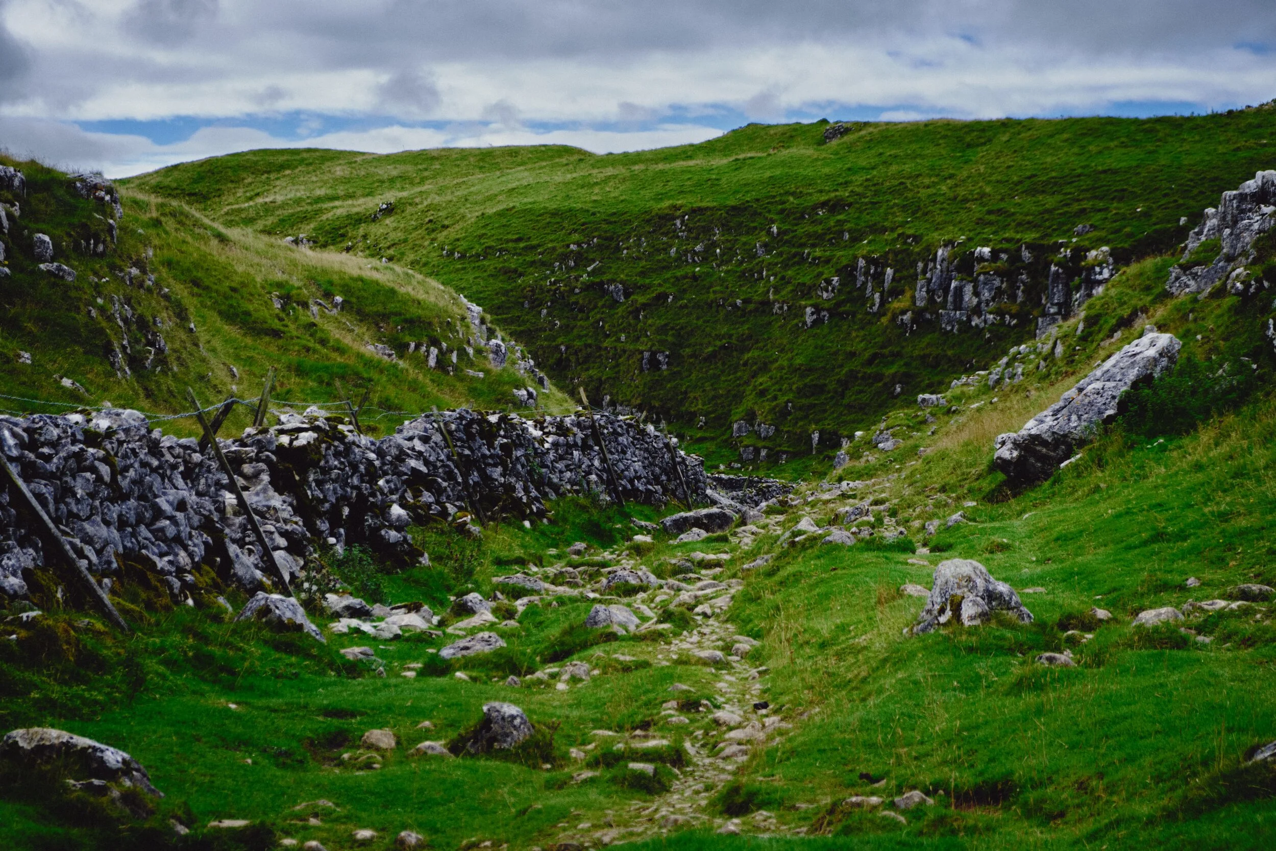
My Lisabet, navigating through a narrow stile in the wall. The yellow fell in the distance on the right is Cunswick Fell, with the jagged peaks in the distance being the Lake District fells.
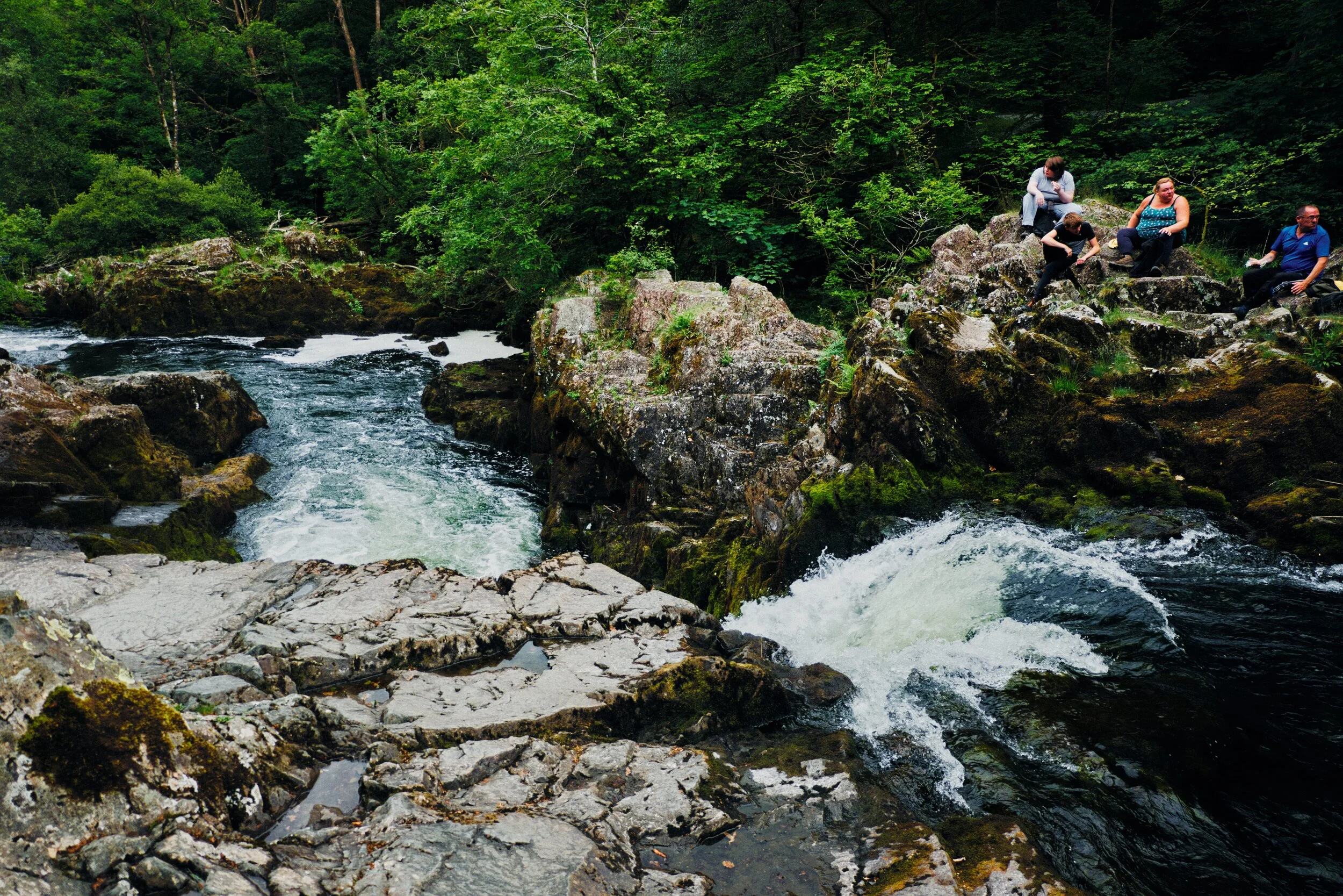
Sgwd Gwladys (pronounced “Sgood Goo-LAD-us”, meaning “the Lady Falls”), found on the Elidir Trail in the Waterfall Country of the Brecon Beacons National Park, South Wales.