From Anstruther, this time we went southwest.
After a brilliant day taking the Fife Coastal Path northeast to Crail, this time we ventured the opposite direction southwest to Pittenweem then St. Monans.
Winds were still strong but the landscapes were no less beautiful for it. Gorgeous sandstone formations, sculpted by wind and water for eons, punctuated visits to civilisation, adorned in jewel-like cottages.
Couldn’t have asked for a better day.
All photos taken on my Sony α7ii using my Sony 24-240mm F3.5-6.3 OSS zoom lens. RAWs edited in Lightroom, merged in Photomatix, then edited and finalised in Photoshop.
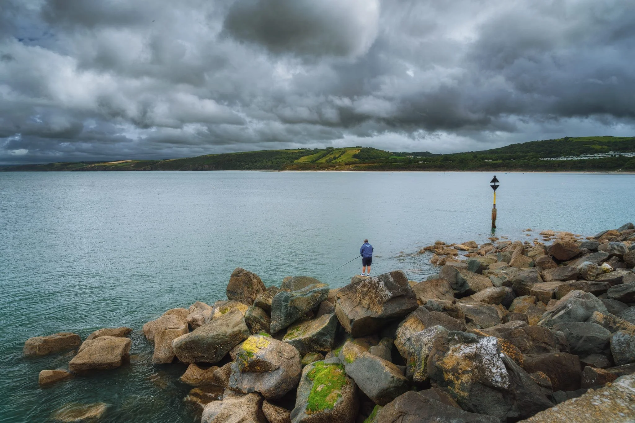
Below the playground and Anstruther Wester’s golfing area, one can play around with the crazy rock formations at Billow Ness. The cliffs and boulders are primarily composed of sandstone; the layering indicates these rocks were deposited in horizontal strata, like an ancient river or sea. The reddish-brown colouring hints at the presence of iron oxides. In the distance, across the Firth of Forth, you can just about make out two distinct “bumps” on the horizon. The one on the left is Bass Rock, and on the right is Berwick Law.
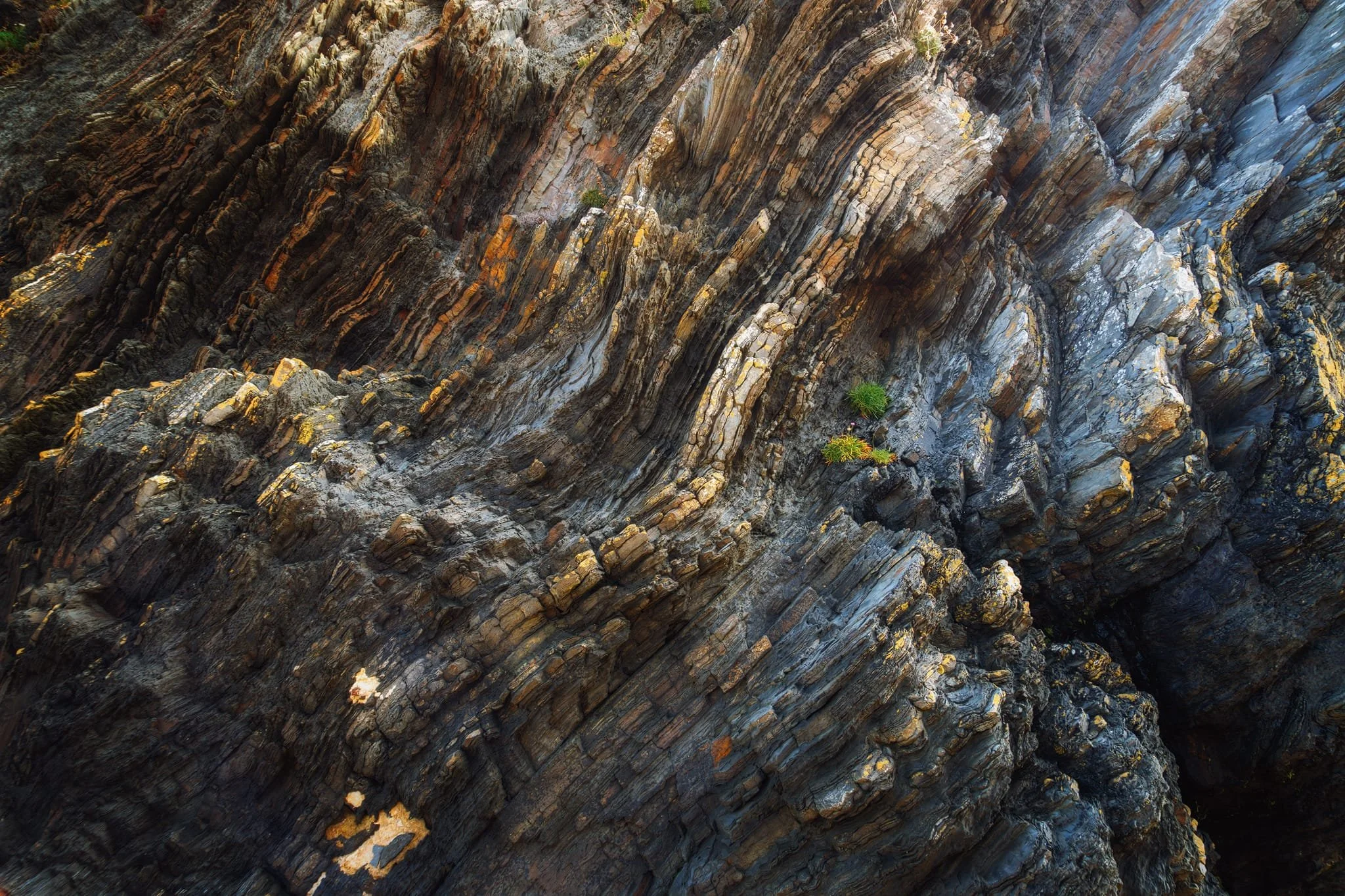
A more abstract close-up of the layering of this incredible sandstone cliff. This is millions of years of history, one layer at a time.
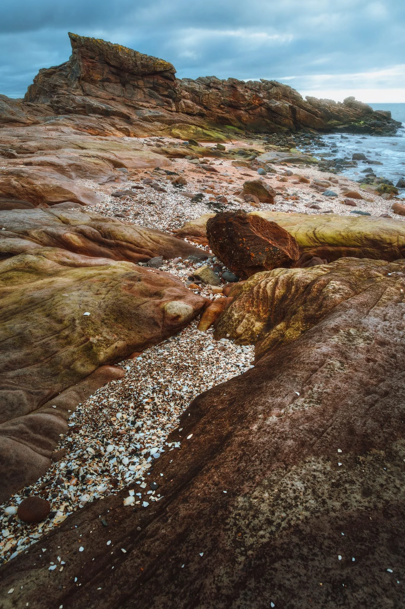
Sandstone, especially in the presence of water, also tends to produce these beautiful sculptured forms that are irresistible to photograph.
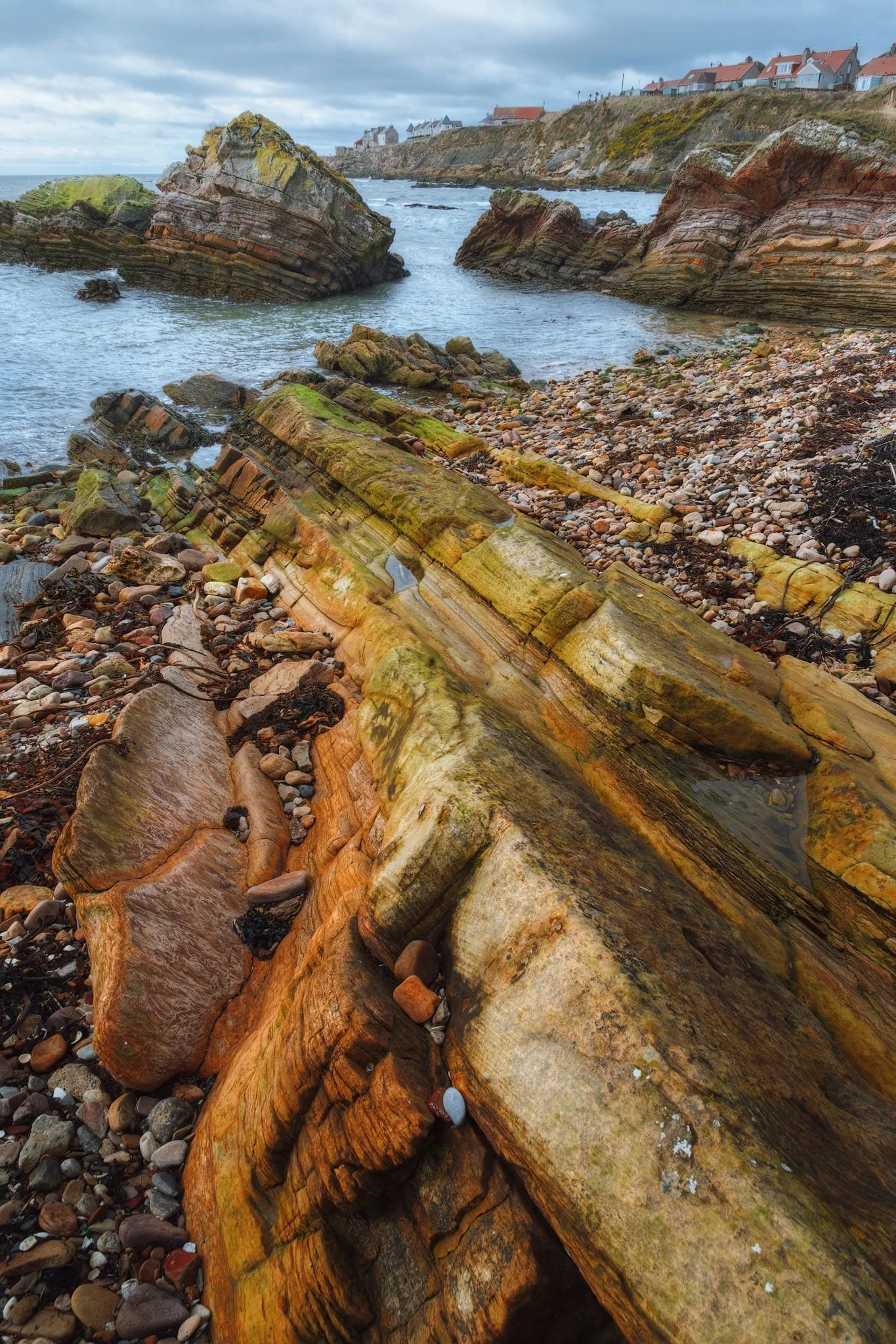
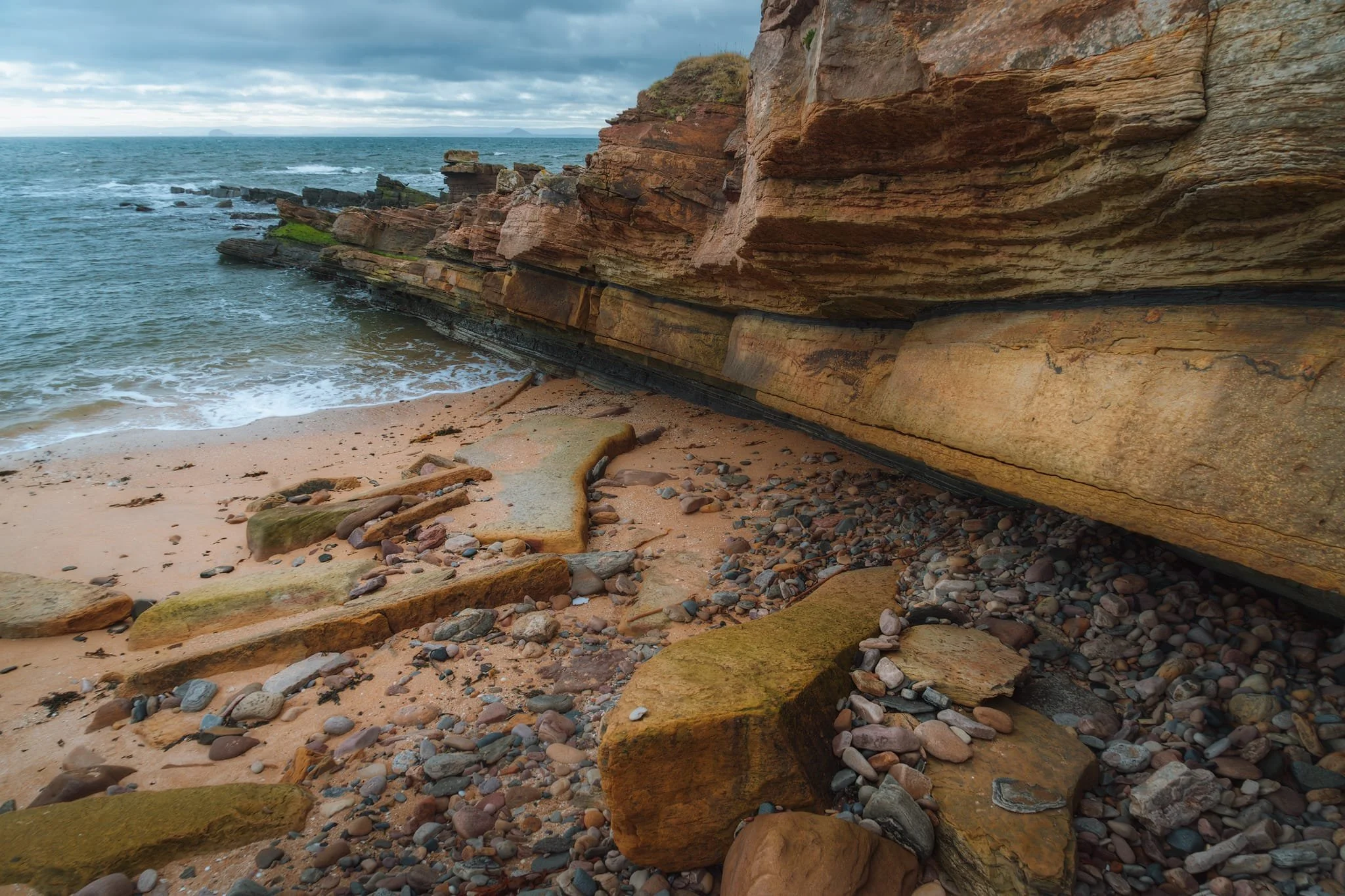
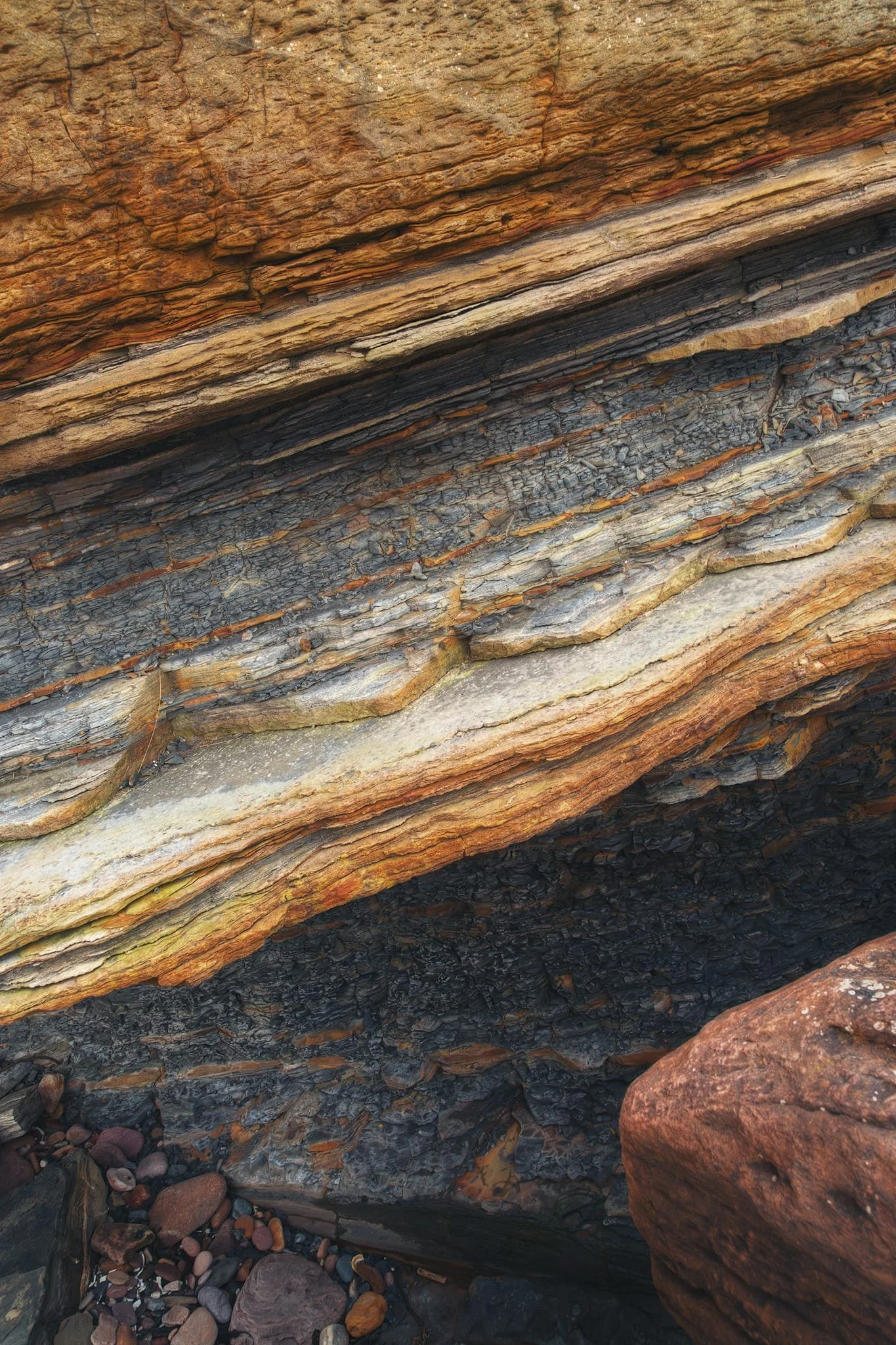
Below Pitenweem, further along the coast, more Sandstone layering is exposed. The beautiful red/brown colours, due to millions of years of oxygen exposure, are complemented with vivid algae greens.
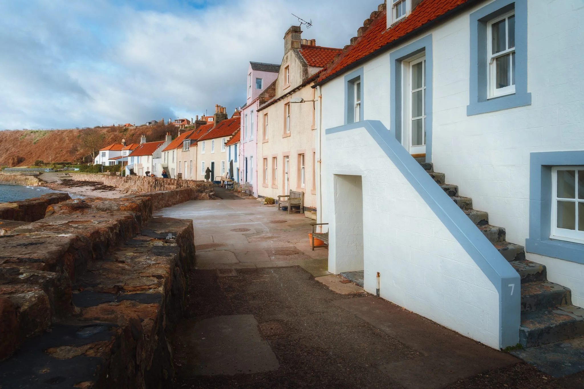
A row of beautiful fishing cottages right by the water at Pittenweem. The name of the village might seem weird. The “Pit-” comes from the Pictish pett meaning ‘place, portion of land’, and “-enweem” comes from the Gaelic na h-Uaimh , meaning ‘of the Caves’. This gives us “The Place of the Caves”, probably named after St Fillan’s cave in the village.
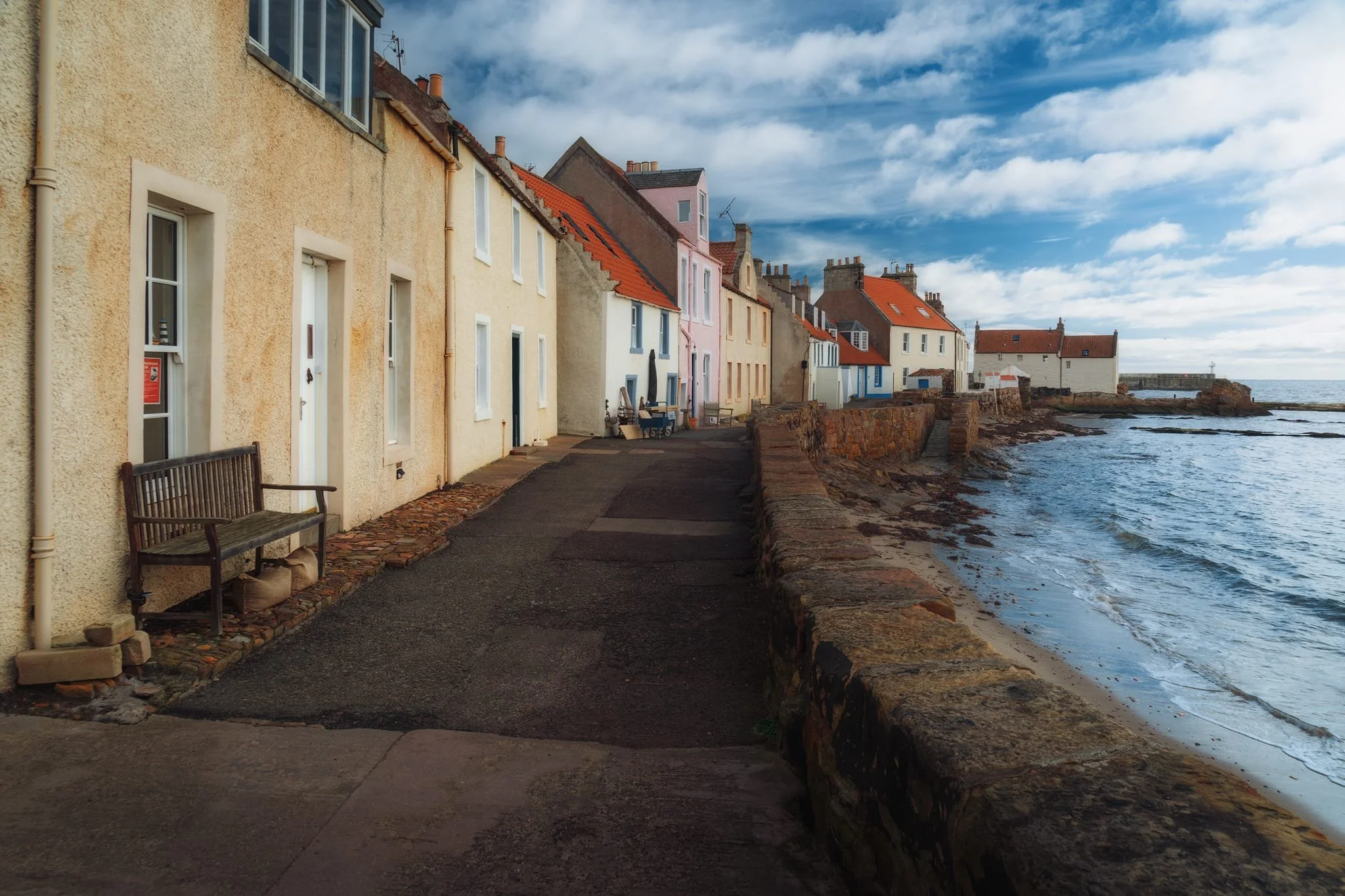
Pittenweem developed as a fishing village probably centred around an early Christian religious settlement. It likely started from the western shoreline, where these cottages are; here, the sheltered beaches were safe places for fishermen to draw their boats up out of the water.
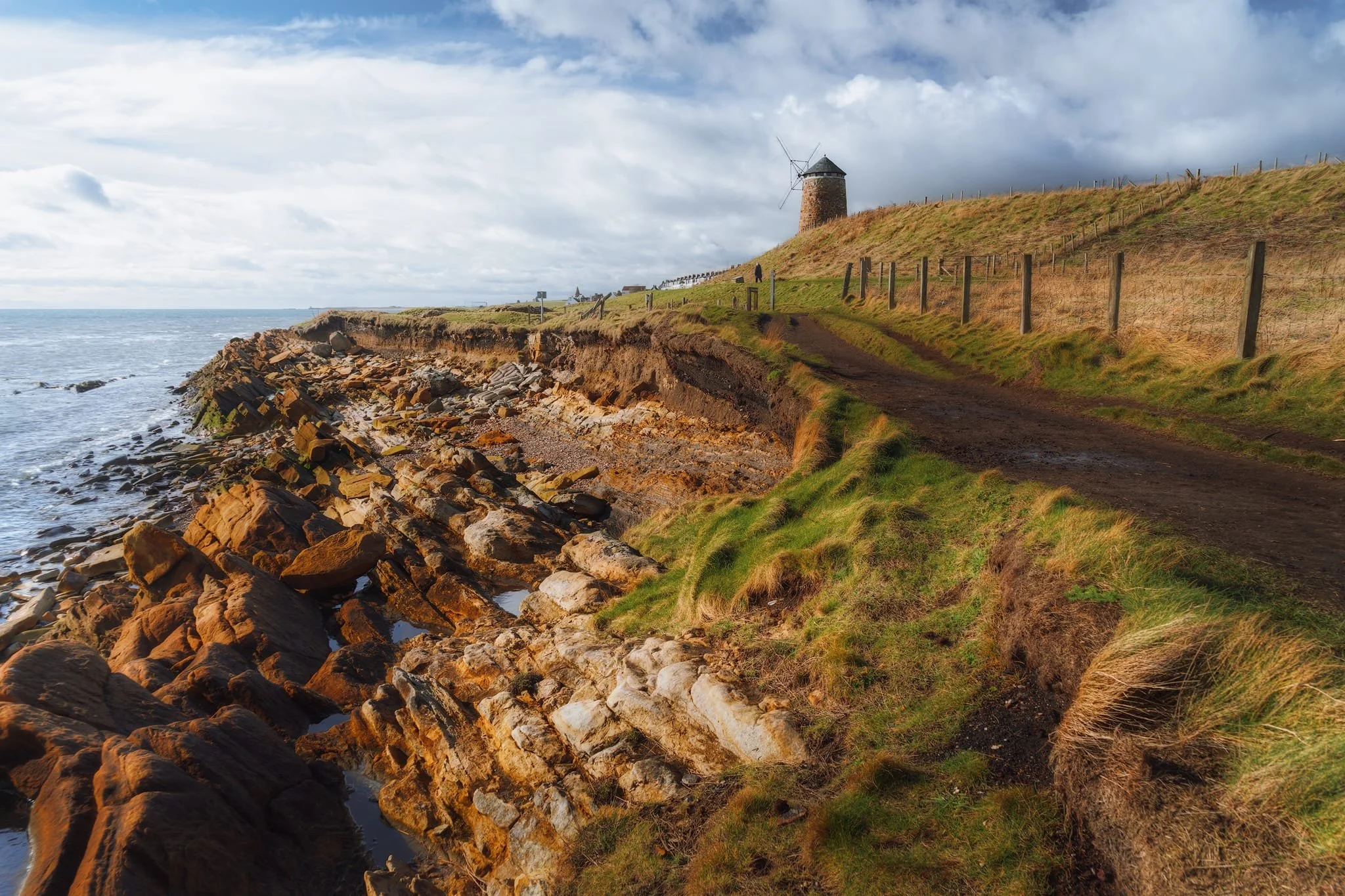
Our next destination along the Fife Coastal Path was St. Monans. Another historical fishing village, its historic buildings include this now defunct windmill that once powered a salt panning industry.
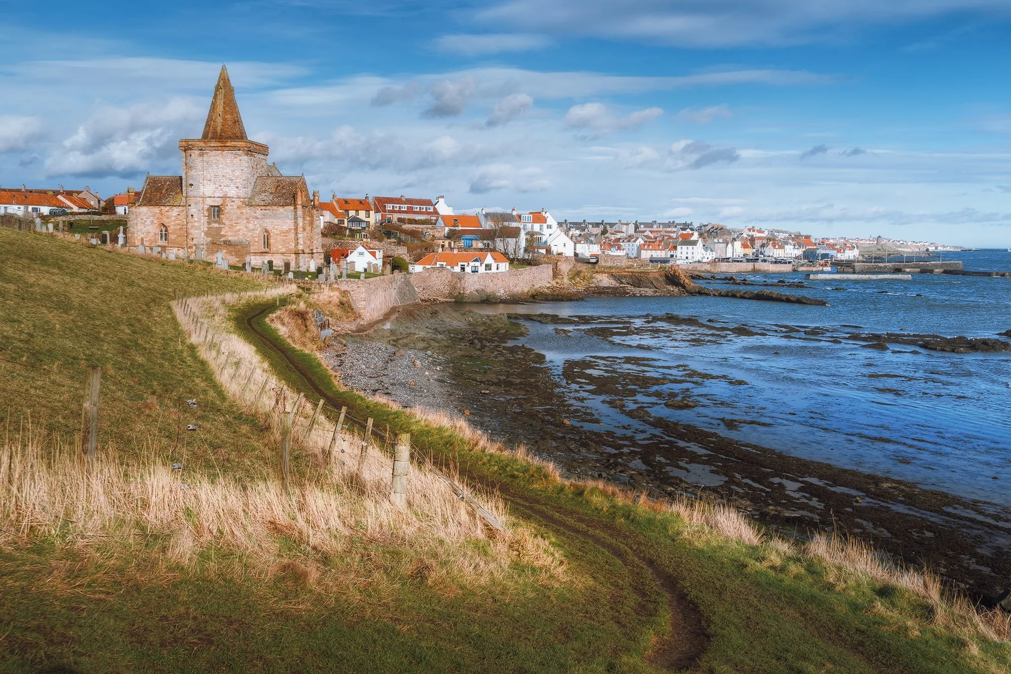
St. Monans in all its glory with St Monans church on the left. The church dates from 1369 CE, built by King David II Bruce. It’s usually known as “the church nearest the sea”, which is probably true.