Time to revisit more familiar areas.
Last time we attempted to explore Winnats Pass and Mam Tor was way back in May 2015. Back then I was considerably heavier and unfit. Since then I’ve lost a lot of weight and gained fitness. It would be interesting to see how I would fare tackling these locations compared to last time.
Our day started in bonny Castleton, heading west to the foot of Winnats Pass and hiking up the pass alongside the road, a 20% gradient uphill. After reaching the top, we would then continue up the moorland to locate the Mam Tor trail. Then it’s simple enough to follow the path to the summit, along the Great Ridge and then down the valley to Castleton.
Though the tops were windier than in the past few days, it was still unreasonably hot for an October day, pushing 21ºC. In any case, the light was compliant and the views were astounding.
All photos taken on my Sony α7ii using my Sony FE 28–70mm f3.5–5.6 OSS zoom lens. RAWs were developed in Lightroom for iPad, finalised in Darkroom for iPad.
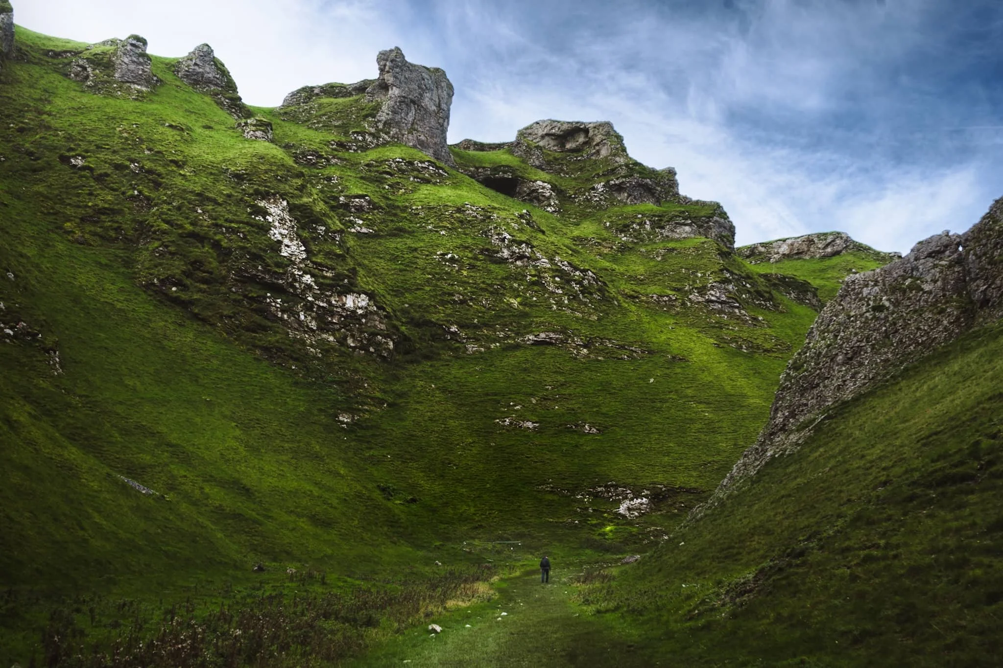
The impressive limestone crags above Winnats Pass dominate the skyline as you make your way up.
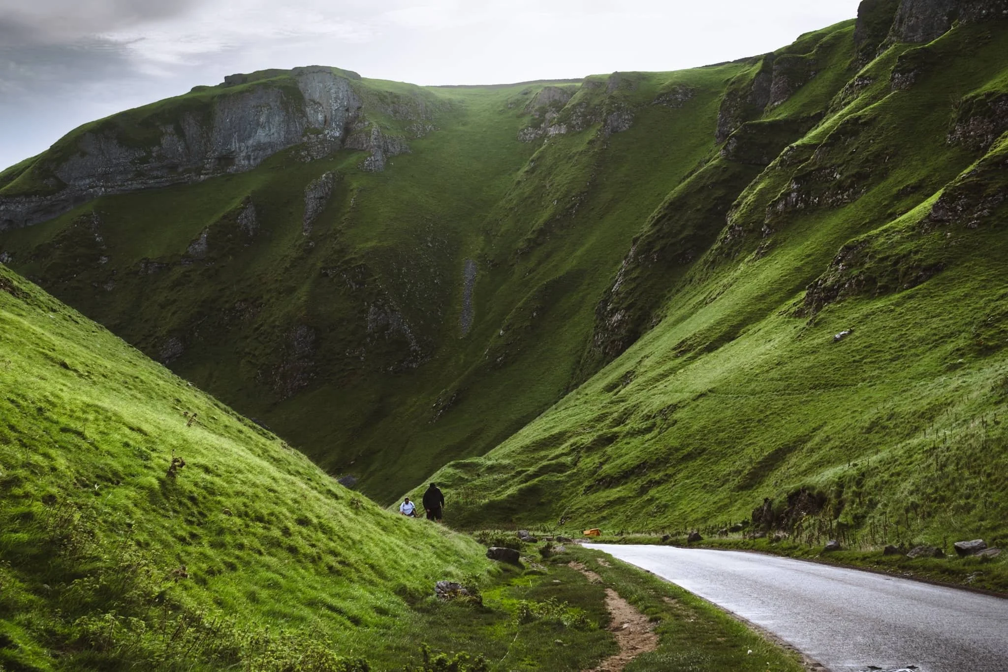
Looking back down Winnats Pass from roughly halfway up, the sun starting to rise above the gorge walls.
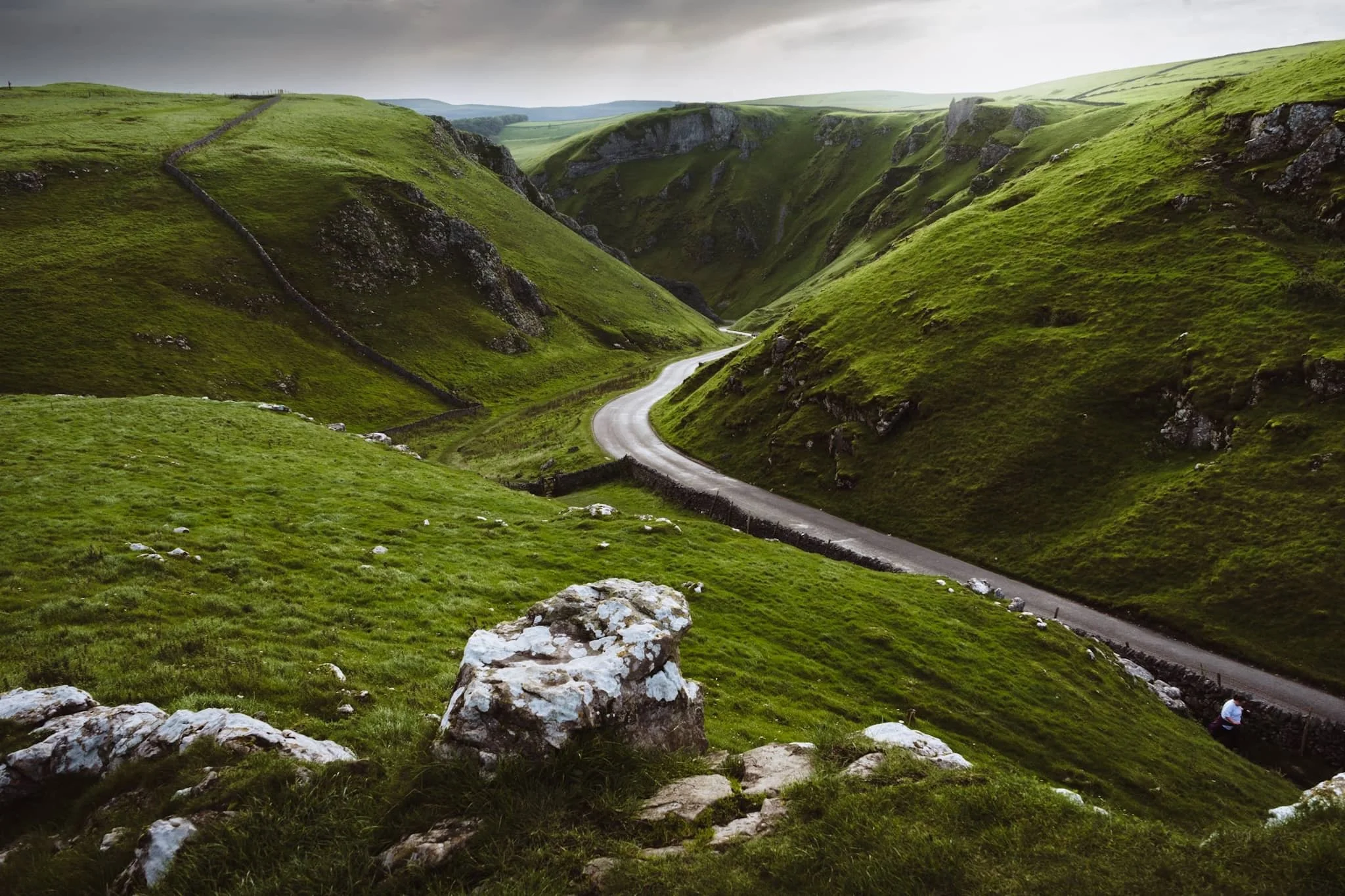
We found an isolated crag that gave us a solid composition looking down the pass. The name “Winnats” is a corruption over time of the original name “Wind Gates” Pass, due to the howling winds that funnel through the gorge.
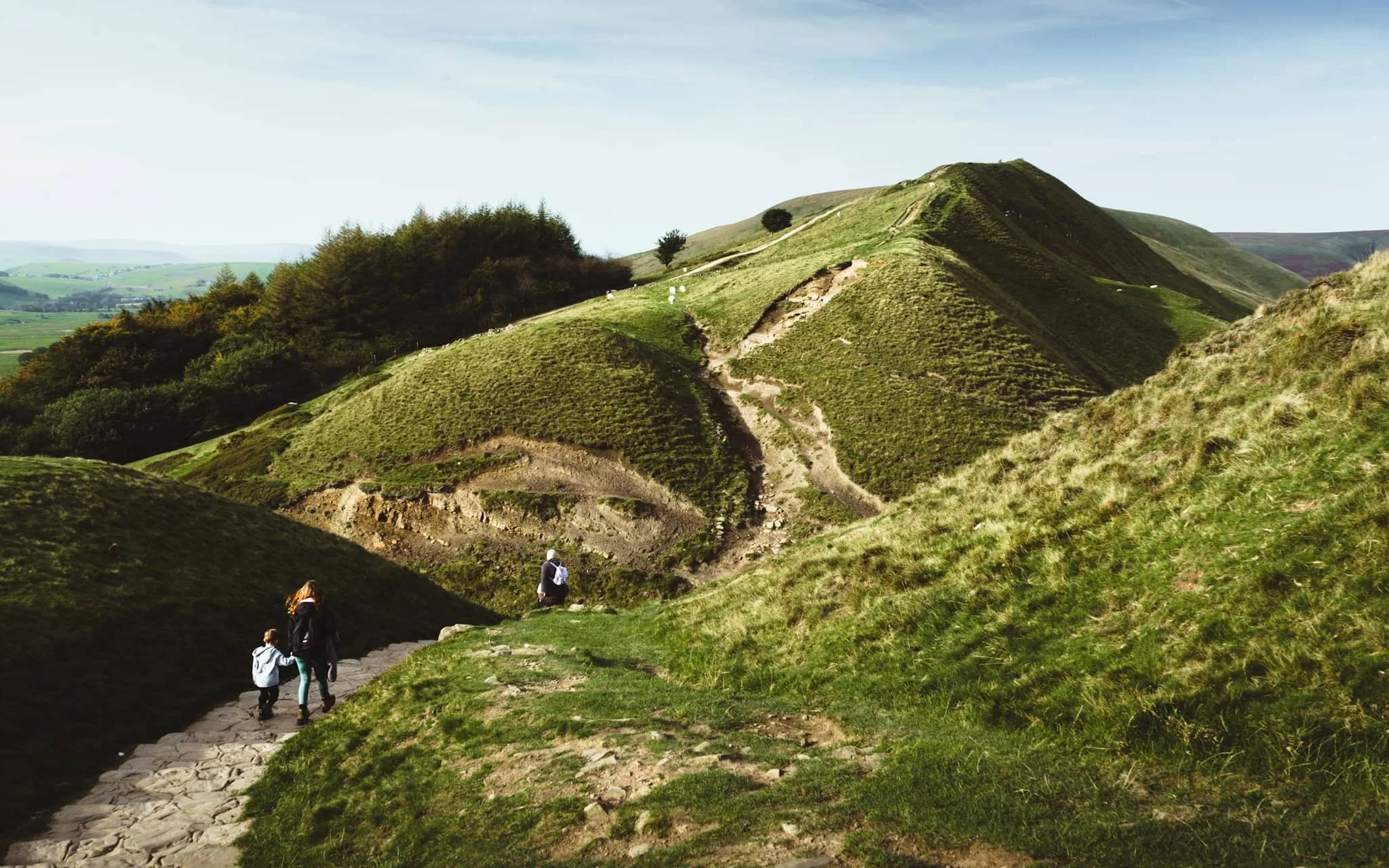
From the top of the pass, it was easy enough to head up the moorland and locate the Mam Tor trail. Even just climbing up the trail a little bit, the views back down to Rushup Edge are already superb.
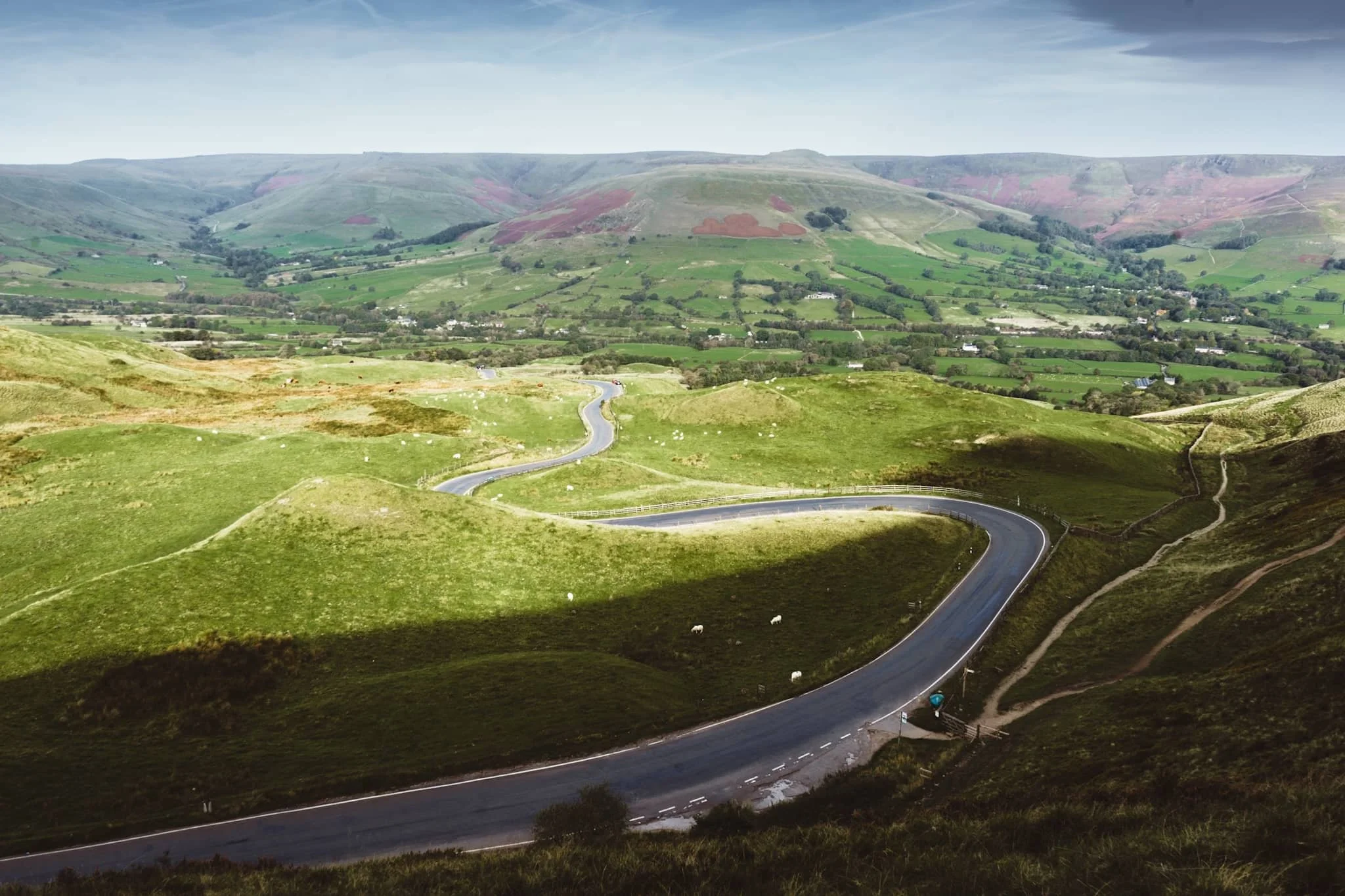
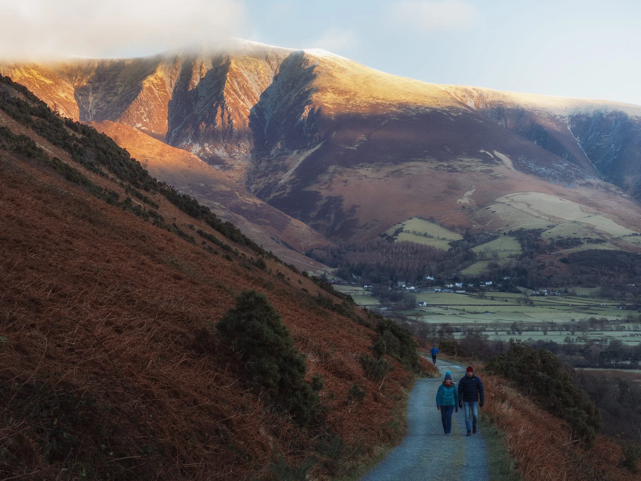
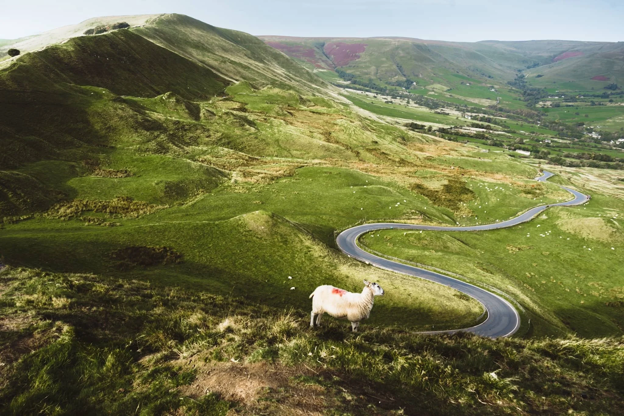
Around the shoulder of Mam Tor, the views towards Edale and Kinder Scout above are stunning. Aided, in part, by the winding road as a lovely leading line.
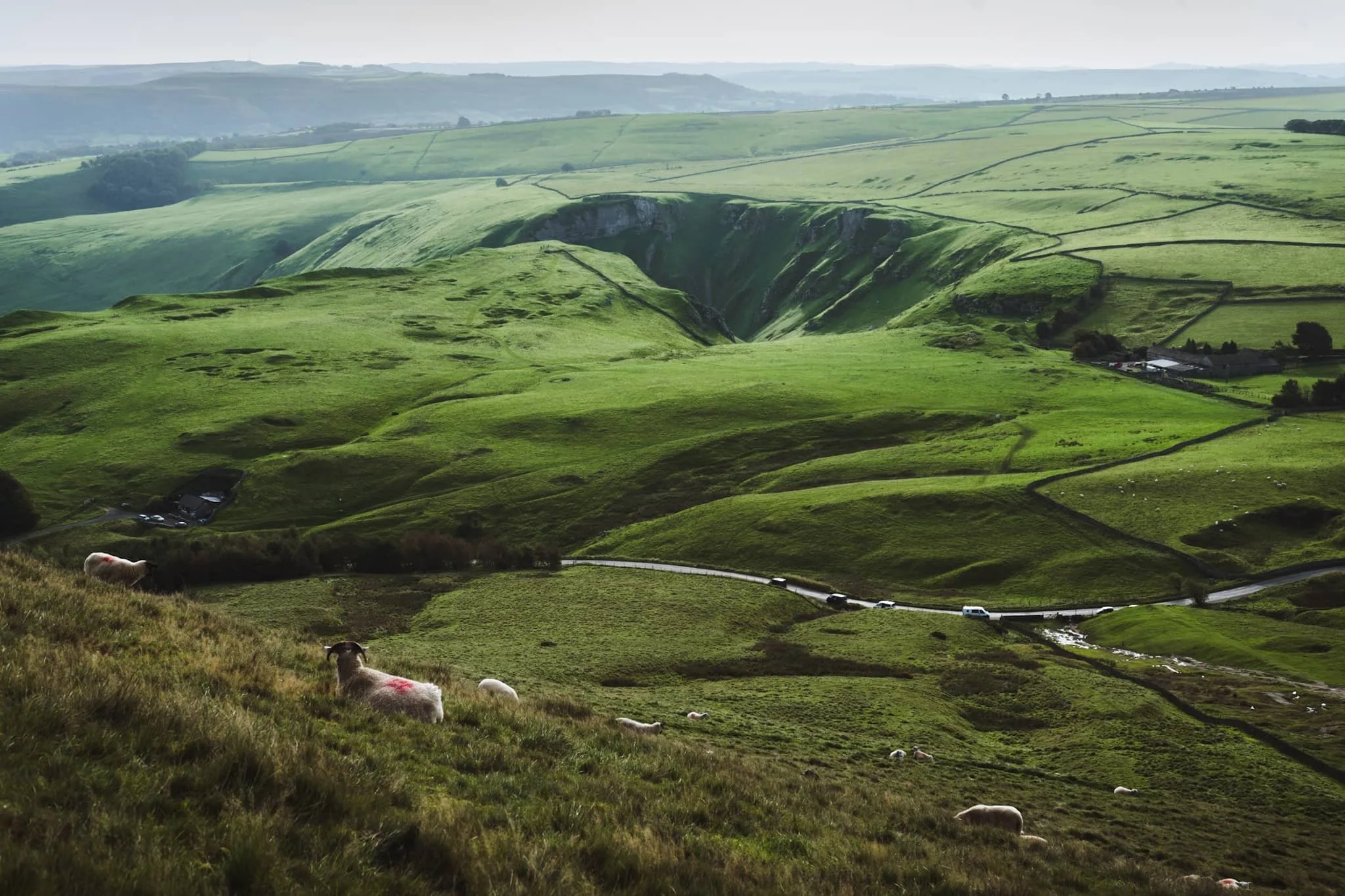
On the way up Mam Tor, the view back towards Winnats Pass reveals the dramatic drop of the gorge. It was once believed to be a giant collapsed cave, but evidence suggests it formed around an underwater canyon. Over time, other rocks covered this area. Much later, erosion revealed the pass we see today, shaped by melting water finding weak points in the rock.
As we climb higher, I find a sheep on the shoulder of Mam Tor, seemingly enjoying the views towards Edale.
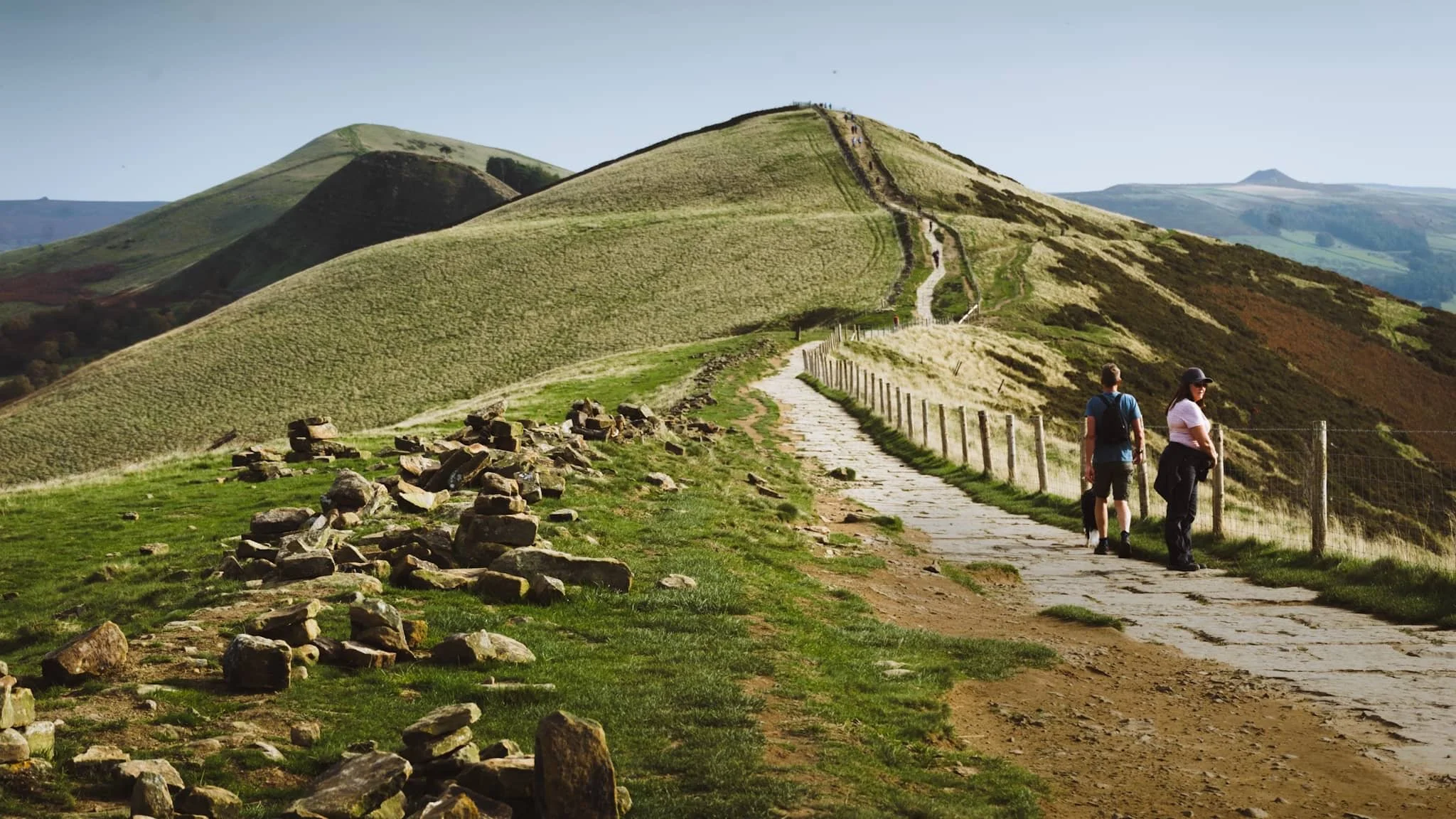
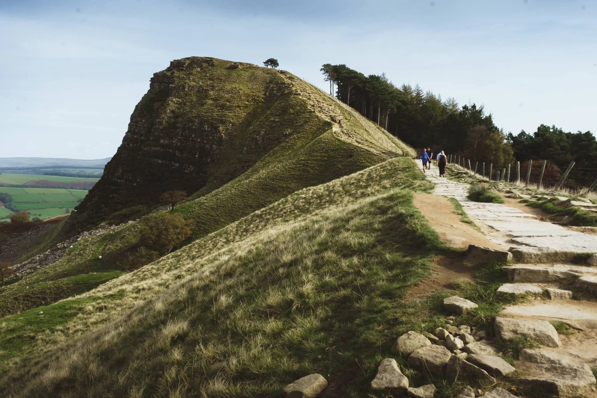
Beyond the summit of Mam Tor, at 517 m / 1,696 ft above sea level, our next goal was clear in front of us: Hollin’s Cross and Back Tor along the Great Ridge.
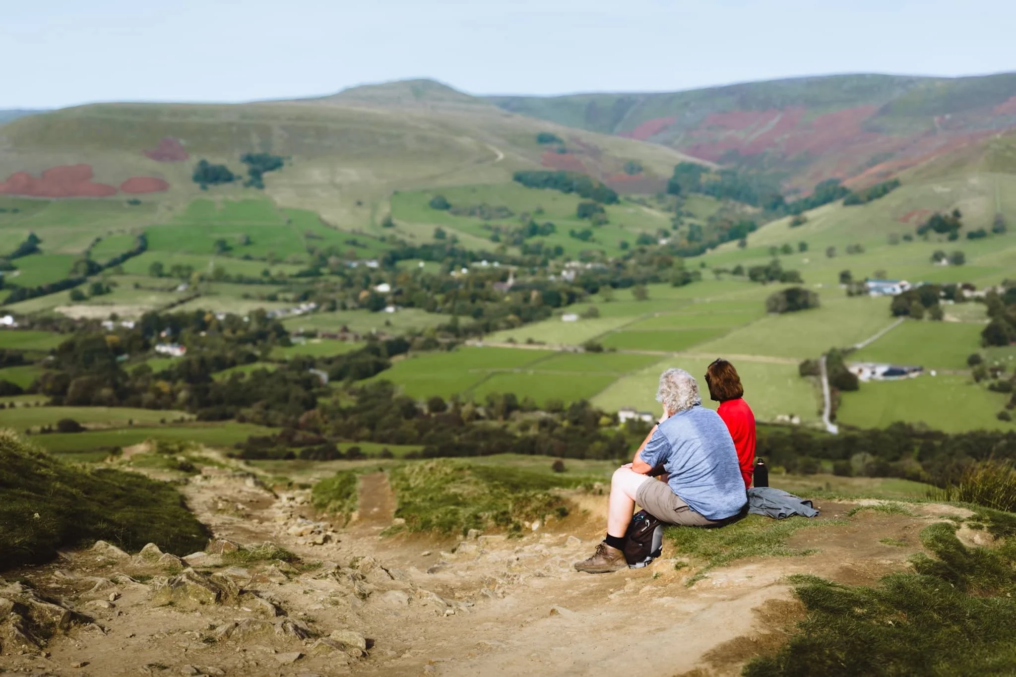
Near Hollin’s Cross, fellow hikers rest and take the time to enjoy the extensive panoramic views across Edale.
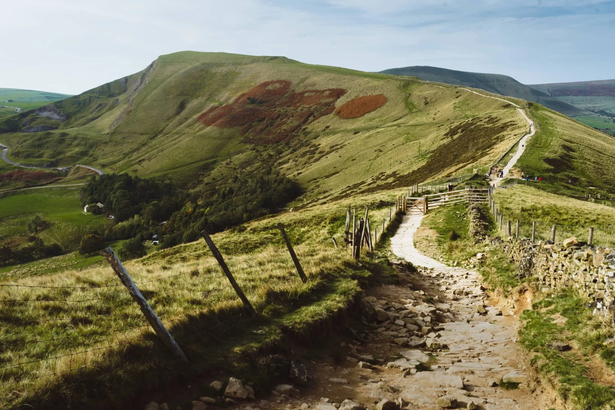
Looking back along the ridge from Hollin’s Cross reveals profile of Mam Tor. The hill is also known as Shivering Hill, as its southeastern face near-constantly sheds rocks and causes landslips. In fact a long-established road underneath this side of Mam Tor, the A625, was abandoned in 1979 due to the constant need to repair the road after landslides.
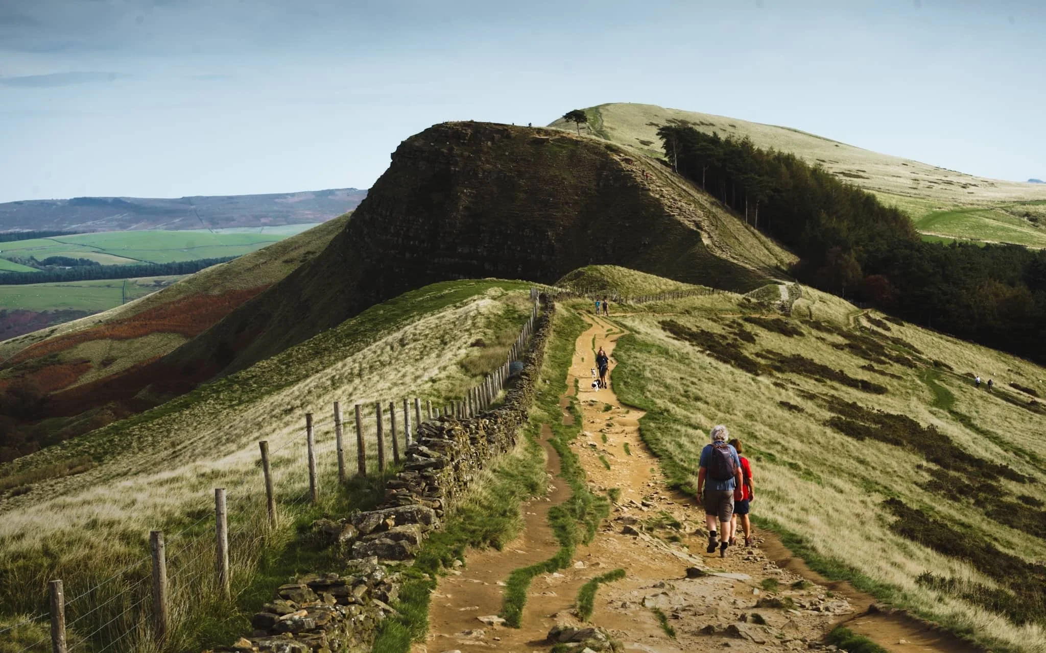
Beyond Hollin’s Cross, our next destination was unmistakeable: the hulking crag of Back Tor.
Back Tor has similar geology to Mam Tor, and as such what you see is the result of a large shale landslip that falls dramatically down to the valley floor of Edale.
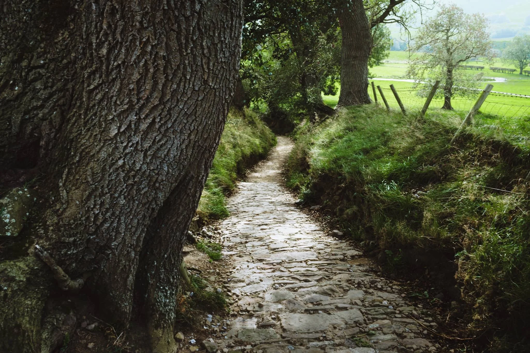
After falling on my arse a few times navigating the muddy trail down from the Great Ridge (and getting punctured by gorse on both occasions), I’m relieved to finally locate a paved country lane. Happily, it was also a nice composition to record.
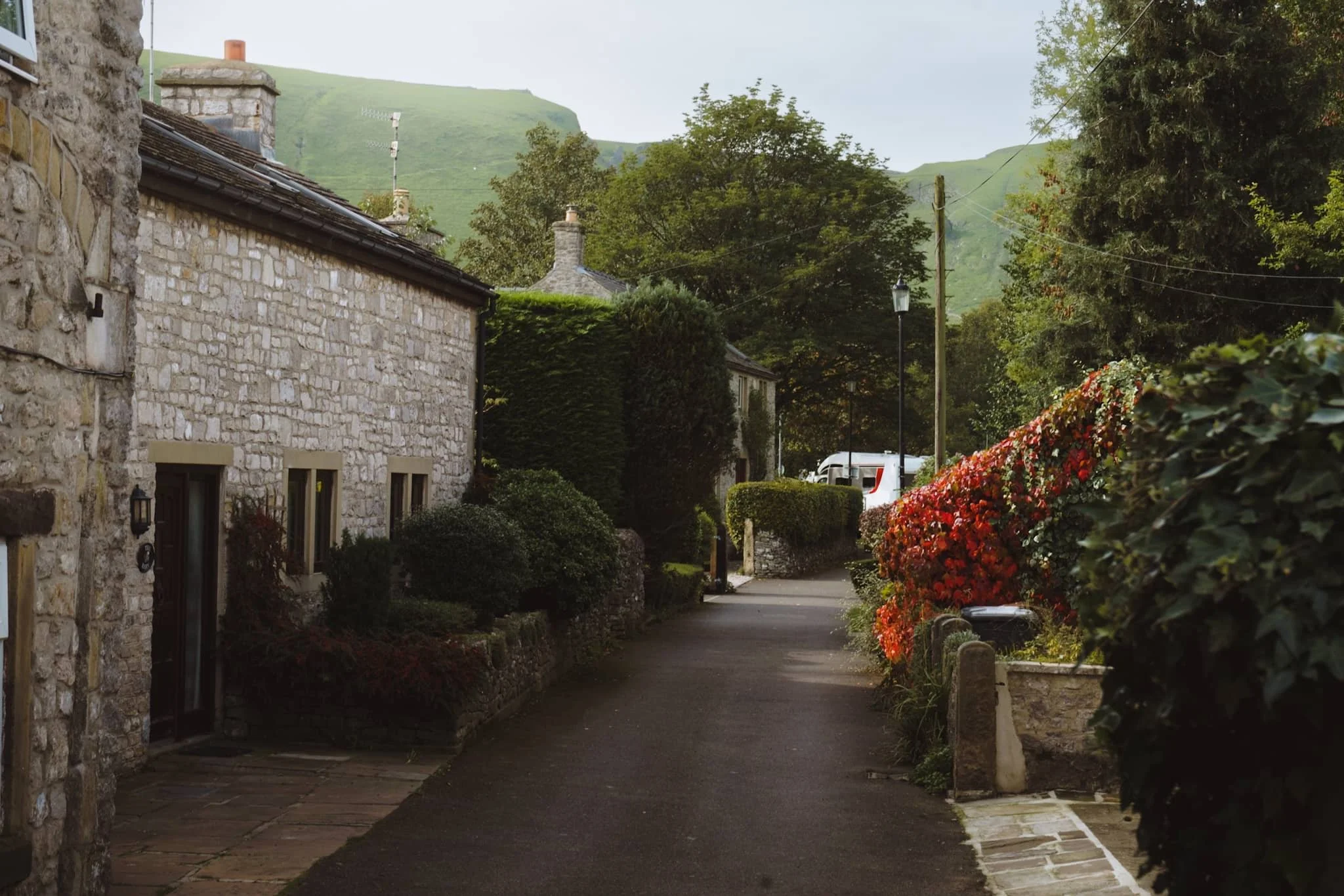
From almost everywhere in Castleton, the towering crags of Winnats Pass are never far away.
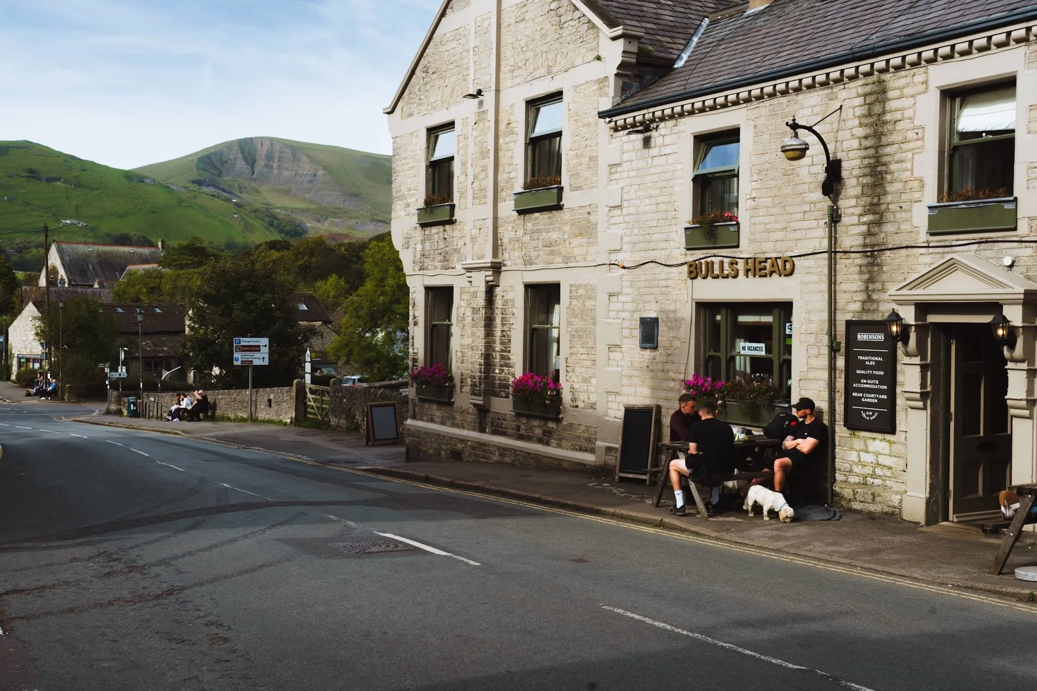
Friends enjoy a pint outside the Bulls Head, whilst Mam Tor’s southeastern face rises clearly in the distance.